Category:Maps of volcanoes in Iceland
Jump to navigation
Jump to search
Subcategories
This category has the following 23 subcategories, out of 23 total.
*
A
- Maps of Askja (4 F)
B
- Maps of Bárðarbunga (4 F)
E
- Maps of Eldfell (7 F)
H
- Maps of Hekla (1 F)
K
- Maps of Krafla (8 F)
L
- Maps of Laki (3 F)
S
T
- Maps of Tindfjallajökull (2 F)
Ö
- Maps of Öræfajökull (6 F)
Þ
- Maps of Þorbjörn (2 F)
Media in category "Maps of volcanoes in Iceland"
The following 17 files are in this category, out of 17 total.
-
Askja location.png 400 × 311; 42 KB
-
Eldfell eruption en.svg 717 × 721; 82 KB
-
Esja carte simple.png 157 × 181; 3 KB
-
Grímsvötn Volcano Injects Ash into the Stratosphere, 05-22-2011.jpg 1,265 × 860; 349 KB
-
Hekla (A. Ortelius) Detail from map of Iceland 1585.jpg 1,434 × 1,137; 450 KB
-
Hlöðufedl11.jpg 4,885 × 2,717; 5.15 MB
-
Hvannadalshnúkur.png 640 × 480; 29 KB
-
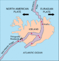
Iceland Mid-Atlantic Ridge Fig16 el.gif 250 × 259; 15 KB
-
Iceland Mid-Atlantic Ridge Fig16.gif 376 × 390; 9 KB
-
Iceland Mid-Atlantic Ridge heb.png 376 × 390; 14 KB
-
Iceland Mid-Atlantic Ridge map IS.svg 376 × 390; 97 KB
-
Iceland Mid-Atlantic Ridge map-de.svg 752 × 786; 106 KB
-
Iceland Mid-Atlantic Ridge map.svg 376 × 390; 129 KB
-
Karte Island statistik.png 722 × 404; 50 KB
-
Kesk-Atlandi mäestik Islandil.svg 376 × 390; 71 KB
-
Midatlantiese rif - ysland.png 377 × 390; 21 KB
-
Volcanic system of Iceland-Map-en.svg 726 × 588; 345 KB


