Category:Maps of the Captaincy General of the Philippines
Jump to navigation
Jump to search
Media in category "Maps of the Captaincy General of the Philippines"
The following 24 files are in this category, out of 24 total.
-
Viceroyalty of New Spain-Territories.svg 863 × 444; 1.23 MB
-
Spanish Provinces in the Pacific.png 411 × 250; 35 KB
-
Itinerario legazpi.jpg 328 × 716; 70 KB
-
Andres Urdaneta Tornaviaje.jpg 1,590 × 1,306; 1.54 MB
-
Imperio español en Asia y Oceanía.png 300 × 323; 25 KB
-
16th century Portuguese Spanish trade routes.png 2,835 × 1,188; 2 MB
-
16th century Spanish trade routes.png 2,835 × 1,188; 775 KB
-
Mapa de Filippinas Formosa y costa de China para el Galeon de Manila.JPG 3,508 × 2,552; 930 KB
-
Cagayan River 1720.png 508 × 356; 340 KB
-
Capitanía general de Filipinas.svg 494 × 243; 200 KB
-
Flag map of Spanish East Indies (1565–1898).png 2,000 × 3,446; 328 KB
-
La nueva españa 1.PNG 805 × 628; 25 KB
-
Locations of Spanish Presidios in the Philippines.png 2,000 × 3,120; 224 KB
-
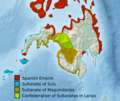
Moro Sultanates (Philippines) (cropped).png 778 × 654; 572 KB
-
Moro Sultanates (Philippines).png 1,539 × 966; 1.43 MB
-
Nueva España 1795.png 4,000 × 2,169; 486 KB
-
PH locator old Spanish Manila province.png 300 × 440; 26 KB
-
Plano de Manila 1851.jpg 2,609 × 2,067; 850 KB
-
Spanish map of Mindanao.jpg 524 × 331; 29 KB
-
Spanish province of Manila map.png 700 × 1,260; 64 KB
-
Spanish Provinces in the Pacific.jpg 411 × 250; 14 KB
-
Spanish territories by 1892.jpg 373 × 322; 61 KB
-
Territories of the Viceroyalty of New Spain.png 1,357 × 628; 42 KB


