Category:1865 map of the Holy Land by Menke and Merz
Jump to navigation
Jump to search
Media in category "1865 map of the Holy Land by Menke and Merz"
The following 16 files are in this category, out of 16 total.
-
1865 Spruner Map of Canaan - Mesopotamia crop.jpg 1,873 × 1,454; 690 KB
-
1865 Spruner Map Israel or Palestine ante 70 AD.jpg 1,365 × 1,888; 1.18 MB
-
1865 Spruner Map Israel or Palestine post 70 AD.jpg 1,353 × 2,180; 1.39 MB
-
1865 Spruner Map of Canaan - Canaan crop.jpg 2,145 × 2,631; 1.31 MB
-
1865 Spruner Map of Canaan - Gibeonitae crop.jpg 626 × 565; 127 KB
-
1865 Spruner Map of Canaan - Mountains of Sinai crop.jpg 1,094 × 632; 177 KB
-
1865 Spruner Map of Israel, Canaan - Jerusalem crop.jpg 464 × 565; 110 KB
-
1865 Spruner Map of the Holy Land - 4th-5th century Levant crop.jpg 610 × 906; 156 KB
-
1865 Spruner Map of the Holy Land - Arabia petraea - Nabatean crop.jpg 613 × 623; 104 KB
-
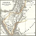
1865 Spruner Map of the Holy Land - Arabia petraea crop.jpg 792 × 665; 127 KB
-
1865 Spruner Map of the Holy Land - Galilaea crop.jpg 765 × 513; 155 KB
-
1865 Spruner Map of the Holy Land - Iudeae Maccabaeorum crop.jpg 759 × 449; 121 KB
-
1865 Spruner Map of the Holy Land - Jerusalem crop.jpg 597 × 811; 188 KB
-
1865 Spruner Map of the Holy Land - Tabula Peutingeriana crop.jpg 1,954 × 510; 286 KB


