Category:Maps of the history of Saint Petersburg
Jump to navigation
Jump to search
Subcategories
This category has only the following subcategory.
S
Media in category "Maps of the history of Saint Petersburg"
The following 11 files are in this category, out of 11 total.
-
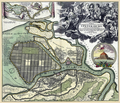
Homann MapSpb1716-17.png 2,300 × 1,970; 8.8 MB
-
Ino vs Smolyachkovo in 1855.png 1,009 × 626; 1.31 MB
-
Proektʺ... (Projet de port pour Saint Petersbourg 1868.) - btv1b55011188m.jpg 5,735 × 3,574; 3.31 MB
-
RevoluciónDeFebreroEnRusia1917.svg 716 × 840; 607 KB
-
Ru-SPb-Aptekarskiy-1849.jpg 660 × 895; 155 KB
-
Б-Охт кладб.png 4,461 × 3,185; 1.19 MB
-
Ириновский вокзал.jpg 916 × 487; 272 KB
-
Карта Ириновской дор.jpg 1,305 × 893; 532 KB
-
Карта-схема дворцового переворота 1762 г..jpg 1,257 × 853; 228 KB


