Category:Maps of the Landkreis Südliche Weinstraße
Jump to navigation
Jump to search
Urban districts (cities): Frankenthal · Kaiserslautern · Coblenz · Landau · Ludwigshafen · Mainz · Neustadt an der Weinstrasse · Speyer · Trier · Zweibrücken
Subcategories
This category has only the following subcategory.
Media in category "Maps of the Landkreis Südliche Weinstraße"
The following 15 files are in this category, out of 15 total.
-
Germany.District.Südliche Weinstraße.Map.PNG 922 × 452; 5 KB
-
Karte Landkreis Südliche Weinstraße.png 754 × 800; 137 KB
-
Karte Landkreis Südliche Weinstraße.svg 437 × 464; 140 KB
-
Karte Verbandsgemeinde Annweiler am Trifels.png 936 × 1,000; 157 KB
-
Karte Verbandsgemeinde Bad Bergzabern.png 936 × 1,000; 156 KB
-
Karte Verbandsgemeinde Edenkoben.png 936 × 1,000; 157 KB
-
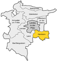
Karte Verbandsgemeinde Herxheim.png 936 × 1,000; 156 KB
-
Karte Verbandsgemeinde Landau-Land.png 936 × 1,000; 157 KB
-
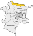
Karte Verbandsgemeinde Maikammer.png 936 × 1,000; 156 KB
-
Karte Verbandsgemeinde Offenbach an der Queich.png 936 × 1,000; 157 KB
-
Lage des Landkreises Südliche Weinstraße in Deutschland.png 197 × 235; 3 KB
-
Locator map SÜW in Germany.svg 1,075 × 1,273; 513 KB
-
Locator map SÜW in Rhineland-Palatinate.svg 708 × 913; 627 KB
-
Rhineland p suew.png 419 × 503; 13 KB
-
SÜW in Rheinland-Pfalz.svg 574 × 744; 133 KB


