Category:Maps of Landau in der Pfalz
Jump to navigation
Jump to search
Urban districts (cities): Frankenthal · Kaiserslautern · Coblenz · Landau · Ludwigshafen · Mainz · Neustadt an der Weinstrasse · Speyer · Trier · Zweibrücken
Wikimedia category | |||||
| Upload media | |||||
| Instance of | |||||
|---|---|---|---|---|---|
| Category combines topics | |||||
| Landau in der Pfalz | |||||
town in Rhineland-Palatinate, Germany | |||||
| Instance of |
| ||||
| Location |
| ||||
| Head of government |
| ||||
| Significant event |
| ||||
| Population |
| ||||
| Area |
| ||||
| Elevation above sea level |
| ||||
| official website | |||||
 | |||||
Media in category "Maps of Landau in der Pfalz"
The following 37 files are in this category, out of 37 total.
-
Kaart van de streek tussen Mannheim en Landau, ca. 1701-1713, RP-P-OB-83.037-31.jpg 3,175 × 2,812; 2.28 MB
-
Plattegrond van Landau, ca. 1701-1713, RP-P-OB-83.037-32.jpg 3,217 × 2,724; 2.13 MB
-
LASB K Hellwig 0943.jpg 2,803 × 2,025; 8.49 MB
-
Victorien der Geallieerden op Vranryk en Spangien. Aº 1702 (BM 1859,0514.341.129).jpg 2,500 × 2,139; 1.41 MB
-
Dammheim-lage.png 172 × 133; 2 KB
-
Einteilung der Stadt Landau.png 1,868 × 1,748; 2.58 MB
-
Karte von Landau (Pfalz) 20x20 Raster.png 2,236 × 1,750; 2.92 MB
-
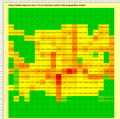
Kohlenstoffmonoxid-Ausstoß in Landau, stündliche Emission von Autos.png 1,156 × 1,147; 111 KB
-
Landau in der Pfalz in Germany.png 188 × 235; 5 KB
-
Landau-arzheim.png 575 × 423; 52 KB
-
Landau-godramstein.png 575 × 423; 52 KB
-
Landau-landau.png 575 × 423; 53 KB
-
Landau-mörlheim.png 575 × 423; 52 KB
-
Landau-mörzheim.png 575 × 423; 52 KB
-
Landau-nord ost.png 575 × 423; 52 KB
-
Landau-nußdorf.png 575 × 423; 52 KB
-
Landau-queichheim.png 575 × 423; 53 KB
-
Landau-wollmesheim.png 575 × 423; 52 KB
-
Landau.svg 800 × 600; 48 KB
-
LASB K Hellwig 0564.jpg 3,168 × 2,464; 4.08 MB
-
LASB K Hellwig 0870.jpg 1,775 × 1,270; 1.09 MB
-
LASB K Hellwig 0951.jpg 2,313 × 2,957; 8.81 MB
-
LASB K Hellwig 1037.jpg 5,420 × 4,365; 4.88 MB
-
LASB K Hellwig 1038.jpg 5,390 × 4,486; 6.06 MB
-
LASB K Hellwig 1039.jpg 3,810 × 3,457; 2.27 MB
-
LASB K Hellwig 1040.jpg 4,682 × 2,976; 2.94 MB
-
LASB K Hellwig 1041.jpg 5,187 × 3,831; 4.99 MB
-
LASB K Hellwig 1042.jpg 4,692 × 6,560; 7.78 MB
-
LASB K Hellwig 1043.jpg 3,089 × 5,158; 3.91 MB
-
LD in Rheinland-Pfalz.svg 574 × 744; 133 KB
-
Locator map LD in Rhineland-Palatinate.svg 708 × 913; 627 KB
-
Pfaelzerwaldkarte Flussgebiete Queich.png 1,348 × 668; 1.28 MB


