Cartographie des Caraïbes
Jump to navigation
Jump to search
Cartographie historique de la Caraïbe comprenant l'archipel des Antilles et les territoires continentaux qui bordent la mer des Caraïbes.
-
World map indicating dependent territories in 2007. Note that this map only indicates territories that are specifically categorized as "dependent territories". Territories that are an integral part of a country, like French Guiana, Svalbard, and Réunion are not indicated because they are not formally dependent territories. See Dependent territory for more information.
-
Cartes géographiques anciennes du site histoirepostale.net, Old maps from histoirepostale.net website. Alexandre Vuillemin (reproduit par histoirepostale.net). Avec commentaires.
-
Antilles. Map from the Brockhaus and Efron Encyclopedic Dictionary, 1890-1907
-
Antilles (orthographic projection). Keepscases. AC au 14.01.2011. AC au 14.01.2011
-
Map of the Central America (Continent and Antilles), Mapa-múndi destancando em vermelho a América Central (Ístmica e Insular. Own work by Heraldicos. Permissions : Myself (Problèmes !!).
-
The Antilles, Las Antillas ("El Caribe"). Own work by TownDown, 4 May 2009. Aucun commentaire (AC) au 14.01.2011.
-
Positionskarte der Kleinen Antillen. Own work, NordNordWest. Avec commentaires.
-
Caribbean - Lesser Antilles. own work based on PD map edited by M.Minderhoud. AC au 14.01.2011
-
Caribbean - Lesser Antilles.PNG.Own work based on PD map edited by M.Minderhoud. AC au 14.01.2011
-
Œuvre dérivée.
-
Caribbean - Greater Antilles.PNG. own work based on PD map edited by M.Minderhoud
-
Autogenerated locator map for bilateral relations. Countries as indicated by filename. Made from BlankMap-World6, compact.svg by Marmelad. Avec commentaires.
-
Les différentes Antilles Françaises au court du temps. Own work by Gd21091993.(Contributeur éphémère ?).
-
L'île de la Dominique (république) encadrée au nord de la Guadeloupe et les îles de la Désirade, de Marie-Galante et des Saintes ainsi qu'au sud par La Martinique, deux départements français d'outre mer. Commentaires archive copy at the Wayback Machine.
-
Petites Antilles - NASA NLT Landsat 7 (Visible Color) Satellite Image. Voir page
-
AC au 14.01.2011
-
AC au 14.01.2011
-
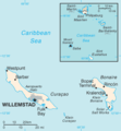
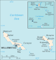
Map of the Netherlands Antilles from the 2004 World Factbook (2005-02-10 revision). World Factbook website
-
Map of the Netherlands Antilles from the 1985 CIA World Factbook.
-
Map of the Netherland Antilles, taken from the CIA World Factbook (public domain).
-
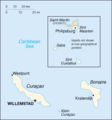
del1=Positionskarte der Niederländische Antillen (Inseln über dem Winde) Quadratische Plattkarte, N-S-Streckung 107 %, Geographische Begrenzung der Karte. Avec commentaires. (Appel à traduction)
-
Avec commentaires.
-
Location of the Netherlands Antilles. Originally created for English Wikipedia by Vardion.
-
Map: en:Leeward Antilles (location); adapted by en:User:Cogito ergo sumo from en:Image:BlankMap-Caribbean.png/en:Image:LocationLesserAntilles.png
-
Œuvre dérivée.
-
Map over the Antilles, with the Greater Antilles marked in dark green. (Edited version of LocationLesserAntilles.png.).
-
Major island groups of the Caribbean: the Bahamas (red), Greater Antilles (yellow), and Lesser Antilles (green). The Cayman Islands, despite their small size, are not typically considered a part of any of these groups and are colored brown.
-
L'île de Montserrat, territoire d'outremer du Royaume Uni. dans les petites Antilles. A noter l'activité soutenu du volcan la soufrière de Montserrat. L'image provient d'une prise par la station spatial Alpha le 9 juillet 2001.Attention à l'orientation du cliché (sud en haut).
-
Map of the Netherlands Antilles, Sint Eustatius marked. Primary source: FBI, USA
-
Description:Carte de localisation de Klein Bonaire, Antilles néerlandaises, Pays-Bas. Auteur:Rémih à partir d'une carte du CIA WorldFactBook.
-
Description:Carte de localisation de Saint-Eustache, Antilles néerlandaises, Pays-Bas.
-
A vector version of LocationCaricom.png. It should be used in place of this raster image when superior.
Cyclones dans la Caraïbe
[edit]-
Sans date
-
2000


