Category:Maps of the Baltics in the 15th century
Jump to navigation
Jump to search
English: This category is about the history maps of the area of the Baltic states in the 15th century, meaning 1401-1500 CE.
The Baltics are current-day Lithuania,
  Latvia,
  Estonia and often also the immediate surroundings (East Prussia, the Baltic Sea, Finland, Belarus and West Russia). Maps showing a much larger area may belong into Category:Maps of Eastern Europe in the 15th century or Category:Maps of Europe in the 15th century. Maps specifically about only one of the Baltic states may be sorted into subcategories.
Contemporary old maps belong into the corresponding categories of Category:15th-century maps of the Baltics (or ...of Estonia, ...of Latvia, ...of Lithuania) and the subcategories there.
The Baltics are current-day
Contemporary old maps belong into the corresponding categories of Category:15th-century maps of the Baltics (or ...of Estonia, ...of Latvia, ...of Lithuania) and the subcategories there.
Subcategories
This category has only the following subcategory.
Media in category "Maps of the Baltics in the 15th century"
The following 6 files are in this category, out of 6 total.
-
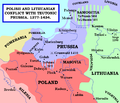
Polish and Lithuanian Conflict with Prussia. 1377-1435..png 968 × 834; 182 KB
-
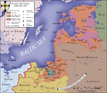
Teutonic state 1308-1455.svg 822 × 611; 103 KB
-
Teutonic Order 1466-es.svg 1,210 × 1,053; 1.79 MB
-
Teutonic Order 1466.png 1,200 × 1,043; 744 KB
-
TeutonicOrder1422.png 4,213 × 2,932; 16.24 MB
-
Union de Kalmar.png 2,136 × 2,646; 813 KB


