Category:Maps of the Grand Duchy of Lithuania
Jump to navigation
Jump to search
Wikimedia category | |||||
| Upload media | |||||
| Instance of | |||||
|---|---|---|---|---|---|
| Category combines topics | |||||
| Grand Duchy of Lithuania | |||||
Eastern European monarchical state that existed from 1236 to 1795 | |||||
| Instance of |
| ||||
| Part of |
| ||||
| Location |
| ||||
| Capital |
| ||||
| Basic form of government |
| ||||
| Legislative body |
| ||||
| Official language | |||||
| Anthem | |||||
| Currency | |||||
| Inception |
| ||||
| Dissolved, abolished or demolished date |
| ||||
| Population |
| ||||
| Area |
| ||||
| Religion or worldview |
| ||||
| Replaces | |||||
 | |||||
Subcategories
This category has the following 3 subcategories, out of 3 total.
M
Media in category "Maps of the Grand Duchy of Lithuania"
The following 115 files are in this category, out of 115 total.
-
Lithuania map 1230-1240.jpg 1,454 × 911; 193 KB
-
1237 Kievan Rus' Livonia Lithuania.png 1,056 × 868; 452 KB
-
BielensteinLettgallenSemgallenKurenLiven1250.jpg 4,718 × 4,180; 3.59 MB
-
Lithuania map 1240-1263.jpg 1,454 × 911; 218 KB
-
Teutonic state 1250.png 823 × 670; 42 KB
-
Lithuanian state in 1251-1263.PNG 731 × 570; 556 KB
-
Mindaugas Lithuania.png 775 × 597; 191 KB
-
Teutonic Order 1260.png 1,200 × 1,043; 814 KB
-
Ливонская Конфедерация 1260.png 600 × 650; 192 KB
-
Teutonic state 1308-1455.svg 822 × 611; 103 KB
-
Lithuania map 1316-1341.jpg 2,136 × 1,932; 522 KB
-
Lithuania map 1345-1377.jpg 2,136 × 1,932; 590 KB
-
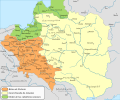
Poland Lithuania under Jogaila Jagiello.png 968 × 834; 122 KB
-
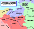
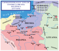
Polish and Lithuanian Conflict with Prussia. 1377-1435..png 968 × 834; 182 KB
-
Polonha - Dinastia Jagellon.png 1,030 × 1,083; 468 KB
-
Lietuva ir Lenkija.Lithuania and Poland 1387.png 726 × 756; 674 KB
-
Poland and Lithuania 1387.PNG 1,400 × 1,382; 1.95 MB
-
Map of Lithuania and Poland c. 1400 (ru).svg 574 × 475; 53 KB
-
Map of Lithuania and Poland c. 1400.jpg 574 × 475; 38 KB
-
Poland and Lithuania under Jogaila (Wladyslaw II Jagiello).png 574 × 475; 76 KB
-
Vialikaje Kniastva Litoŭskaje, Ruskaje, Žamojckaje.svg 1,522 × 1,695; 160 KB
-
VytautoLDK.png 1,479 × 1,389; 144 KB
-
Zmudz 1386-1434 AD.jpg 678 × 635; 134 KB
-
Deutscher Orden 1410+Farb.png 1,200 × 1,043; 370 KB
-
Deutscher Orden 1410.png 1,200 × 1,043; 868 KB
-
Grunwald 1410.png 1,200 × 1,424; 845 KB
-
Litva, pachatak XV st..png 574 × 475; 79 KB
-
Wschod rzeczpospolita.jpg 4,500 × 5,296; 2.34 MB
-
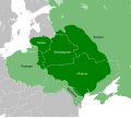
Grand Duchy of Lithuania under Vitovt.svg 450 × 491; 300 KB
-
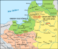
Poland, Lithuania and Teutonic state at the beginning of the XV cn.svg 592 × 491; 402 KB
-
Grand Duchy of Lithuania 1430.png 2,013 × 1,724; 263 KB
-
Polish and Lithuanian Conflict with Prussia. 1377-1435-es.svg 341 × 286; 1.86 MB
-
1444 map Khanates Lithuania Novgorod Pskov Muscovy Ryazan Tver.png 2,892 × 2,328; 10.47 MB
-
Teutonic state 1455.png 823 × 668; 27 KB
-
Upper Oka Principalities 1462 ru.png 1,107 × 902; 44 KB
-
VKL-1462-ru.png 2,328 × 1,845; 208 KB
-
Królestwo Polskie i Wielkie Księstwo Litewskie w 1466 r..svg 1,502 × 1,310; 3.2 MB
-
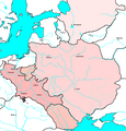
1Jagiellon countries 1490.PNG 782 × 600; 262 KB
-
Jagiellon countries 1490.PNG 2,916 × 2,992; 1.68 MB
-
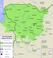
Lithuanian language in the 16th century.png 1,600 × 1,757; 1.17 MB
-
Baltics-1525.png 2,281 × 2,153; 114 KB
-
Poland and Lithuania in 1526.PNG 2,000 × 1,568; 917 KB
-
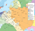
Poland and Lithuania in 1561.PNG 2,405 × 2,230; 1.09 MB
-
1712. Samogitie et Lithuanie Propre, Grand Duché de Lithuanie.png 1,381 × 792; 2.33 MB
-
Administrative Divisions of the Grand Duchy of Lithuania in 1654.png 4,039 × 3,316; 587 KB
-
Brama smoleńska Natanson-Leski.jpg 1,413 × 921; 445 KB
-
C. 1560 Poland and Lithuania.jpg 3,879 × 3,031; 3.25 MB
-
GDL Map, 15cent.png 2,000 × 1,529; 505 KB
-
Glinski's Rebellion by V. Tsemoushev.tif 1,271 × 1,951; 717 KB
-
Grand Duchy of Lithuania 1462 within modern boundaries-en.svg 1,152 × 1,028; 792 KB
-
Grand Duchy of Lithuania 1462 within modern boundaries-ru.svg 1,152 × 1,028; 789 KB
-
Grand Duchy of Lithuania.png 2,000 × 2,027; 445 KB
-
Grand Duché de Lituanie et royaume de Pologne (1619).png 1,143 × 899; 414 KB
-
Großfürstentum Litauen 13.–15. Jh.png 1,379 × 1,533; 517 KB
-
Historia de Lituania.svg 1,525 × 1,750; 396 KB
-
Jagiellon countries 1490m9.PNG 1,214 × 931; 927 KB
-
Jagiellon countries 1490vmvmvm9.PNG 2,501 × 2,618; 927 KB
-
Jagiellon Realm.png 587 × 511; 13 KB
-
Kingdom of Galicia Volhynia Rus' Ukraine 1245 1349.jpg 2,301 × 2,856; 5.18 MB
-
Królestwo Polskie i Wielkie Księstwo Litewskie w 1466 r-es.svg 1,406 × 1,228; 1.22 MB
-
LihuanianHistory.ru.svg 1,520 × 1,690; 190 KB
-
LithuaniaHistory.png 1,519 × 1,743; 574 KB
-
Lithuanian History-hu.svg 1,525 × 1,750; 110 KB
-
Lithuanian state in 13-15th centuries (IT-Version).png 1,010 × 1,411; 661 KB
-
Lithuanian state in 13-15th centuries-de.svg 729 × 813; 675 KB
-
Lithuanian state in 13-15th centuries-es.svg 1,514 × 1,686; 525 KB
-
Lithuanian state in 13-15th centuries-hu.svg 729 × 813; 264 KB
-
Lithuanian state in 13-15th centuries-ro.svg 1,525 × 1,750; 155 KB
-
Lithuanian state in 13-15th centuries.png 1,010 × 1,411; 875 KB
-
LithuanianHistory de.svg 1,525 × 1,750; 110 KB
-
LithuanianHistory ro.svg 1,525 × 1,750; 109 KB
-
LithuanianHistory sr.svg 1,525 × 1,750; 110 KB
-
LithuanianHistory zh.svg 1,525 × 1,750; 110 KB
-
LithuanianHistory-es.svg 1,518 × 1,692; 459 KB
-
LithuanianHistory-hr.svg 1,525 × 1,750; 110 KB
-
LithuanianHistory-PL.svg 1,518 × 1,743; 104 KB
-
LithuanianHistory-ru.svg 1,525 × 1,750; 98 KB
-
LithuanianHistory.svg 1,525 × 1,750; 110 KB
-
Livonian war map (1558-1560) uk.svg 848 × 639; 34 KB
-
Livonian war map (1558-1560)-es.svg 848 × 639; 386 KB
-
Livonian war map (1558-1560).svg 848 × 639; 25 KB
-
Map of Lithuania and Poland c. 1400 es.svg 512 × 424; 257 KB
-
Map of Reč Paspalitaja Abodvuch Narodaŭ (lang-be).png 1,973 × 1,556; 556 KB
-
Mindaugas Lithuania (Voruta).png 775 × 597; 189 KB
-
Poland and Lithuania in 1526-es.svg 1,408 × 1,122; 1.08 MB
-
Poland and Lithuania in 1561-es.svg 1,490 × 1,376; 7.01 MB
-
Poland, Lithuania and Teutonic state at the beginning of the XV es.svg 592 × 491; 1.02 MB
-
Polish and Lithuanian Conflict with Prussia. 1377-1435 - it.svg 599 × 517; 1.47 MB
-
Principality of Smolensk 1237.png 1,069 × 691; 385 KB
-
ProvLithuania.png 1,042 × 812; 185 KB
-
Pskov Republic 1389.png 1,405 × 1,100; 58 KB
-
Rus-1389-lg.png 2,599 × 2,476; 184 KB
-
Rus-1389.png 3,548 × 2,609; 258 KB
-
Russo–Lithuanian Wars-1500 campaign-rus0.1.svg 578 × 627; 193 KB
-
Stary Dzedzin 17th Century be.png 1,210 × 910; 71 KB
-
Stary Dzedzin 17th Century de.png 1,210 × 910; 113 KB
-
Stary Dzedzin 17th Century en.png 1,210 × 910; 66 KB
-
Stary Dzedzin 17th Century ru.png 1,210 × 910; 72 KB
-
Teutonic state (rus).png 823 × 611; 31 KB
-
Teutonic state 1250 hu.svg 1,097 × 893; 262 KB
-
Teutonic state 1308-1455-it.svg 822 × 611; 104 KB
-
Toeppen Ordenspreussen.jpg 6,800 × 5,632; 4.67 MB
-
Upper Oka Principalities 1389 ru.png 1,046 × 845; 34 KB
-
Upper Oka Principalities 1434 pl.png 932 × 968; 188 KB
-
ВКЛ, Беларусь, Літва.jpg 1,568 × 1,734; 746 KB
-
Еголдаева тьма.jpg 7,906 × 6,171; 2.72 MB
-
Кароткі нарыс гісторыі Беларусі (1926). Карта Беларусі ў XVI-XVIII вякох.jpg 2,192 × 1,614; 673 KB
-
Кароткі нарыс гісторыі Беларусі (1926). Карта Вялікага Княства Літоўскага ў XIV-XV в.в.jpg 2,670 × 3,016; 1.33 MB
-
Княжество Глинских 15 век.svg 392 × 353; 1.18 MB
-
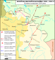
Літоўска-маскоўская вайна, кампанія 1500 року.svg 578 × 627; 185 KB


