Category:Maps of the Balkans in the 15th century
Jump to navigation
Jump to search
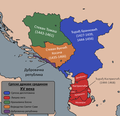
English: This category is about the subject of the Balkans 1401-1500 CE: History maps showing substantial parts of the Balkans as they were in the 15th century.
Contemporary old maps belong into: Category:15th-century maps of the Balkans and its subcategories. - Maps showing single countries belong into "Maps of <country> in the 15th century".
Contemporary old maps belong into: Category:15th-century maps of the Balkans and its subcategories. - Maps showing single countries belong into "Maps of <country> in the 15th century".
Maps of the history of the Balkans: (BCE) (CE) 4th century · 6th century · 7th century · 8th century · 9th century · 10th century · 11th century · 12th century · 13th century · 14th century · 15th century · 16th century · 17th century · 19th century · 20th century ·
Subcategories
This category has the following 4 subcategories, out of 4 total.
Media in category "Maps of the Balkans in the 15th century"
The following 7 files are in this category, out of 7 total.
-
C. 1400 Southeastern Europe.jpg 1,862 × 1,390; 2.75 MB
-
Principatele 1450.jpg 359 × 479; 348 KB
-
Serbia in 15th century.png 479 × 365; 87 KB
-
South-Eastern Europe at the beginning of the 15th century.jpg 1,908 × 1,435; 1.1 MB
-
Srpske države sredinom 15. veka.png 828 × 797; 157 KB
-
The Ottoman Empire 1451-1481.jpg 1,408 × 1,344; 1.01 MB
-
The Ottoman Empire before 1453, H. G. Wells' Outline of History, page 366.jpg 1,572 × 1,216; 392 KB


