Category:Maps of the Balkans during World War II
Jump to navigation
Jump to search
Subcategories
This category has the following 4 subcategories, out of 4 total.
Media in category "Maps of the Balkans during World War II"
The following 5 files are in this category, out of 5 total.
-
Balcans 1942.jpg 651 × 698; 117 KB
-
Balkan boundary changes 1938 to 1941.jpg 641 × 340; 67 KB
-
Balkanfront 19440831-19441130.png 530 × 617; 763 KB
-
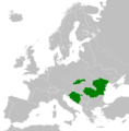
CRO RO SVK.png 450 × 456; 66 KB
-
RedArmy19Aug31Dec44.jpg 1,256 × 956; 531 KB


