Category:Maps of Albania during World War II
Jump to navigation
Jump to search
Media in category "Maps of Albania during World War II"
The following 52 files are in this category, out of 52 total.
-
Albania 1913-1941.png 467 × 804; 400 KB
-
Albania during ww2.png 326 × 465; 76 KB
-
Albania Greek occupation.png 330 × 355; 17 KB
-
Albania road map construction under Italian occupation 1939-1943.png 477 × 683; 232 KB
-
2차 대전 기간 알바니아의 지도.png 647 × 839; 115 KB
-
Map of Albania during Worl War 2.png 647 × 839; 156 KB
-
Map of Albania during WWII-CS.png 1,005 × 1,305; 281 KB
-
Map of Albania during WWII-IT.png 1,030 × 1,306; 292 KB
-
Map of Albania during WWII-SQ.png 643 × 839; 158 KB
-
Map of Albania during WWII.png 647 × 839; 187 KB
-
GranAlbania 1941-hu.svg 1,725 × 2,115; 243 KB
-
GranAlbania1941 sr.svg 1,725 × 2,115; 185 KB
-
GranAlbania1941.svg 1,725 × 2,115; 466 KB
-
KingdomOfAlbania1941.png 1,698 × 3,000; 870 KB
-
KingdomOfAlbania1943.png 2,300 × 3,700; 948 KB
-
Albanian Kingdom (1939).svg 450 × 456; 452 KB
-
Albanian Kingdom (1942).svg 450 × 456; 500 KB
-
AtlBalk1940.jpg 318 × 327; 146 KB
-
AtlBalk1942.jpg 318 × 327; 141 KB
-
Balcans 1942.png 651 × 698; 86 KB
-
Besatzungsgebiete-Alb.png 330 × 355; 22 KB
-
Bulgaria 1944 WWII svg.png 266 × 329; 49 KB
-
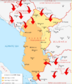
German invasion of Albania, 1943.png 453 × 534; 104 KB
-
Greek Offensive 1940 41 in Northern Epirus el.svg 1,097 × 844; 766 KB
-
Greek Offensive 1940 41 in Northern Epirus-2-es.svg 1,097 × 844; 1.06 MB
-
Greek Offensive 1940 41 in Northern Epirus-2.svg 1,097 × 844; 1.06 MB
-
Greek Offensive 1940 41 in Northern Epirus.svg 1,097 × 844; 769 KB
-
Greek Offensive Epirus-2-hu.svg 1,097 × 844; 1.06 MB
-
Griechische Gegenoffensive.png 300 × 500; 50 KB
-
Griechische-Offensive-1.jpg 330 × 355; 73 KB
-
Griechische-Offensive-3.png 330 × 355; 19 KB
-
Griechische-Offensive11.png 330 × 355; 20 KB
-
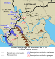
GuerraItaloGriega28101940.svg 1,052 × 1,116; 178 KB
-
Kosovo 1913-1992 CIA.jpg 978 × 827; 296 KB
-
Kosovo 1941-sr.png 663 × 772; 48 KB
-
Kosovo 1941.png 663 × 772; 54 KB
-
Map of Kosovo during WW II.png 783 × 524; 97 KB
-
Map of Vardar Macedonia during WW II.png 814 × 666; 135 KB
-
Ndarja administrative e Tokave të Liruara.svg 2,073 × 3,543; 1.25 MB
-
OcupaciónGriegaDeAlbania 1940-1941-hu.svg 1,700 × 1,700; 149 KB
-
OcupaciónGriegaDeAlbania19401941.svg 1,700 × 1,700; 235 KB
-
Responsability zones Mac WW II.jpg 517 × 395; 58 KB
-
Srbsko WWII es.svg 804 × 1,124; 313 KB
-
Western Balkans 1942-2008-hu.svg 1,222 × 930; 248 KB
-
Western Balkans 1942.2008 (ru).png 900 × 675; 338 KB
-
Western Balkans 1942.2008 (ru).svg 1,200 × 900; 298 KB
-
Western Balkans 1942.2008 ca.svg 1,222 × 930; 246 KB
-
Western Balkans 1942.2008 ES.svg 1,222 × 930; 543 KB
-
Western Balkans 1942.2008 sr.svg 1,200 × 900; 298 KB
-
Western Balkans 1942.2008.png 800 × 600; 292 KB
-
WorldWarIILocationMapAL.png 630 × 766; 23 KB
-
Ελληνοϊταλικός Πόλεμος 28101940.svg 1,052 × 1,116; 178 KB


