Category:Maps of World War II in Europe
Jump to navigation
Jump to search
Wikimedia category | |||||
| Upload media | |||||
| Instance of | |||||
|---|---|---|---|---|---|
| |||||
Subcategories
This category has the following 20 subcategories, out of 20 total.
A
B
E
F
G
H
M
S
W
Pages in category "Maps of World War II in Europe"
This category contains only the following page.
Media in category "Maps of World War II in Europe"
The following 200 files are in this category, out of 210 total.
(previous page) (next page)-
17th April 1945 near Borsov.jpg 3,136 × 4,704; 3.26 MB
-
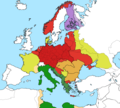
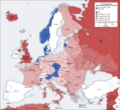
Second world war europe 1941-1942 map de.png 1,090 × 1,000; 161 KB
-
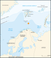
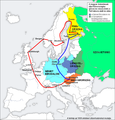
Barents 1942-it.svg 969 × 1,094; 158 KB
-
Barents 1942.svg 964 × 1,088; 130 KB
-
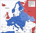
Ww2-europe-overview.gif 1,170 × 750; 177 KB
-
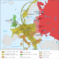
Ww2summarymapeurope.gif 1,235 × 1,388; 204 KB
-
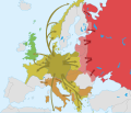
Second world war europe 1943-1945 map de.png 1,088 × 998; 274 KB
-
266 стрелковая дивизия - этапы боевого пути.jpg 4,098 × 3,235; 4.62 MB
-
2svitovavijnamapa.jpg 1,090 × 1,000; 659 KB
-
A-A Hattı.png 1,280 × 1,280; 994 KB
-
Bundesarchiv R 49 Bild-0705, Polen, Herkunft der Umsiedler, Karte.jpg 800 × 602; 274 KB
-
Cambridge American Cemetery and Memorial - the Great Map.JPG 2,560 × 1,920; 984 KB
-
Carte opération Herkules.png 325 × 351; 13 KB
-
Civilian casualties in WWII.png 3,404 × 2,528; 959 KB
-
Communications Zone boundaries April 1945.png 845 × 1,073; 332 KB
-
Confini Trieste-Istria2.jpg 1,471 × 2,130; 371 KB
-
Convoy PQ-17 map 1942 (noms des navires)-fr.svg 970 × 1,095; 186 KB
-
Convoy PQ-17 map 1942-fr.svg 970 × 1,095; 239 KB
-
Corsica 1943.png 508 × 641; 109 KB
-
Cost of World War II in Deaths.jpg 3,509 × 2,528; 897 KB
-
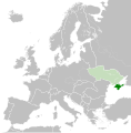
Crimea within Nazi Germany.svg 450 × 456; 485 KB
-
Deplac.Eur.C-O. 1939-1944.jpg 1,122 × 1,912; 717 KB
-
Deplac.Eur.C-O. 1945-1953.jpg 1,128 × 1,910; 730 KB
-
Die 'großzügigste Umsiedlungsaktion' with Poland superimposed, 1939.jpg 800 × 602; 206 KB
-
Duitslandchurchill.png 998 × 896; 171 KB
-
Duitslandroosevelt.png 998 × 896; 200 KB
-
Durchmarschpläne IMG 1701.JPG 2,250 × 3,000; 1.31 MB
-
Easterneurope10.jpg 1,256 × 956; 2.1 MB
-
ETO Boundary changes 1942-1943.jpg 800 × 671; 87 KB
-
Europ7.GIF 800 × 589; 44 KB
-
Fliegerhorst Venlo Map 1944.jpg 1,312 × 1,424; 659 KB
-
Free French Army movement map 1941 to 1945.jpg 924 × 803; 126 KB
-
Führerbunker-ja.png 1,024 × 1,318; 268 KB
-
Führerhauptquartiere Lage.svg 1,130 × 800; 740 KB
-
G-5 Refugee Control Points - NARA - 100384839.jpg 7,424 × 4,214; 1.52 MB
-
Gebietsveränderungen Balkan 1938-43.png 387 × 617; 298 KB
-
Gen Okrug Belarus Administrative.png 660 × 980; 165 KB
-
GreekItalian2ndItal.JPG 486 × 335; 48 KB
-
GreekItalianGreekCounter.JPG 429 × 295; 43 KB
-
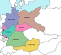
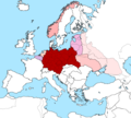
Großdeutsches Reich-europe.png 1,829 × 1,647; 59 KB
-
Großdeutsches Reich.png 1,829 × 1,647; 103 KB
-
Hammond's map of The Mediterranean Europe and Northern Africa.jpg 16,144 × 12,306; 64.84 MB
-
Hitler-Headquarters-Europe (Eagle's Nest inset).png 1,120 × 790; 628 KB
-
Hitler-Headquarters-Europe.png 1,120 × 790; 473 KB
-
Hopeakettu-suunnitelma.png 634 × 834; 26 KB
-
Iceland invasion targets.png 485 × 343; 44 KB
-
Independent State of Croatia location.png 1,088 × 998; 175 KB
-
Invasion of Iceland ja.svg 726 × 550; 373 KB
-
Invasion of Wehrmacht on Luxembourg 9may1940.jpg 351 × 377; 48 KB
-
Invasion of Yugoslavia lines of attack Why We Fight no. 5(1 he).svg 445 × 321; 478 KB
-
Irish and Scottish Bases.jpg 1,142 × 1,665; 265 KB
-
Italian offensive Bourg Saint-Maurice-1940-IT.png 606 × 493; 156 KB
-
Italian offensive Bourg Saint-Maurice-1940-IT.svg 606 × 493; 196 KB
-
Italian offensive Bourg Saint-Maurice-1940.svg 606 × 493; 92 KB
-
Italian offensive Mont Cenis-1940-IT.png 606 × 492; 210 KB
-
Italian offensive Mont Cenis-1940.svg 606 × 492; 332 KB
-
Italian offensive, Bourg Saint-Maurice.png 858 × 511; 58 KB
-
Italian offensive, Mont Cenis.png 851 × 514; 70 KB
-
Italienska områden 1939.PNG 326 × 332; 11 KB
-
Jagarleveransen 1940-2-2.png 763 × 671; 108 KB
-
Jagarleveransen 1940-2.png 763 × 671; 108 KB
-
Jagarleveransen 1940.png 763 × 671; 98 KB
-
Jan Karski missions en.png 3,507 × 2,480; 2.83 MB
-
Jan Karski missions hu.png 3,507 × 2,480; 2.88 MB
-
Jugoslavija i Evropa maj 1943.jpg 1,209 × 983; 1.07 MB
-
Kapitulacija Italije i ustanak u okupiranoj Jugoslaviji 1943.png 1,984 × 1,455; 1.78 MB
-
Kirkness-Petsamo offensive plan.jpg 873 × 600; 109 KB
-
Kobryn.png 988 × 435; 115 KB
-
Kuban-bruggenhoofd-sept-oct-1.jpg 1,618 × 1,208; 507 KB
-
Landen ww2.png 4,170 × 3,245; 984 KB
-
Latinaxis.png 450 × 456; 64 KB
-
Location map of Weissruthenien-fr.svg 1,414 × 2,248; 134 KB
-
Location of the Kingdom of the South.png 449 × 456; 38 KB
-
LocationThirdReich.png 450 × 456; 44 KB
-
Lotnictwo francja.png 8,562 × 10,132; 5.93 MB
-
LuxembourgishFrenchoccupation1945-55-deutsch.jpg 370 × 466; 80 KB
-
LuxembourgishFrenchoccupation1945-55-english.jpg 370 × 466; 75 KB
-
Map of the Mediterranean.jpg 3,263 × 1,816; 761 KB
-
Map.5.jpg 1,256 × 956; 193 KB
-
Map950.jpg 5,130 × 4,838; 2.49 MB
-
Mapa simplificado de europa en 1943.svg 854 × 744; 34 KB
-
Marshall Plan.png 428 × 395; 84 KB
-
Marshall Plan.svg 454 × 450; 410 KB
-
Martian Defense Map - Anse de Vauville (South) - NARA - 100384359 (page 1).jpg 7,920 × 6,270; 4.18 MB
-
Martian Defense Map - Anse de Vauville (South) - NARA - 100384359 (page 2).jpg 7,924 × 6,317; 2.72 MB
-
Martian Defense Map - Barneville - NARA - 100384356 (page 1).jpg 7,952 × 6,258; 4.36 MB
-
Martian Defense Map - Barneville - NARA - 100384356 (page 2).jpg 7,928 × 6,298; 2.9 MB
-
Martian Defense Map - Havre de Portbail - NARA - 100384353 (page 1).jpg 7,940 × 6,257; 4.1 MB
-
Martian Defense Map - Les Pieux - NARA - 100384368 (page 1).jpg 7,940 × 6,276; 4.32 MB
-
Martian Defense Map - Lessay - NARA - 100384365 (page 1).jpg 7,952 × 6,250; 3.68 MB
-
Martian Defense Map - Lessay - NARA - 100384365 (page 2).jpg 7,944 × 6,260; 2.38 MB
-
Martian Defense Map - Periers - NARA - 100384362 (page 1).jpg 7,936 × 6,248; 3.8 MB
-
Martian Defense Map - Periers - NARA - 100384362 (page 2).jpg 7,928 × 6,264; 3.01 MB
-
Mediterranean Area Map.jpg 557 × 419; 64 KB
-
MontenegrolocatormapWWII.png 250 × 115; 6 KB
-
Nazi Germany 1942 location map.svg 800 × 683; 678 KB
-
Nazi Occupied Europe September 1943 Map.png 1,901 × 1,650; 199 KB
-
Newsmap - June 12, 1944.jpg 2,580 × 1,930; 1.6 MB
-
Newsmap - May 7, 1945.jpg 2,579 × 1,920; 1.54 MB
-
Niederlassungsstruktur des Einsatzstabes Reichsleiter Rosenberg (ERR).jpg 1,040 × 720; 420 KB
-
OEF-reference-map.jpg 700 × 1,225; 99 KB
-
Omaha Beach and Beach Maintenance Area.jpg 800 × 445; 76 KB
-
Operation Jupiter 1942 map.png 1,185 × 947; 2.35 MB
-
Order of battle - OB West, 6 June 1944.jpg 800 × 1,020; 170 KB
-
Order of Battle Map France, Germany, and the Low Countries - NARA - 100385237.jpg 4,888 × 3,853; 1.39 MB
-
Pacte Ribbentrop-Molotov-ar.svg 741 × 514; 293 KB
-
Pacte Ribbentrop-Molotov.svg 741 × 514; 296 KB
-
Petsamo 01.jpeg 1,508 × 1,533; 748 KB
-
Plan of Mulberry A at Omaha Beach.jpg 800 × 677; 60 KB
-
Planheft Schweiz.jpg 1,500 × 2,000; 2.48 MB
-
Polskie dywizjony lotn anglia.png 1,900 × 2,738; 1.33 MB
-
Pražská ofenzíva.jpg 560 × 559; 218 KB
-
Progress wehrmacht lux May 1940.jpg 351 × 377; 63 KB
-
Pursuit Across France - NARA - 100384821.jpg 10,816 × 6,613; 5.99 MB
-
Radio de alcance das Torres de Arneiro.svg 3,784 × 2,544; 1.22 MB
-
Radio de alcance dos Elektra-Sonne.png 2,402 × 1,626; 370 KB
-
Railroad traffic disruptions in the area of Army Group Center, August 1943.jpg 1,100 × 816; 124 KB
-
Railways in use by US forces east of Paris.jpg 1,000 × 1,302; 338 KB
-
Regional Organization of SOS in the United Kingdom.jpg 800 × 1,032; 222 KB
-
Reichskommissariat Ukraine (2).png 1,803 × 1,060; 816 KB
-
Reichskommissariat-Ukraine.jpg 1,876 × 1,072; 1.13 MB
-
ReichskommissariatUkraineMap (deutsch).png 1,803 × 1,060; 223 KB
-
ReichskommissariatUkraineMap.png 3,000 × 2,352; 1.36 MB
-
Ribbentrop-Molotov no legend.svg 718 × 669; 216 KB
-
Ribbentrop-Molotov no.svg 1,052 × 744; 248 KB
-
Ribbentrop-Molotov ro.svg 1,052 × 744; 248 KB
-
Ribbentrop-Molotov-gr.svg 1,052 × 744; 253 KB
-
Ribbentrop-Molotov-hebrew.svg 1,052 × 744; 226 KB
-
Ribbentrop-Molotov-ru.svg 1,053 × 750; 28 KB
-
Ribbentrop-Molotov.fi.svg 1,100 × 777; 251 KB
-
Ribbentrop-Molotov.PNG 884 × 641; 63 KB
-
Ribbentrop-molotov.png 1,258 × 878; 225 KB
-
Ribbentrop-Molotov.svg 1,052 × 744; 377 KB
-
Ribbentrop-Motov-no.svg 362 × 517; 59 KB
-
Ribbentrop-Motov.svg 362 × 517; 62 KB
-
Rom1940-1941.png 587 × 430; 30 KB
-
Routes to Berlin.jpg 960 × 1,240; 472 KB
-
Sala Holocausto, Genocidio y Crímenes contra la humanidad 07.jpg 3,000 × 2,000; 4 MB
-
Second world war europe 1935-1939 map de.png 958 × 875; 607 KB
-
Second world war europe 1941-1942 map it.gif 1,090 × 1,000; 108 KB
-
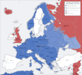
Second world war europe 1943-1945 map en.png 1,090 × 1,000; 264 KB
-
Second world war europe 1943-1945 map HE.png 1,090 × 1,000; 298 KB
-
Second world war europe 1943-1945 map it.gif 1,090 × 1,000; 129 KB
-
Second world war europe 1943-1945 map pl.png 1,090 × 1,000; 454 KB
-
Second world war europe 1943-1945 map pl2.png 1,090 × 1,000; 256 KB
-
Segonda Guèrra Mondiala - Euròpa (1942-1945).png 1,166 × 671; 393 KB
-
Segonda Guèrra Mondiala - Teatre europu - 1939-1942.png 3,000 × 3,001; 1.93 MB
-
Segonda Guèrra Mondiala - Teatre europu - 1942-1945.png 3,000 × 3,004; 2.05 MB
-
Skaalefjord.png 234 × 426; 37 KB
-
Slowakei.1943.jpg 912 × 567; 735 KB
-
Southern Shoulder Map.jpg 1,589 × 921; 461 KB
-
SovietBlockade1940.jpg 1,452 × 1,052; 1.39 MB
-
Stamp of USSR1973CPA4204.jpg 336 × 482; 75 KB
-
Sudetenland.png 1,298 × 575; 27 KB
-
Territorial victors against axis powers (Europe).png 6,519 × 4,126; 2.29 MB
-
The North American Indian in the World War LOC 2016586524.tif 5,920 × 4,924; 83.4 MB
-
The route to Sfakia.jpg 648 × 967; 406 KB
-
The routes used by escape lines to help downed airmen escape Nazi-occupied Europe,.jpg 1,279 × 1,800; 231 KB
-
Third Army Positions - 1 Sep 1944.png 1,830 × 1,451; 178 KB
-
Three faces of Europe, 1950.jpg 1,095 × 1,550; 282 KB
-
TomLubENG.png 2,880 × 2,880; 1.56 MB
-
TomLubENG.svg 1,440 × 1,440; 8.08 MB
-
TomLubPL.png 2,880 × 2,880; 1.56 MB
-
TomLubPL.svg 1,440 × 1,440; 8.08 MB
-
Tosse.png 955 × 789; 180 KB
-
Tour map 1.jpg 960 × 731; 145 KB
-
Tour map 2.jpg 960 × 731; 117 KB
-
Transnistria administratie romaneasca.png 393 × 708; 11 KB
-
Transnistria WW2.svg 1,300 × 3,200; 2.26 MB
-
Travels of the 289th.jpg 10,295 × 7,442; 29.13 MB
-
Truck routes in use by the US Army, 25 March - 8 May 1945.jpg 1,000 × 1,302; 238 KB
-
Téli háború magyar önkénteseinek útja.png 960 × 1,000; 167 KB
-
UK-NWE-Norway-2.jpg 800 × 526; 86 KB
-
Unidentified Map - NARA - 100384845.jpg 5,836 × 7,289; 5.08 MB
-
Unternehmen Barthold.gif 662 × 600; 82 KB
-
Unternehmen Barthold.png 800 × 732; 112 KB
-
Ustanak u Jugoslaviji i Evropa 1941.png 2,025 × 1,494; 1.89 MB
-
Utah Beach and Beach Maintenance Area.jpg 800 × 1,032; 147 KB
-
V-Weapon sites F B.png 1,588 × 1,046; 2.6 MB
-
V-Weapon sites.png 2,775 × 1,284; 4.23 MB
-
Village of Kesternich Map - 1944.jpg 734 × 439; 177 KB
-
Volkhov bridgehead (south) - 1941.svg 943 × 607; 2.88 MB
-
Western Europe WW2.png 357 × 328; 27 KB
-
WWII Anti-Axis Greek Language Propaganda Maps - 06 - Germany reduced to its pre-war size.jpg 10,320 × 10,012; 17.28 MB
-
WWII Campaign Map of 390 Anti-Aircraft Artillery (Automatic Weapons) Battalion.jpg 2,048 × 1,536; 622 KB
-
WWII in Europe 1939-1941-blank.svg 1,258 × 1,075; 113 KB
-
WWII in Europe 1939-1941-en.svg 1,256 × 1,259; 175 KB
-
WWII in Europe 1939-1941-english.svg 612 × 792; 84 KB
-
WWII in Europe 1939-1941-nv.svg 1,258 × 1,257; 495 KB
-
WWII in Europe 1939-1941-pl.svg 1,256 × 1,259; 176 KB
-
WWII Occupied Europe Blank Map.png 1,088 × 998; 200 KB
-
WWII51 Gothic Line.jpg 1,780 × 1,375; 847 KB
-
WWll европа map. jpg.jpg 1,200 × 1,001; 315 KB


