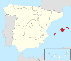
Category:Maps of the Balearic Islands
Jump to navigation
Jump to search
Provinces of Spain: Álava · Albacete · Alicante · Almería · Asturias‡ · Ávila · Badajoz · Balearic Islands‡ · Barcelona · Biscay · Burgos · Cáceres · Cádiz · Cantabria‡ · Castellón · Ciudad Real · Córdoba · A Coruña · Cuenca · Gipuzkoa · Girona · Granada · Guadalajara · Huelva · Huesca · Jaén · León · Lleida · Lugo · Madrid‡ · Málaga · Murcia‡ · Navarre‡ · Ourense · Palencia · Las Palmas · Pontevedra · La Rioja‡ · Salamanca · Santa Cruz de Tenerife · Segovia · Seville · Soria · Tarragona · Teruel · Toledo · Valencia · Valladolid · Zamora · Zaragoza · Autonomous cities: Ceuta · Melilla
‡: uniprovincial autonomous communities.
‡: uniprovincial autonomous communities.
Autonomous communities of Spain: Andalusia · Aragon · Asturias · Balearic Islands · Basque Autonomous Community · Canary Islands · Cantabria · Castile and León · Castilla–La Mancha · Catalonia · Extremadura · Galicia · Community of Madrid · Region of Murcia · Navarre · La Rioja · Valencian Community · Autonomous cities: Ceuta · Melilla
Wikimedia category | |||||
| Upload media | |||||
| Instance of | |||||
|---|---|---|---|---|---|
| Category combines topics | |||||
| Balearic Islands | |||||
archipelago in the Mediterranean Sea | |||||
| Instance of | |||||
| Location | Balearic Islands, Spain | ||||
| Located in or next to body of water | |||||
| Capital | |||||
| Coastline |
| ||||
| Highest point | |||||
| Population |
| ||||
| Area |
| ||||
| official website | |||||
 | |||||
Subcategories
This category has the following 18 subcategories, out of 18 total.
Pages in category "Maps of the Balearic Islands"
This category contains only the following page.
Media in category "Maps of the Balearic Islands"
The following 30 files are in this category, out of 30 total.
-
Balear.svg 474 × 546; 17 KB
-
Baleares-rotulado.png 1,013 × 636; 293 KB
-
BALEARES.jpg 720 × 540; 25 KB
-
Balearic BG.png 615 × 709; 49 KB
-
Balearic Islands-Flagmap.svg 829 × 495; 572 KB
-
CabreraMap.png 4,320 × 4,320; 21.83 MB
-
Comarcas de Baleares 2a.png 2,560 × 1,359; 230 KB
-
Comarcas in der autonomen Gemeinschaft Balearen 2022.png 3,000 × 2,100; 547 KB
-
ES + PT + islas.png 3,334 × 1,911; 1.92 MB
-
ETH-BIB-Balearen, Situations-Karte-Dia 247-Z-00421.tif 2,921 × 3,469; 29.11 MB
-
Gerichtsbezirke in der autonomen Gemeinschaft Balearen 2022.png 3,000 × 2,100; 530 KB
-
Ibiza Municipalities.svg 512 × 646; 84 KB
-
Islas Baleares Crecimiento-1998-2008.png 1,000 × 716; 55 KB
-
Islas Baleares Crecimiento-2008-2018.png 1,000 × 716; 60 KB
-
Islas Baleares Densidad-2018.png 1,000 × 716; 55 KB
-
Islas Baleares en 1800.svg 468 × 343; 473 KB
-
Islas Baleares Población-2018.png 1,000 × 716; 56 KB
-
Karte Autonome Gemeinschaft Balearen Gerichtsbezirke 2022.png 3,000 × 2,100; 531 KB
-
Karte Gemeinden und Comarcas autonome Gemeinschaft Balearen 2022.png 3,999 × 2,799; 662 KB
-
Karte Gemeinden und Gerichtsbezirke autonome Gemeinschaft Balearen 2022.png 3,999 × 2,799; 649 KB
-
Mapa de Formentera (Baleares, España).png 306 × 96; 25 KB
-
Mapa de Ibiza (Baleares, España).png 241 × 183; 40 KB
-
Mapa de Mallorca (Baleares, España).png 542 × 340; 149 KB
-
Mapa de Menorca (Baleares, España).png 247 × 180; 42 KB
-
Municipios antitaurinos Baleares.png 622 × 412; 10 KB
-
Municipis de les illes balears amb colles castelleres.jpg 2,000 × 1,336; 162 KB
-
NJ 31 - Series 1302 - U.S. Army Map Service - 1958 - Algiers and Balearic Islands.jpg 4,926 × 5,330; 5.17 MB
-
Parc national de l'Archipel de Cabrera.svg 512 × 348; 164 KB
-
Relief map of Spain Balearic Islands.png 2,332 × 1,521; 792 KB
-
Reliefkarte Balearische Inseln 2022.png 3,450 × 2,269; 1.53 MB


