Category:Maps of Andalusia
Jump to navigation
Jump to search
Autonomous communities of Spain: Andalusia · Aragon · Asturias · Balearic Islands · Basque Autonomous Community · Canary Islands · Cantabria · Castile and León · Castilla–La Mancha · Catalonia · Extremadura · Galicia · Community of Madrid · Region of Murcia · Navarre · La Rioja · Valencian Community · Autonomous cities: Ceuta · Melilla
Wikimedia category | |||||
| Upload media | |||||
| Instance of | |||||
|---|---|---|---|---|---|
| Category combines topics | |||||
| Andalusia | |||||
autonomous community of Spain | |||||
| Instance of | |||||
| Location |
| ||||
| Located in or next to body of water | |||||
| Capital | |||||
| Legislative body | |||||
| Executive body | |||||
| Highest judicial authority |
| ||||
| Official language | |||||
| Anthem |
| ||||
| Head of government |
| ||||
| Inception |
| ||||
| Highest point | |||||
| Population |
| ||||
| Area |
| ||||
| Elevation above sea level |
| ||||
| Replaces | |||||
| Different from | |||||
| official website | |||||
 | |||||
Subcategories
This category has the following 28 subcategories, out of 28 total.
- Maps of Eastern Andalusia (18 F)
!
- SVG maps of Andalusia (15 F)
*
.
C
E
F
- Flag maps of Andalusia (11 F)
H
L
- Linguistic maps of Andalusia (11 F)
- Location maps of Andalusia (25 F)
M
O
P
- Population maps of Andalusia (14 F)
T
W
- Wine maps of Andalusia (21 F)
Pages in category "Maps of Andalusia"
This category contains only the following page.
Media in category "Maps of Andalusia"
The following 62 files are in this category, out of 62 total.
-
Aceites DOP Andalucía.svg 947 × 548; 575 KB
-
Altimetria andalucia.png 1,610 × 1,011; 1.71 MB
-
Andalucia flora.png 3,000 × 2,064; 342 KB
-
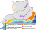
Andalucia pisos climáticos.png 3,000 × 2,064; 565 KB
-
Andalucia poblacion 2018.png 1,600 × 997; 394 KB
-
Andalucia precipitaciones anuales.png 3,000 × 2,064; 415 KB
-
Andalucia red ciudades.jpg 1,241 × 753; 164 KB
-
AndaluciaProvinces Outline Spain.png 392 × 232; 27 KB
-
Andalucía alta velocidad.png 1,800 × 1,200; 202 KB
-
Andalucía crecimiento 1998-2008.png 1,600 × 979; 410 KB
-
Andalucía crecimiento 2008-2018.png 1,600 × 979; 401 KB
-
Andalucía densidad 2018.png 1,600 × 1,011; 381 KB
-
Andalucía por provincias.png 1,600 × 1,000; 165 KB
-
Andalusia blank map.svg 964 × 560; 197 KB
-
Andalusia municipalities ALEA.png 1,395 × 833; 611 KB
-
Andalusia(independence)-Flagmap.svg 839 × 489; 285 KB
-
Andalusien Karte.png 1,503 × 897; 361 KB
-
Caballa y Melva de Andalucia.png 722 × 418; 66 KB
-
CanalSevillaBonanza.png 1,551 × 361; 121 KB
-
Clima andalucía.png 850 × 509; 539 KB
-
Clima AO.png 858 × 717; 361 KB
-
Comarcas in der autonomen Gemeinschaft Andalusien 2022.png 3,000 × 2,119; 1.38 MB
-
Embalses de Andalucía.png 2,000 × 1,169; 1,019 KB
-
Gerichtsbezirke in der autonomen Gemeinschaft Andalusien 2022.png 3,000 × 2,119; 1.35 MB
-
Hart administrativă a Andaluziei.png 1,600 × 1,000; 134 KB
-
Hospitales del Servicio Andaluz de Salud.png 1,600 × 1,000; 201 KB
-
Iberian lynx distribution in Andalusia, Spain (end of 2011).png 2,000 × 1,348; 335 KB
-
Localización de la Puebla de Vicar.png 596 × 574; 67 KB
-
Mapa composición Biobancos SSPA.jpg 1,000 × 650; 183 KB
-
Mapa de Andalucía con interrogaciones.png 1,780 × 736; 182 KB
-
Mapa de las provincias de Andalucía-ca.png 409 × 244; 18 KB
-
Mapa de las provincias de Andalucía.png 409 × 244; 7 KB
-
Mapa sanitario de Andalucía.png 1,291 × 862; 691 KB
-
Mapa sanitario de Andalucía.svg 1,019 × 679; 1.28 MB
-
Municipios gobernados por el PA.png 828 × 481; 197 KB
-
Municipiosnacionalistasand.png 828 × 481; 269 KB
-
Olive-Anda.png 457 × 278; 107 KB
-
Partidos Judiciales de Andalucía.svg 1,003 × 580; 2.16 MB
-
Provinciae Vandalitiae.svg 512 × 345; 1,004 KB
-
Provincias de Andalucía-HE.svg 947 × 547; 122 KB
-
Provincias de Andalucía.png 800 × 500; 65 KB
-
Provincias de Andalucía.svg 947 × 547; 161 KB
-
Red de Municipios por la Tercera República.svg 1,003 × 580; 2.45 MB
-
Relief map of Spain Andalusia.png 4,064 × 2,713; 15.46 MB
-
Reliefkarte Andalusien 2022.png 6,695 × 4,939; 33.45 MB
-
Relieve andalucia.png 692 × 426; 407 KB
-
RENTA 2006.png 3,509 × 2,478; 342 KB
-
Ruta betica.jpg 1,266 × 800; 330 KB
-
Ruta del Califato.JPG 590 × 488; 48 KB
-
Ríos de Andalucía.png 973 × 598; 216 KB
-
Sistemas Beticos.png 725 × 512; 518 KB
-
Slope andalucia.png 995 × 606; 68 KB
-
Strait Of Gibraltar he.svg 4,678 × 2,429; 2.34 MB
-
Tabernas-gd.svg 744 × 1,052; 419 KB
-
Tabernas-gd2.svg 744 × 1,052; 423 KB
-
Tabernas-gd3.svg 1,052 × 744; 423 KB
-
Tabernas-gd4.svg 1,052 × 744; 424 KB
-
Vegetacion en andalucia.png 3,119 × 1,842; 382 KB
-
West-East provinces of Andalusia.svg 1,000 × 600; 239 KB
-
Ανδαλουσία ορογραφικός.png 1,610 × 1,011; 1.73 MB
-
Ανδαλουσία πλήρης.JPG 1,082 × 749; 147 KB
-
Андалусийн аймгууд.png 1,348 × 788; 49 KB


