Category:Maps of rivers of the United States
Jump to navigation
Jump to search
English: Maps of the Rivers in the United States.
Subcategories
This category has the following 29 subcategories, out of 29 total.
A
B
C
- Maps of the Colorado River (37 F)
D
J
K
- Maps of the Klamath River (1 P, 12 F)
M
- Maps of the Missouri River (48 F)
O
P
- Maps of the Potomac River (28 F)
R
S
- Maps of the Schuylkill River (19 F)
- Maps of the Snake River (10 F)
- South Platte River maps (4 F)
T
- Maps of the Tennessee River (54 F)
V
- Maps of the Virgin River (6 F)
W
- Maps of the Wabash River (5 F)
Y
- Maps of the York River (7 F)
Media in category "Maps of rivers of the United States"
The following 31 files are in this category, out of 31 total.
-
US map - rivers and lakes.png 1,584 × 1,224; 301 KB
-
1867 Beers Map of Yonkers - Tibbetts Brook 01.jpg 3,000 × 3,703; 2.71 MB
-
1867 Beers Map of Yonkers - Tibbetts Brook 02.jpg 1,701 × 2,575; 1.3 MB
-
1867 Beers Map of Yonkers - Tibbetts Brook 03.jpg 1,701 × 2,575; 1.29 MB
-
A map of the sources of the Chaudière, Penobscot, and Kennebec rivers, LOC 74692578.tif 4,618 × 5,510; 72.8 MB
-
Alabama-Coosa Branch of Mobile River System - NARA - 109182421.jpg 7,040 × 5,503; 3.6 MB
-
Alabama-Coosa Branch of Mobile River System - NARA - 109182423.jpg 16,053 × 8,224; 13.19 MB
-
Alabama-Coosa Branch of Mobile River System - NARA - 109182427.jpg 14,540 × 3,360; 6.85 MB
-
Alabama-Coosa Branch of Mobile River System - NARA - 109182429.jpg 6,560 × 4,628; 2.96 MB
-
American Heritage Rivers Map.PNG 718 × 452; 172 KB
-
Arkansasbasincimarron.jpg 771 × 533; 259 KB
-
French River (Massachusetts + Connecticut) map.jpg 1,951 × 4,526; 3.29 MB
-
History of transportation in the United States before 1860 (1917) (14757943321).jpg 4,392 × 2,951; 1.75 MB
-
HUC Regions Map - NHDPlusHRStatus.png 4,200 × 3,400; 1.32 MB
-
Longest Rivers of the US with labels fixed again 2.jpg 1,759 × 1,004; 840 KB
-
Longest Rivers of the US with labels.jpg 1,759 × 1,004; 833 KB
-
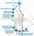
Map of the FM Area Diversion Project.jpg 2,401 × 2,554; 2.26 MB
-
Mississippi River basin.jpg 300 × 222; 9 KB
-
National-atlas-usa-rivers-unlabeled.png 758 × 584; 171 KB
-
Pascatway River New England.jpg 3,440 × 2,448; 749 KB
-
Refernces to the accompanying map.; Index to maps in Hudson River Valley Atlas. NYPL1691423.tiff 7,230 × 5,428; 112.28 MB
-
The American midland naturalist (1909) (17969100270).jpg 3,278 × 4,153; 1.9 MB
-
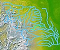
Wpdms nasa topo white river south dakota.jpg 300 × 250; 45 KB


