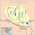
Category:Maps of the Red River of the South
Jump to navigation
Jump to search
Media in category "Maps of the Red River of the South"
The following 15 files are in this category, out of 15 total.
-
Redrivermap1.jpg 837 × 524; 255 KB
-
1796 blackriverOuachita.jpg 3,120 × 4,160; 2.22 MB
-
Little red rivermap.png 500 × 500; 124 KB
-
Map of Mouth of Red River, Louisiana - NARA - 128215826.jpg 8,900 × 4,064; 1.66 MB
-
Red River campaign map.jpg 9,238 × 14,971; 3.1 MB
-
Red River campaign.svg 744 × 1,052; 59 KB
-
Red River Exp 1806 map.png 9,287 × 2,862; 32.39 MB
-
Red River, Louisiana Cross Section1.jpg 5,487 × 6,734; 1.75 MB
-
Red River, Louisiana Deposits1.jpg 5,341 × 6,771; 6.82 MB
-
Red watershed.png 250 × 188; 23 KB
-
Redrivermap.jpg 856 × 532; 262 KB


