Category:Maps of rivers of Canada
Jump to navigation
Jump to search
Subcategories
This category has the following 12 subcategories, out of 12 total.
A
- Athabasca River maps (3 F)
B
M
- Maps of the Columbia River (63 F)
- Maps of the Slave River (4 F)
O
R
S
- Maps of the Snake River (10 F)
Media in category "Maps of rivers of Canada"
The following 59 files are in this category, out of 59 total.
-
Alberta rivers.png 808 × 1,019; 1.15 MB
-
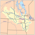
Assiniboinerivermap.png 500 × 499; 139 KB
-
Athabasca Watershed.png 808 × 1,019; 863 KB
-
Bowrivermap.jpg 657 × 531; 296 KB
-
Bulletin - United States National Museum (1960) (20478526306).jpg 2,918 × 2,144; 1.65 MB
-
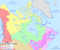
Canada drainage map - en.svg 1,114 × 942; 429 KB
-
Canada drainage map - fr.svg 1,114 × 942; 429 KB
-
Canada-Drainage.png 860 × 691; 199 KB
-
Churchill river hudson basin map.png 1,200 × 788; 1.6 MB
-
Columbia basin project.JPG 520 × 823; 92 KB
-
Columbia drainage basin blank map.png 808 × 790; 712 KB
-
Explorations in the far North (1898) (20774462695).jpg 2,570 × 3,822; 1.31 MB
-
Flathead River Map.png 813 × 628; 100 KB
-
Franklin 2 (6).jpg 912 × 387; 106 KB
-
Kejimkujik National Park.svg 3,146 × 1,655; 4.27 MB
-
Kennebecasis River map.jpg 1,142 × 547; 129 KB
-
Kettle River Map.png 669 × 727; 103 KB
-
Kootenay River map with states and provinces.png 794 × 683; 89 KB
-
Kootenay River map.png 794 × 683; 85 KB
-
Longest Rivers of Canada.jpg 1,398 × 938; 737 KB
-
Longest Rivers of Canada.png 2,400 × 1,802; 5.03 MB
-
Mackenzie River basin map.png 1,222 × 1,122; 2.11 MB
-
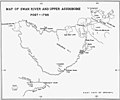
Map of Swan River and Upper Assiniboine River (Peter Fidler 1795).jpg 3,065 × 2,544; 1.04 MB
-
Map of the Niagara Frontier, 1869.jpg 482 × 787; 325 KB
-
Map of Western British North America (David Thompson 1813-1814).jpg 9,146 × 5,744; 7.32 MB
-
Maple nd rivermap.png 494 × 495; 138 KB
-
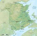
Rivers of New Brunswick map-fr.svg 2,237 × 2,199; 3.18 MB
-
Rivers of New Brunswick topographic map-fr.svg 2,237 × 2,199; 3.41 MB
-
North Saskatchewan basin map.png 1,200 × 822; 1.64 MB
-
NorthSaskMap.jpg 831 × 549; 393 KB
-
Okanogan River.png 626 × 683; 59 KB
-
Pellyrivermap.jpg 672 × 423; 254 KB
-
Pembinarivermap.png 500 × 499; 137 KB
-
Pend Oreille River Map.png 899 × 727; 123 KB
-
Pend Oreille-Clark Fork dams.jpg 689 × 605; 151 KB
-
Quappellerivermap.png 500 × 499; 137 KB
-
RichelieuValleyMontrealThreeRivers1777.png 562 × 872; 816 KB
-
Riv chic map.jpg 750 × 666; 485 KB
-
Major Rivers in West Canada.png 1,879 × 1,353; 2.51 MB
-
Riviereassiniboinecarte.png 500 × 499; 135 KB
-
Rivierequappellecarte.png 500 × 499; 133 KB
-
Rivieresouriscarte.png 500 × 499; 137 KB
-
Roseaurivermap.png 500 × 499; 136 KB
-
Saskatchewan basin map.png 1,200 × 836; 1.73 MB
-
Sourisrivermap.png 500 × 499; 141 KB
-
South Saskatchewan basin map.png 1,200 × 849; 1.77 MB
-
Southnahannirivermap.jpg 856 × 637; 470 KB
-
St John River Map-fr.png 576 × 420; 299 KB
-
St John River Map.png 576 × 420; 117 KB
-
South-West Canada.jpg 1,788 × 1,370; 3.25 MB
-
Vancouver Island-reliefPittRiver.png 578 × 600; 643 KB
-
Hydrographic Network of West Canada.png 1,763 × 1,353; 2.7 MB
-
Wildricerivermap.png 500 × 499; 141 KB


