Category:Maps of provinces of the Netherlands
Jump to navigation
Jump to search
Subcategories
This category has the following 17 subcategories, out of 17 total.
D
F
G
L
N
O
S
U
Z
Media in category "Maps of provinces of the Netherlands"
The following 59 files are in this category, out of 59 total.
-
Base Map of the Netherlands.png 752 × 1,006; 372 KB
-
Dutch provinces by nominal GRP in 2016.png 4,290 × 4,700; 1.12 MB
-
Dutch provinces by nominal GRP per capita in 2016.png 4,290 × 4,700; 1.11 MB
-
Gemeenten alles 1400px.gif 1,400 × 1,711; 1.51 MB
-
Gemeenten alles 1440px.gif 1,440 × 1,760; 1.55 MB
-
Gemeenten lijnen 1440px.png 1,400 × 1,689; 281 KB
-
Hollandia tartományai.png 800 × 948; 288 KB
-
IntochtenVanSinterklaasTot2012.png 1,000 × 1,193; 156 KB
-
KoninginnedagBezoekLocaties.png 1,000 × 1,193; 142 KB
-
Map of the Netherlands.svg 743 × 881; 252 KB
-
Map provinces Netherlands-de.svg 743 × 881; 516 KB
-
Map provinces Netherlands-el.svg 743 × 881; 887 KB
-
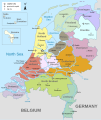
Map provinces Netherlands-en.svg 743 × 881; 1,003 KB
-
Map provinces Netherlands-es.svg 743 × 881; 944 KB
-
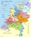
Map provinces Netherlands-fr.svg 743 × 881; 888 KB
-
Map provinces Netherlands-fy.svg 743 × 881; 886 KB
-
Map provinces Netherlands-he.svg 743 × 881; 847 KB
-
Map provinces Netherlands-it.svg 743 × 881; 888 KB
-
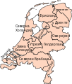
Map provinces Netherlands-mk.svg 743 × 881; 1.31 MB
-
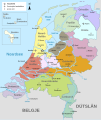
Map provinces Netherlands-nl.svg 743 × 881; 856 KB
-
Nederlandene kort.png 400 × 474; 28 KB
-
NederlandProvincie.jpg 462 × 568; 90 KB
-
NederlandProvincies.png 357 × 303; 11 KB
-
Nederlandse provincies (gemeenten).png 534 × 616; 65 KB
-
Nederlandse Provincies Duits.png 350 × 404; 36 KB
-
NederlandseProvincies.png 350 × 404; 35 KB
-
NederlandseProvinciesLarge.png 800 × 923; 244 KB
-
Netherland Provincies sr.svg 350 × 404; 137 KB
-
Netherlands Map (Without Islands).svg 743 × 881; 797 KB
-
Netherlands map large dutch 3.png 800 × 948; 305 KB
-
Netherlands map large dutch-10-10-10.png 800 × 948; 246 KB
-
Netherlands map large-10-10-10.png 1,200 × 1,423; 471 KB
-
Netherlands map large.png 1,200 × 1,423; 445 KB
-
Netherlands map rus.png 800 × 948; 85 KB
-
Netherlands map small clear.png 400 × 474; 19 KB
-
Netherlands map small HE.png 400 × 474; 52 KB
-
Netherlands map small.png 400 × 474; 28 KB
-
Netherlands provinces map blank.svg 743 × 881; 69 KB
-
Netherlands with provinces.png 200 × 235; 23 KB
-
NetherlandsGlobe.gif 500 × 500; 69 KB
-
NetherlandsGlobe.png 500 × 500; 229 KB
-
NetherlandsGlobeGrey.png 500 × 500; 87 KB
-
NetherlandsNavigationButtonUnanimated.gif 350 × 404; 23 KB
-
NL Provinzen, Backsteingotik.png 801 × 949; 375 KB
-
Pays-bas-10-10-10.png 800 × 948; 840 KB
-
Pays-bas.jpg 800 × 948; 161 KB
-
Province-NL.png 350 × 404; 27 KB
-
Provinces of the Netherlands (LT).svg 595 × 710; 216 KB
-
Provinces of the Netherlands - blank (alternative colors).svg 595 × 710; 75 KB
-
Provinces of the Netherlands - blank.svg 595 × 710; 72 KB
-
Provinces of the Netherlands-mk.svg 200 × 236; 107 KB
-
Provinces of the Netherlands.png 842 × 1,191; 121 KB
-
Provinces of the Netherlands.svg 200 × 236; 159 KB
-
Provincierandstad.jpg 200 × 236; 35 KB
-
Provincies lijnen 1440px.gif 1,440 × 1,760; 229 KB
-
Provincies-Gemeenten-public-600.gif 600 × 763; 197 KB
-
Provincies-Gemeenten-public-600.png 600 × 763; 200 KB
-
Stadionierungsorte der K-Verbände in Holland.jpg 656 × 725; 74 KB
-
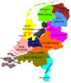
Провинции на Нидерландия.png 1,824 × 1,998; 448 KB


