Category:Maps of provinces of Italy
Jump to navigation
Jump to search
Subcategories
This category has the following 22 subcategories, out of 22 total.
Media in category "Maps of provinces of Italy"
The following 73 files are in this category, out of 73 total.
-
Administrative map of Italy showing regions, provinces and communes.png 1,632 × 2,112; 198 KB
-
Circoscrizione giudiziaria Monza.svg 956 × 744; 960 KB
-
Estat de las províncias d'Itàlia 2015.png 1,200 × 1,500; 96 KB
-
Gemeinden Italien 2018.png 3,000 × 3,592; 2.93 MB
-
Gemeinden Italien 2023.png 5,000 × 6,295; 5.93 MB
-
Gemeinden Italien 2024.png 5,000 × 5,986; 5.36 MB
-
Italia-Province 2.png 235 × 275; 20 KB
-
Italian provinces (1992).svg 512 × 660; 307 KB
-
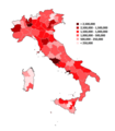
Italian provinces by population (2011).png 5,300 × 6,785; 2.63 MB
-
Italian provinces by population density, 2011.png 5,300 × 6,785; 2.57 MB
-
Italian provinces no regions ka.svg 1,200 × 1,500; 1.66 MB
-
Italian provinces no regions.svg 1,200 × 1,500; 1.64 MB
-
Italian provinces.png 1,281 × 880; 26 KB
-
ITALIAN PROVINCES.png 1,660 × 1,980; 115 KB
-
Italian Provinces.png 1,660 × 1,980; 80 KB
-
Italian provinces.svg 512 × 660; 357 KB
-
Italian regions provinces German.svg 1,200 × 1,500; 1.66 MB
-
Italian regions provinces mk.svg 1,200 × 1,500; 2.25 MB
-
Italian regions provinces white no labels.svg 1,200 × 1,500; 1.59 MB
-
Italian regions provinces.svg 1,200 × 1,500; 1.65 MB
-
Italian regions white (with new provinces).svg 1,200 × 1,500; 646 KB
-
Italian regions white.svg 1,200 × 1,500; 878 KB
-
Italian Regions.png 5,300 × 11,810; 2.31 MB
-
ItalianProvinces.png 1,632 × 2,112; 117 KB
-
Italien Regionen Metropolitanstädte.png 1,830 × 2,177; 135 KB
-
Italien, Verwaltungseinheiten mit gotischer Backsteinarchitektur.png 1,830 × 2,177; 159 KB
-
Italy Labelled Map Scalable.svg 1,200 × 1,500; 1.2 MB
-
Italy map with provinces.svg 1,200 × 1,500; 556 KB
-
Italy, administrative divisions (regions+provinces) - de - colored.svg 1,034 × 1,299; 2.14 MB
-
Italy, administrative divisions (regions+provinces) - de - monochrome.svg 1,034 × 1,299; 2.14 MB
-
Italy, administrative divisions (regions+provinces) - Nmbrs - colored.svg 1,034 × 1,299; 2.32 MB
-
Italy, administrative divisions (regions+provinces) - Nmbrs - monochrome.svg 1,034 × 1,299; 2.32 MB
-
Italy, administrative divisions (regions+provinces) - XY - colored.svg 1,034 × 1,299; 2.44 MB
-
Italy, administrative divisions (regions+provinces) - XY - monochrome.svg 1,034 × 1,299; 2.45 MB
-
Italy, administrative divisions - de (provinces) - colored.svg 1,034 × 1,299; 2.34 MB
-
Italy, administrative divisions - de (provinces).svg 1,034 × 1,299; 2.32 MB
-
Italy, administrative divisions - Nmbrs (provinces) - colored.svg 1,034 × 1,299; 2.39 MB
-
Italy, administrative divisions - Nmbrs (provinces).svg 1,034 × 1,299; 1.94 MB
-
Italy, administrative divisions - XY (provinces) - colored.svg 1,034 × 1,299; 2.44 MB
-
Italy, administrative divisions - XY (provinces).svg 1,034 × 1,299; 2.45 MB
-
Italy.geohive.gif 620 × 723; 30 KB
-
Kingdom of Italy 1861 map.png 3,360 × 3,950; 1.16 MB
-
Kingdom of Italy 1866 map.png 3,360 × 3,950; 1.23 MB
-
Kingdom of Italy 1870 map.png 3,360 × 3,950; 1.23 MB
-
Kingdom of Italy 1923 map.png 3,360 × 3,950; 1.29 MB
-
Kingdom of Italy 1924 map.png 3,360 × 3,950; 1.3 MB
-
Kingdom of Italy 1935 map.png 3,360 × 3,950; 1.39 MB
-
Kingdom of Italy 1941 map.png 3,360 × 3,950; 1.41 MB
-
Map of Italia centrale.svg 972 × 887; 1.27 MB
-
Map of Italia meridionale - Amalfi Coast.svg 1,044 × 1,232; 938 KB
-
Map of Italia meridionale.svg 1,044 × 1,232; 937 KB
-
Map of Italia.svg 2,167 × 2,769; 5.06 MB
-
Map of Italian provinces (1954).svg 1,200 × 1,500; 542 KB
-
Map of Italian provinces (1964).svg 1,200 × 1,500; 541 KB
-
Map of Italian provinces (1968).svg 1,200 × 1,500; 544 KB
-
Map of Italian provinces (1970).svg 1,200 × 1,500; 545 KB
-
Map of Italian provinces (1974).svg 1,200 × 1,500; 546 KB
-
Map of Italian provinces (1992).svg 1,200 × 1,500; 555 KB
-
Map of Italian provinces - animated.gif 960 × 1,200; 508 KB
-
Map of Italy blank.svg 1,200 × 1,500; 822 KB
-
Mapa de Italia (subdivisiones).svg 2,167 × 2,769; 3.38 MB
-
POPOLATION PROVINCES OF ITALY.png 1,777 × 2,025; 163 KB
-
Popolazione province.png 1,500 × 1,933; 364 KB
-
Popolazione province.svg 512 × 660; 293 KB
-
Province Italiane posizione.png 350 × 424; 11 KB
-
Province Italiane.jpg 1,556 × 1,883; 253 KB
-
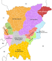
Provincia di Bergamo divisioni.svg 744 × 875; 1.9 MB
-
Provincia di Como divisioni.svg 744 × 1,052; 946 KB
-
Regioni, province e comuni italiani.svg 800 × 1,030; 3.8 MB
-
Regions, provinces and municipalities in Italy.svg 666 × 791; 87.78 MB
-
Republic of Italy 1947 map.png 3,360 × 3,950; 1.32 MB
-
Republic of Italy 1954 map.png 3,360 × 3,950; 1.32 MB
-
이탈리아의 프로빈차.svg 1,200 × 1,500; 1.66 MB


