Category:Maps of North Brabant
Jump to navigation
Jump to search
Provinces of the Netherlands: Drenthe · Flevoland · Friesland · Gelderland · Groningen · Limburg · North Brabant · North Holland · Overijssel · South Holland · Utrecht · Zeeland
Wikimedia category | |||||
| Upload media | |||||
| Instance of | |||||
|---|---|---|---|---|---|
| Category combines topics | |||||
| North Brabant | |||||
province of the Netherlands | |||||
| Pronunciation audio | |||||
| Instance of | |||||
| Named after | |||||
| Location | Netherlands | ||||
| Capital | |||||
| Head of government |
| ||||
| Inception |
| ||||
| Population |
| ||||
| Area |
| ||||
| official website | |||||
 | |||||
Subcategories
This category has the following 70 subcategories, out of 70 total.
- Road maps of North Brabant (71 F)
*
- Maps of Rucphense Heide (3 F)
- Maps of Wallsteijn (3 F)
A
B
C
- Maps of Cromvoirt (2 F)
D
E
F
- Maps of Fijnaart (2 F)
G
H
K
- Maps of Klundert (5 F)
L
M
- Maps of Dussen (4 F)
N
O
R
S
T
V
W
Z
Media in category "Maps of North Brabant"
The following 134 files are in this category, out of 134 total.
-
2009-Basisbeeld-Provincie10-Noord-Brabant.jpg 1,340 × 830; 473 KB
-
2009-Risicokaart-Regio20-MWB.jpg 734 × 611; 224 KB
-
2009-Risicokaart-Regio21-Brabant-noord.jpg 734 × 517; 188 KB
-
2009-Risicokaart-Regio22-ZOB.jpg 662 × 540; 174 KB
-
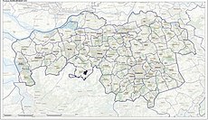
2010-NL-P10-Noord-Brabant-positiekaart-gemgrenzen.jpg 1,494 × 819; 309 KB
-
2010-NL-P10-Noord-Brabant-positiekaart-gemnamen.jpg 1,494 × 819; 328 KB
-
2010-P10-Noord-Brabant-basisbeeld.jpg 1,340 × 820; 521 KB
-
2010-P10-Noord-Brabant-outline-tr.png 1,202 × 638; 141 KB
-
2010-R20-MWB-basisbeeld.jpg 857 × 716; 351 KB
-
2010-R21-Brabant-Noord-basisbeeld.jpg 819 × 604; 292 KB
-
2010-R22-Zuidoost-Brabant-basisbeeld.jpg 792 × 658; 291 KB
-
2011-P10-Noord-Brabant-b54.jpg 1,968 × 1,078; 1.43 MB
-
2011-P10-Noord-Brabant-o54.png 1,727 × 922; 268 KB
-
2012-P10-NB-basis.jpg 1,804 × 982; 1.37 MB
-
2012-R20-MWB-basis.jpg 1,189 × 864; 890 KB
-
2012-R21-BN-basis.jpg 1,067 × 701; 675 KB
-
2012-R22-BZO-basis.jpg 985 × 705; 595 KB
-
2012-Top10AHN-Brabantsewal.jpg 1,196 × 1,886; 925 KB
-
2013-P10-NB-b.jpg 2,132 × 1,160; 1.89 MB
-
2013-P10-NB-o.png 1,595 × 844; 514 KB
-
2013-R20-MWB-b.jpg 1,405 × 1,015; 1.06 MB
-
2013-R21-BN-b.jpg 1,261 × 826; 927 KB
-
2013-R22-BZO-b.jpg 1,164 × 852; 832 KB
-
2013-Top33-Brabantsewal.jpg 2,096 × 2,589; 3.03 MB
-
2013-Top33-P10-Noord-Brabant.jpg 15,396 × 8,385; 81.04 MB
-
2015-P10-Noord-Brabant-o.png 1,916 × 1,015; 1,010 KB
-
2015-P10-Noord-Brabant.jpg 3,407 × 1,886; 3.78 MB
-
2015-R20-MWB.jpg 2,198 × 1,686; 2.07 MB
-
2015-R21-Brabant-Noord.jpg 2,118 × 1,211; 1.5 MB
-
2015-R22-BZO.jpg 1,876 × 1,411; 1.49 MB
-
2016-P10-Noord-Brabant-o.png 2,136 × 1,129; 1.05 MB
-
2016-P10-Noord-Brabant.jpg 2,653 × 1,457; 2.01 MB
-
2017-P10-Noord-Brabant.jpg 2,726 × 1,530; 2.9 MB
-
2018-P10-Noord-Brabant.jpg 3,435 × 1,912; 1.44 MB
-
Acht zaligheden geografisch.png 1,080 × 578; 167 KB
-
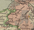
Brabant1477.png 409 × 362; 331 KB
-
Brabantse dialecten.png 1,160 × 960; 457 KB
-
Brabantselijn.png 774 × 428; 9 KB
-
Brabantsewal-natuur-OpenTopo.jpg 5,095 × 9,438; 20.7 MB
-
Cultuur historische streken Noord Brabant.jpg 1,040 × 570; 162 KB
-
DeKempen NL BE.jpg 2,000 × 2,717; 1.05 MB
-
DeKempen NLBE.jpg 2,000 × 2,717; 1.05 MB
-
DeKempenZOOM.jpg 2,000 × 2,717; 1.02 MB
-
Dijken Baardwijkse overlaat.jpg 800 × 380; 173 KB
-
EconomischGeografischGebied 112MiddenMeijerij.png 375 × 204; 10 KB
-
Editiekaart.png 709 × 385; 84 KB
-
Frankish Foederatus.png 570 × 471; 73 KB
-
Gebiedsafbakeningmeierij1998.PNG 282 × 133; 9 KB
-
GM0770.Eersel Rol-Banner Sch..Afb. 2023-05-01.png 776 × 2,580; 3.1 MB
-
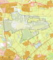
HetGroeneWoud.jpg 1,202 × 638; 207 KB
-
Historischemeierij.PNG 282 × 131; 10 KB
-
Holland1477.png 336 × 333; 188 KB
-
Kaart Baarle.png 1,780 × 1,018; 5.1 MB
-
Landen West Brabant.png 652 × 448; 27 KB
-
LocatieProvNoordBrabant.png 534 × 616; 50 KB
-
LocatieRegioBrabantseBuitensteden.png 280 × 130; 10 KB
-
LocatieRegioBredaTilburg.png 280 × 130; 10 KB
-
LocatieRegioWaalboss.png 280 × 130; 7 KB
-
Map - NL - Brabantse Stedenrij Municipalities (2009).png 2,000 × 1,067; 248 KB
-
Map - NL - Historical Land van Ravenstein.png 2,000 × 1,067; 329 KB
-
Map - NL - Municipalities De Meierij (2011).png 2,000 × 1,067; 346 KB
-
Map - NL - Municipality Meierij Graafschap Rode Historical.png 2,000 × 1,067; 309 KB
-
Map - NL - Municipality Meierij Historical.png 2,000 × 1,067; 306 KB
-
Map - NL - Municipality Meierij Kempenland Historical.png 2,000 × 1,067; 309 KB
-
Map - NL - Municipality Meierij Maasland Historical.png 2,000 × 1,067; 309 KB
-
Map - NL - Municipality Meierij Oisterwijk Historical.png 2,000 × 1,067; 308 KB
-
Map - NL - Municipality Meierij Peelland Historical.png 2,000 × 1,067; 309 KB
-
Mapa Brabante do Norte.jpg 307 × 417; 39 KB
-
Midden-Noord-Brabant.png 1,054 × 1,200; 151 KB
-
Natura2000 - Loonse en Drunense Duinen & Leemkuilen.png 2,016 × 2,267; 604 KB
-
NodaalGebied 71Uden.gif 375 × 204; 13 KB
-
Noord Brabant-Position.png 200 × 235; 23 KB
-
Noord brabant.GIF 201 × 291; 4 KB
-
Noord-Brabant bevolkingsdichtheid (BAG).png 4,899 × 2,801; 441 KB
-
Noord-Brabant in the Netherlands 2019.svg 888 × 1,001; 160 KB
-
Noord-Brabant in the Netherlands.svg 888 × 1,001; 146 KB
-
Noord-Brabant position.svg 200 × 236; 158 KB
-
Noord-Brabant.png 842 × 1,191; 48 KB
-
Noordoost-Brabantmap.png 1,446 × 742; 602 KB
-
NorthBrabantNetherlandsGlobe.png 500 × 500; 235 KB
-
NorthBrabantNetherlandsGlobeGrey.png 500 × 500; 89 KB
-
NorthBrabantTranparency.GIF 201 × 291; 6 KB
-
P Provinces of the Netherlands - North Brabant.gif 424 × 388; 36 KB
-
P10-NB-positiekaart2-gemlabels.png 1,780 × 1,018; 1.4 MB
-
Patabus.jpg 700 × 223; 80 KB
-
Prov-Noord-Brabant-OpenTopo.jpg 2,899 × 1,681; 950 KB
-
Provinces of the Netherlands - Noord-Brabant.svg 595 × 710; 67 KB
-
Provincie Noord-Brabant.gif 1,148 × 688; 538 KB
-
Provincie-10-Noord-Brabant-2009.png 1,148 × 688; 605 KB
-
Regio-20-MWB-2009.png 689 × 578; 279 KB
-
Regio-21-BN-2009.png 672 × 485; 217 KB
-
Regio-22-ZOB-2009.png 548 × 512; 187 KB
-
Rivierlopen-tijd.jpg 700 × 439; 133 KB
-
Samenwerkingsverband Regio Eindhoven.png 280 × 210; 12 KB
-
Uden COROP35.gif 375 × 204; 14 KB
-
Uden EGG112.gif 375 × 204; 12 KB
-
Uden KvKOostBrabant.gif 375 × 204; 19 KB
-
Uden NG71.gif 375 × 204; 14 KB
-
Uden StedelijkeRegio.gif 375 × 204; 13 KB
-
Uden VerzorgingsgebiedBernhoven.gif 375 × 204; 13 KB
-
Uden VerzorgingsgebiedCentrum.gif 375 × 204; 16 KB
-
VG044N-A1-A3 Duizel MIN+OAT+Sat. 270x225 15,1MB.jpg 7,656 × 6,378; 14.42 MB
-
VGhK.014N F1-F5 Witreit-Weibosch, Postelse Heide 16,2 MB 2023-10-23.jpg 6,804 × 9,526; 15.4 MB
-
VGhK.014N Witreit-Weibosch 19,6 MB 2023-10-23.jpg 9,526 × 6,804; 18.71 MB
-
VGhK.044.Steensel-B1-B3 MOSaNi,ahn2 (252x180 18,9 MB) 2022-10-05 (50-80-95).jpg 9,922 × 7,089; 18.05 MB
-
VGhK.044.Steensel-B1-B3 Pr.0(252x180 21,4 MB) 2022-10-19 (70-uit-80).jpg 9,922 × 7,089; 20.39 MB
-
VGhK.044A.Duizel-A1-A3 Pr.onl.(168x120 18,8 MB) 2023-01-08.jpg 9,526 × 6,804; 17.72 MB
-
VGhK.084 B1-B3 Hulsel (19,6 MB-Upload 50-75-2023-12-09).jpg 9,526 × 6,804; 18.66 MB
-
VGhK.084 B1-B3 Hulsel (19,7 MB-Upload 50-25-2023-12-09).jpg 9,526 × 6,804; 18.81 MB
-
VGhK.F1-F2 Bergeijk Witreit Weebosch (50-75 23,4MB 2023-11-19)jpg.jpg 9,668 × 6,906; 22.3 MB
-
VGhK.Rol-Banner Bergeijk 2023-10-23 21,0 MB.jpg 6,025 × 14,530; 20 MB
-
VGhK.VK1.044-046-162 2022-06-25 (A1) Pr.2 10,2 MB.jpg 6,804 × 9,528; 9.69 MB
-
VGhK.VK1.044-046-162 2022-06-25 (A1) Pr.3 20,3 MB.jpg 6,804 × 9,528; 19.36 MB
-
VGhK.VK1.Canon 2022-04-29 (A1) 16,8 MB (BGr.op 58x82).png 4,764 × 3,402; 16.01 MB
-
VGhK.VK1.Canon 2022-04-29 (A1) 34,6 MB (BGr.uit).png 4,764 × 3,402; 32.95 MB
-
VGK.014N F1-F5 Witreit-Weibosch, Postelse Heide 16,8 MB 2023-10-23.jpg 6,804 × 9,526; 16.03 MB
-
VGK.014N Witreit-Weibosch 20,8 MB 2023-10-23.jpg 9,526 × 6,804; 19.82 MB
-
VGK.Rol-Banner Bergeijk 2022-08-14 16,3 MB.jpg 6,192 × 14,933; 15.55 MB
-
VGK.Rol-Banner Bladel 2022-08-10 14,0 MB.jpg 4,390 × 15,000; 13.4 MB
-
VGK.Rol-Banner Reusel de Mierden 2022-09-12 (60,6x205,6 13,6 MB).jpg 4,414 × 14,977; 12.94 MB
-
VGK.VK1.Pr.Ve. 2022-06-07 (A1) 10,7 MB.jpg 6,804 × 9,528; 10.23 MB
-
VGK.VK1.Pr.Ve. 2022-06-15 (A1) 16,1 MB.jpg 6,804 × 9,528; 15.4 MB
-
VGK.VK1.Pr.Ve. 2022-06-20 (A1) Pr.2 9,2 MB.jpg 9,528 × 6,804; 8.6 MB
-
VGK.VK1.Pr.Ve. 2022-06-20 (A1) Pr.3 18,1 MB.jpg 9,528 × 6,804; 16.94 MB
-
VGKa.10084.B1-B3 MOSani+Na. 2,4x3,6 21,5 MB (2020-11-30).jpg 6,806 × 10,206; 20.51 MB
-
VGKa.10162N-Vessem-MOSa+Na Omg.A1,A2,B1,B2,C1,E1-E3 (3,9 x 2,9 29,0 MB 2021-02-24).jpg 11,113 × 8,334; 27.66 MB
-
VGKx.044N.Duizel-A1-A3 00-Groep 270x180 10,8 MB.jpg 7,653 × 5,102; 10.28 MB
-
VGKx.162N.Omg.D1-D5 Sch 1,8- 85Pr-MOSa+Na(378x378 30,6 MB).jpg 10,715 × 10,715; 29.21 MB
-
VGKx.162N.Omg.F1-F4 Sch. 1,8- 80Pr-MOSa+Na(324x324 24,8 MB).jpg 9,185 × 9,185; 23.65 MB
-
West Brabant 1580 Deventer.png 1,533 × 1,368; 3.39 MB
-
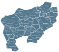
West-Noord-Brabant.png 1,316 × 1,160; 188 KB
-
Westbrabantbegrenzing.png 594 × 525; 192 KB
-
Westhoek.png 668 × 516; 25 KB
-
Zuiderfrontier.png 441 × 172; 36 KB

