Category:Maps of Java
Jump to navigation
Jump to search
May only include maps that focus on the island of Java. If other major islands of Indonesia are visible, use other categories, such as Category:Maps of western Indonesia / Category:Maps of eastern Indonesia. If showing the location of Java in relation with Indonesia, use Category:Locator maps of Java. If not showing the whole of Java, use the province level category(/categories).
Wikimedia category | |||||
| Upload media | |||||
| Instance of | |||||
|---|---|---|---|---|---|
| Category combines topics | |||||
| Java | |||||
island of Indonesia, Southeast Asia | |||||
| Instance of | |||||
| Part of | |||||
| Location | |||||
| Located in or next to body of water | |||||
| Significant event |
| ||||
| Width |
| ||||
| Length |
| ||||
| Highest point | |||||
| Population |
| ||||
| Area |
| ||||
| Elevation above sea level |
| ||||
| Different from | |||||
 | |||||
Subcategories
This category has the following 19 subcategories, out of 19 total.
!
*
D
- Drainage basin maps of Java (10 F)
J
- Java & Madura 1:50.000 (455 F)
L
- Location maps of Java (3 F)
M
O
T
Media in category "Maps of Java"
The following 48 files are in this category, out of 48 total.
-
2011 april earthquake Java.jpg 408 × 459; 53 KB
-
Alluvial Fan of Rawa Danau.png 908 × 538; 731 KB
-
Archaeological sites and Cities in Mediaeval Java.JPG 696 × 466; 64 KB
-
Buni culture.png 1,600 × 724; 953 KB
-
Cagar Alam Rawa Danau Caldera.png 937 × 552; 819 KB
-
Erste Reisen von Junghuhn in West- und Mitteljava.jpg 1,843 × 1,204; 478 KB
-
Jakarta metropolitan area.png 1,300 × 1,000; 139 KB
-
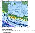
Jakarta Quake August 8-07.JPG 480 × 456; 64 KB
-
Java and Madoera - DPLA - 7321895841b1e7f4c13f91c0c7436515.jpg 7,264 × 3,133; 2.18 MB
-
Java extinción.png 584 × 391; 11 KB
-
Java Gunnung Merapi.JPG 2,525 × 1,040; 700 KB
-
Java Island Map id.png 2,246 × 1,211; 665 KB
-
Java Locator Topography Ijen.png 2,270 × 1,932; 3.9 MB
-
Java Locator Topography.png 2,525 × 1,627; 1.36 MB
-
Java map.png 500 × 338; 30 KB
-
Java sea.jpg 400 × 300; 47 KB
-
Java Topography.png 2,688 × 1,693; 1.16 MB
-
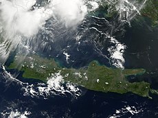
Java-2007-1860.JPG 1,953 × 1,295; 517 KB
-
Java-Chinin.jpg 1,600 × 1,820; 622 KB
-
Java-Vulkane.jpg 2,380 × 1,804; 873 KB
-
JavosSala.png 758 × 402; 35 KB
-
July 2006 Java earthquake Intensity.jpg 612 × 719; 95 KB
-
Junghuhns erste Reisen in West- und Mitteljava.png 1,843 × 1,204; 3.01 MB
-
Junghuhns zweite Reisen mit Dr Fritze.png 1,834 × 1,149; 2.13 MB
-
Kerajaan di Jawa Barat.jpg 3,264 × 3,264; 2.22 MB
-
Kerajaan Mataram Kuno.png 1,649 × 1,649; 392 KB
-
LombokStrait.png 762 × 464; 304 KB
-
Map of java.png 2,000 × 700; 138 KB
-
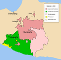
Mataram 1830-en.png 1,137 × 1,128; 58 KB
-
Mataram 1830-nl.png 1,137 × 1,128; 58 KB
-
Metabacetus willi localities - ZooKeys-352-035-g003.jpg 1,341 × 664; 447 KB
-
Pantura.jpg 2,652 × 1,100; 264 KB
-
Peta Bengawan Manukan.jpg 600 × 600; 118 KB
-
Peta Mataram Kuno Id.png 1,585 × 807; 391 KB
-
Peta Provinsi di Jawa.png 780 × 390; 66 KB
-
Peta-kerajaan-pakuan-pajajaran-sebelum menjadi jawa barat.png 1,012 × 403; 46 KB
-
Pulau sangiang map.png 751 × 615; 56 KB
-
Purwakarta Regency Location.png 243 × 171; 6 KB
-
S 9.2, E 105 - S 5.6, E 120 slope map.png 10,138 × 2,453; 4.93 MB
-
Suhita.png 360 × 160; 36 KB
-
Sultanate of Mataram 1636.png 3,138 × 1,096; 583 KB
-
Vom Krakatau bis zum Tambora.jpg 3,994 × 1,707; 1.24 MB
-
Where our tea comes from, 1937.jpg 5,614 × 9,000; 8.71 MB
-
Zweite Reisen von Junghuhn mit Dr Fritze (cropped).jpg 550 × 556; 70 KB
-
Zweite Reisen von Junghuhn mit Dr Fritze.jpg 1,834 × 1,149; 474 KB
-
Амок (1929). Мапа 1.jpg 718 × 326; 226 KB
-
Провинции Явы.png 2,257 × 812; 1.25 MB
-
Физ. карта Явы.png 2,257 × 812; 1.25 MB


