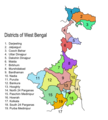
Category:Maps of districts of West Bengal
Jump to navigation
Jump to search
States of India: Andhra Pradesh · Arunachal Pradesh · Assam · Bihar · Chhattisgarh · Goa · Gujarat · Haryana · Himachal Pradesh · Jharkhand · Karnataka · Kerala · Madhya Pradesh · Maharashtra · Manipur · Meghalaya · Mizoram · Nagaland · Odisha · Punjab · Rajasthan · Sikkim · Tamil Nadu · Telangana · Tripura · Uttar Pradesh · Uttarakhand · West Bengal
Union territories: Dadra and Nagar Haveli and Daman and Diu ·
Former states of India:
Former union territories:
Union territories: Dadra and Nagar Haveli and Daman and Diu ·
Former states of India:
Former union territories:
| NO WIKIDATA ID FOUND! Search for Maps of districts of West Bengal on Wikidata | |
| Upload media |
Districts of West Bengal: Alipurduar · Bankura · Birbhum · Cooch Behar · Dakshin Dinajpur · Darjeeling · Hooghly · Howrah · Jalpaiguri · Jhargram · Kalimpong · Kolkata · Malda · Murshidabad · Nadia · North 24 Parganas · Paschim Bardhaman · Paschim Medinipur · Purba Bardhaman · Purba Medinipur · Purulia · South 24 Parganas · Uttar Dinajpur
Subcategories
This category has the following 3 subcategories, out of 3 total.
!
~
Media in category "Maps of districts of West Bengal"
The following 8 files are in this category, out of 8 total.
-
District Hospital West Bengal.svg 1,595 × 2,256; 281 KB
-
West Bengal DIST NUMBERED.png 2,000 × 3,051; 875 KB
-
West Bengal District Map.png 2,000 × 3,051; 898 KB
-
West Bengal districts.png 1,231 × 896; 1.55 MB
-
WestBengalDistricts numbered tag mr.svg 576 × 601; 144 KB
-
WestBengalDistricts numbered-bpy.png 1,589 × 2,115; 429 KB
-
WestBengalDistricts numbered.svg 768 × 1,159; 311 KB
-
WestBengalDistrictscurrent.png 450 × 500; 69 KB


