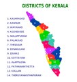
Category:Maps of districts of Kerala
Jump to navigation
Jump to search
States of India: Andhra Pradesh · Arunachal Pradesh · Assam · Bihar · Chhattisgarh · Goa · Gujarat · Haryana · Himachal Pradesh · Jharkhand · Karnataka · Kerala · Madhya Pradesh · Maharashtra · Manipur · Meghalaya · Mizoram · Nagaland · Odisha · Punjab · Rajasthan · Sikkim · Tamil Nadu · Telangana · Tripura · Uttar Pradesh · Uttarakhand · West Bengal
Union territories: Dadra and Nagar Haveli and Daman and Diu ·
Former states of India:
Former union territories:
Union territories: Dadra and Nagar Haveli and Daman and Diu ·
Former states of India:
Former union territories:
Subcategories
This category has the following 2 subcategories, out of 2 total.
L
Media in category "Maps of districts of Kerala"
The following 23 files are in this category, out of 23 total.
-
100px-കേരളം-അപൂവി.png 100 × 100; 12 KB
-
2018 Kerala Floods Red Alert Districts.png 3,445 × 5,020; 402 KB
-
Administrative Divisions of Kerala (2020).svg 1,123 × 1,588; 1.46 MB
-
Districts of Kerala.pdf 1,295 × 1,375; 952 KB
-
Districts of Kerala.png 430 × 420; 13 KB
-
Districts of Kerala.svg 617 × 786; 2.03 MB
-
India Kerala districts numbered.svg 827 × 1,205; 72 KB
-
Kerala - Cumulative rainfall by district 2018.png 983 × 1,235; 307 KB
-
Kerala district map.PNG 268 × 422; 11 KB
-
Kerala districts.png 1,231 × 896; 95 KB
-
Kerala Distrikte.GIF 546 × 915; 10 KB
-
KERALA MAP.jpg 2,050 × 3,431; 1,000 KB
-
Kerala-administrative-divisions-map-en.svg 2,700 × 3,000; 395 KB
-
Kerala-map-en.png 1,429 × 2,500; 288 KB
-
Kerala-map-en.svg 1,429 × 2,500; 127 KB
-
Kerala-map-kn.png 1,429 × 2,500; 302 KB
-
Kerala-map-ml.png 1,429 × 2,500; 313 KB
-
Kerala-map-ml.svg 1,429 × 2,500; 254 KB
-
Kerala-map-sa.png 1,429 × 2,500; 298 KB
-
The districts of Kerala-ar.svg 830 × 880; 2.62 MB
-
The districts of Kerala.svg 830 × 880; 2.62 MB
-
Wayanad Locator map.svg 512 × 343; 2.87 MB
-
கேரளம் அரசியல் வரைபடம்.svg 512 × 710; 768 KB


