Category:Maps of census statistical areas in Minnesota
Jump to navigation
Jump to search
States of the United States: Alabama · Alaska · Arizona · Arkansas · California · Colorado · Connecticut · Delaware · Florida · Georgia · Idaho · Illinois · Indiana · Iowa · Kansas · Kentucky · Louisiana · Maine · Maryland · Massachusetts · Michigan · Minnesota · Mississippi · Missouri · Montana · Nebraska · Nevada · New Hampshire · New Jersey · New Mexico · New York · North Carolina · North Dakota · Ohio · Oklahoma · Oregon · Pennsylvania · Rhode Island · South Carolina · South Dakota · Tennessee · Texas · Utah · Vermont · Virginia · Washington · West Virginia · Wisconsin
Puerto Rico
Puerto Rico
Media in category "Maps of census statistical areas in Minnesota"
The following 25 files are in this category, out of 25 total.
-
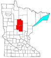
Brainerd Micropolitan Area.png 440 × 498; 24 KB
-
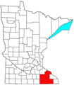
Mankato-New Ulm-North Mankato CSA.png 440 × 498; 14 KB
-
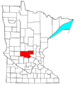
Mankato-North Mankato Micropolitan Area.png 440 × 498; 24 KB
-
Map of the USA highlighting the Twin Cities.gif 4,200 × 3,105; 1.64 MB
-
Map of the USA highlighting the Twin Cities.png 1,050 × 776; 527 KB
-
Metro Fargo.PNG 372 × 217; 10 KB
-
Minneapolis-St. Paul-Bloomington, MN-WI Metro Area.svg 512 × 566; 72 KB
-
Minneapolis-St. Paul-St. Cloud Combined Statistical Area.svg 512 × 544; 81 KB
-
Minneapolis-StPaul-2000.jpg 2,592 × 2,376; 1.06 MB
-
Minneapolis–St. Paul–St. Cloud CSA.png 394 × 426; 22 KB
-
Minnesota CBSAs 2020.png 5,388 × 3,855; 1.11 MB
-
Rochester Metropolitan Area.png 440 × 498; 14 KB
-
Rochester MN Metropolitan Area Updated.png 500 × 573; 72 KB
-
Rochester MN Metropolitan Area.png 500 × 573; 67 KB
-
Rochester, MN MSA.png 432 × 452; 5 KB
-
St. Cloud Metropolitan Area.png 440 × 498; 24 KB
-
Twin Cities 7County Metro.svg 654 × 440; 6.34 MB
-
Twin Cities Map 2.svg 1,726 × 1,923; 6.39 MB
-
Twin Cities Map 3.svg 1,718 × 1,718; 5.97 MB
-
Twin Cities Map.svg 1,726 × 1,923; 6.44 MB
-
Twin Cities Metro Area (13 County).png 1,500 × 1,161; 866 KB
-
Twin Cities.png 262 × 300; 33 KB
-
Twin Cities.svg 5,805 × 6,589; 126 KB
-
TwinCities.jpg 660 × 599; 82 KB
-
US metro areas-Minneapolis-StPaul-Bloomington.jpg 605 × 570; 208 KB


