Category:Maps of Wrexham County Borough
Jump to navigation
Jump to search

Wikimedia category | |||||
| Upload media | |||||
| Instance of | |||||
|---|---|---|---|---|---|
| Category combines topics | |||||
| Wrexham County Borough | |||||
principal area in north-east Wales | |||||
| Instance of |
| ||||
| Location | Wales | ||||
| Capital | |||||
| Inception |
| ||||
| Population |
| ||||
| Area |
| ||||
| Replaces | |||||
| official website | |||||
 | |||||
Subcategories
This category has the following 3 subcategories, out of 3 total.
Media in category "Maps of Wrexham County Borough"
The following 20 files are in this category, out of 20 total.
-
2024 Wales Wrexham Constituencies map.svg 512 × 362; 22 KB
-
Camlas ellesmere.png 712 × 1,002; 697 KB
-
Chirk and Wrexham Area.png 256 × 256; 13 KB
-
English Maelor region map.png 1,000 × 809; 439 KB
-
North Wales 2.png 400 × 497; 58 KB
-
Ordnance Survey 1-250000 - SJ.jpg 4,000 × 4,000; 9.38 MB
-
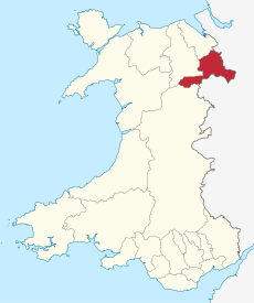
Wales Wrexham locator map.svg 1,047 × 1,251; 147 KB
-
Wales Wrexham.png 335 × 431; 7 KB
-
Wales Wrexham.svg 512 × 612; 277 KB
-
WalesWrexham.png 200 × 225; 22 KB
-
Wrexham (Assembly constituency).svg 1,015 × 513; 63 KB
-
Wrexham BUA location map.svg 512 × 362; 676 KB
-
Wrexham built-up area map 2011.png 850 × 700; 559 KB
-
Wrexham built-up area map 2021.png 800 × 600; 438 KB
-
Wrexham in Wales.svg 1,047 × 1,252; 395 KB
-
Wrexham UK community map (blank).svg 1,425 × 1,008; 670 KB
-
Wrexham UK location map.svg 1,425 × 1,008; 631 KB
-
Wrexham UK map.svg 1,425 × 1,008; 346 KB
-
Wrexham UK relief location map.jpg 1,999 × 1,412; 275 KB
-
Wrexham UK ward map (blank).svg 1,425 × 1,008; 664 KB


