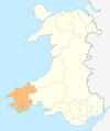
Category:Maps of Pembrokeshire
Jump to navigation
Jump to search

Wikimedia category | |||||
| Upload media | |||||
| Instance of | |||||
|---|---|---|---|---|---|
| Category combines topics | |||||
| Pembrokeshire | |||||
principal area in south-west Wales, United Kingdom | |||||
| Instance of | |||||
| Location | Wales | ||||
| Located in or next to body of water | |||||
| Capital | |||||
| Inception |
| ||||
| Population |
| ||||
| Area |
| ||||
| Different from | |||||
| official website | |||||
 | |||||
Subcategories
This category has the following 7 subcategories, out of 7 total.
C
H
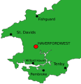
- Maps of Haverfordwest (10 F)
Media in category "Maps of Pembrokeshire"
The following 70 files are in this category, out of 70 total.
-
2024 Wales Pembrokeshire Community map.svg 512 × 393; 1.19 MB
-
2024 Wales Pembrokeshire Constituencies map.svg 512 × 393; 33 KB
-
Admiralty Chart No 1410 St Gowan's Head to New Quay, Published 1881.jpg 16,195 × 11,098; 12.75 MB
-
Admiralty Chart No 1478 St Gowan's Head to St David's Head, Published 1956.jpg 16,339 × 11,231; 46.69 MB
-
Admiralty Chart No 1488 St Anns Head to St Brides Bay, Published 1878.jpg 16,125 × 10,888; 46.67 MB
-
Admiralty Chart No 2879 Milford Haven, Published 1896.jpg 16,553 × 8,219; 18.88 MB
-
Admiralty Chart No 3274 Milford Haven, Published 1961.jpg 16,276 × 11,125; 65.62 MB
-
BaeCeredigion.svg 2,030 × 3,120; 71 KB
-
Bride baymap1946.jpg 2,581 × 1,926; 559 KB
-
Bristol channel detailed map.png 600 × 276; 47 KB
-
Bristol-channel-clean-HE.jpg 600 × 276; 167 KB
-
Bristol-channel-clean.jpg 600 × 276; 139 KB
-
Broadhaven South - information board - geograph.org.uk - 5133333.jpg 2,576 × 1,932; 1.16 MB
-
Caldey Island map 1952.jpg 2,400 × 1,104; 172 KB
-
CardiganBay cy.svg 2,030 × 3,120; 65 KB
-
CardiganBay mk.svg 2,030 × 3,120; 252 KB
-
CardiganBay.svg 2,030 × 3,120; 66 KB
-
CardiganBay2.svg 2,030 × 3,120; 69 KB
-
Deheubarth.PNG 396 × 411; 9 KB
-
Deheubarth1.PNG 570 × 591; 32 KB
-
Dinas Island map detail.JPG 408 × 365; 22 KB
-
Dinas Island map.JPG 326 × 293; 18 KB
-
Fishguard pembrokeshire map.svg 452 × 466; 32 KB
-
Haverfordwest map.svg 925 × 533; 50 KB
-
Haverfordwest pembrokeshire map.svg 452 × 466; 32 KB
-
Pembrokeshire Hundreds.svg 840 × 717; 1.05 MB
-
LDDyfedCantrefi.png 1,344 × 959; 61 KB
-
Llangolman pembrokeshire map.png 250 × 258; 13 KB
-
Location map Pembrokeshire.png 960 × 720; 509 KB
-
Location map Wales Pembrokeshire.png 783 × 772; 292 KB
-
Map Cuffern Manor 1810.jpg 1,200 × 842; 238 KB
-
Milford Haven harbourmap1946.jpg 3,200 × 2,208; 820 KB
-
Milfordhaven pembrokeshire map.svg 452 × 466; 32 KB
-
Narberthmap1952.jpg 1,273 × 873; 692 KB
-
NevernQuarters.jpg 1,744 × 1,944; 405 KB
-
Ordnance Survey 1-250000 - SS.jpg 4,000 × 4,000; 4.77 MB
-
Ordnance Survey One-Inch Sheet 138 151 Fishguard & Pembroke, Published 1965 2.jpg 8,948 × 10,855; 19.26 MB
-
Ordnance Survey One-Inch Sheet 138 151 Fishguard & Pembroke, Published 1965.jpg 8,517 × 9,915; 9.63 MB
-
Ordnance Survey One-Inch Sheet 151 Pembroke, Published 1946.jpg 8,471 × 9,540; 8.72 MB
-
Pembroke Information Board - geograph.org.uk - 4878645.jpg 2,576 × 1,932; 1.24 MB
-
Pembroke pembrokeshire map.svg 452 × 466; 32 KB
-
Pembrokeshire - British Isles.svg 1,250 × 1,835; 1,024 KB
-
Pembrokeshire Brit Isles Sect 5.svg 809 × 743; 939 KB
-
Pembrokeshire Brit Isles Sect 6.svg 545 × 593; 938 KB
-
Pembrokeshire Coast National Park map.svg 1,370 × 1,270; 1.51 MB
-
Pembrokeshire Coast Path and National Park map.svg 1,370 × 1,270; 1.51 MB
-
Pembrokeshire Coast Path.png 1,160 × 1,220; 310 KB
-
Pembrokeshire County Council 2012 Election results map.png 760 × 820; 164 KB
-
Pembrokeshire County Council 2017 Election results map.png 760 × 820; 162 KB
-
Pembrokeshire in Wales.svg 1,047 × 1,252; 395 KB
-
Pembrokeshire map plain.svg 452 × 464; 24 KB
-
Pembrokeshire UK community map (blank).svg 1,425 × 1,095; 1.49 MB
-
Pembrokeshire UK location map.svg 1,425 × 1,095; 1.06 MB
-
Pembrokeshire UK map.svg 1,425 × 1,095; 837 KB
-
Pembrokeshire UK relief location map.jpg 1,999 × 1,536; 244 KB
-
Pembrokeshire UK ward map (blank).svg 1,425 × 1,095; 1.34 MB
-
Pembrokeshire UK ward map 2011 (blank).svg 1,425 × 1,095; 1.33 MB
-
Pembrokeshire Wales community map post-2012.png 765 × 830; 181 KB
-
PembrokeshireBrit6.GIF 398 × 459; 8 KB
-
PembrokeshireBrit6.PNG 398 × 459; 11 KB
-
Plan of Milford Haven.jpg 1,155 × 702; 147 KB
-
Poppit sands location.jpg 337 × 415; 24 KB
-
Skomer en skokholm.png 326 × 285; 15 KB
-
Stdavids pembrokeshire map.svg 452 × 466; 32 KB
-
Wales Pembrokeshire locator map.svg 1,047 × 1,251; 152 KB
-
Wales Pembrokeshire.png 335 × 431; 7 KB
-
Wales Pembrokeshire.svg 512 × 612; 277 KB
-
WalesPembrokeshire.png 200 × 225; 22 KB
-
WalesSouthPembroke1974.png 200 × 245; 10 KB
