Category:Maps of Carmarthenshire
Jump to navigation
Jump to search
Wikimedia category | |||||
| Upload media | |||||
| Instance of | |||||
|---|---|---|---|---|---|
| Category combines topics | |||||
| Carmarthenshire | |||||
principal area in south-west Wales | |||||
| Instance of | |||||
| Location | Wales | ||||
| Located in or next to body of water | |||||
| Visitor center |
| ||||
| Capital | |||||
| Highest point | |||||
| Population |
| ||||
| Area |
| ||||
| Different from | |||||
| official website | |||||
 | |||||

Subcategories
This category has the following 5 subcategories, out of 5 total.
Media in category "Maps of Carmarthenshire"
The following 35 files are in this category, out of 35 total.
-
2024 Wales Carmarthenshire Constituencies map.svg 512 × 399; 20 KB
-
6 Carmarthenshire.png 350 × 418; 198 KB
-
Aqueduct1.jpg 2,036 × 1,339; 287 KB
-
Bristol channel detailed map.png 600 × 276; 47 KB
-
Bristol-channel-clean-HE.jpg 600 × 276; 167 KB
-
Bristol-channel-clean.jpg 600 × 276; 139 KB
-
Burry portmap1954.jpg 1,952 × 976; 269 KB
-
Carmarthen.1610.Speed.map.jpg 1,800 × 1,097; 188 KB
-
Carmarthenshire - British Isles.svg 1,250 × 1,835; 1,024 KB
-
Carmarthenshire Brit Isles Sect 5.svg 809 × 743; 939 KB
-
Carmarthenshire Brit Isles Sect 6.svg 545 × 593; 938 KB
-
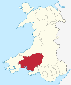
Carmarthenshire in Wales.svg 1,047 × 1,252; 395 KB
-
Carmarthenshire UK community map (blank).svg 1,425 × 1,111; 1.67 MB
-
Carmarthenshire UK location map.svg 1,425 × 1,111; 1.29 MB
-
Carmarthenshire UK map.svg 1,425 × 1,111; 803 KB
-
Carmarthenshire UK relief location map.jpg 1,999 × 1,558; 428 KB
-
Carmarthenshire UK ward map (blank).svg 1,425 × 1,111; 1.47 MB
-
CarmarthenshireBrit6.PNG 398 × 459; 11 KB
-
CarmarthenshireBrit6.png 398 × 459; 8 KB
-
CymruLlanpumsaint.jpg 195 × 225; 9 KB
-
Deheubarth.PNG 396 × 411; 9 KB
-
Deheubarth1.PNG 570 × 591; 32 KB
-
Carmarthenshire Hundreds.svg 1,000 × 704; 382 KB
-
Information Board, Mermaid Gate, St Clears - geograph.org.uk - 4825215.jpg 2,576 × 1,932; 1.26 MB
-
Information Panel - Bancyfelin - geograph.org.uk - 4825350.jpg 2,576 × 1,932; 1.24 MB
-
Ordnance Survey 1-250000 - SS.jpg 4,000 × 4,000; 4.77 MB
-
Speed Carmarthen insert.jpg 754 × 583; 314 KB
-
Wales Carmarthenshire locator map.svg 1,047 × 1,251; 151 KB
-
Wales Carmarthenshire.png 335 × 431; 8 KB
-
Wales Carmarthenshire.svg 512 × 612; 277 KB
-
WalesCarmarthen1974.png 400 × 490; 12 KB
-
WalesCarmarthenshire.png 200 × 225; 22 KB
-
WalesDinefwr1974.png 400 × 490; 12 KB
-
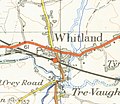
Whitlandmap1952.jpg 740 × 642; 278 KB


