Category:Maps of World War II in Europe 1945
Jump to navigation
Jump to search
Media in category "Maps of World War II in Europe 1945"
The following 19 files are in this category, out of 19 total.
-
1945 Chapin map of Central Europe for TIME Magazine.jpg 5,403 × 7,500; 15.4 MB
-
Allied army positions on 10 May 1945.png 1,216 × 769; 550 KB
-
Antwerp port installations.png 2,967 × 2,252; 117 KB
-
Demarkacni cara 1945.jpg 1,002 × 607; 108 KB
-
Final Operations - 19 April-7 May 1945 (cropped to Czechia).jpg 573 × 351; 257 KB
-
Final Operations - 19 April-7 May 1945.jpg 1,261 × 956; 1.33 MB
-
Allied Occupation Zones.jpg 1,256 × 956; 1.68 MB
-
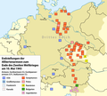
Karte Positionen der Alliierten zum Ende des Zweiten Weltkrieges am 10. Mai 1945.png 1,228 × 1,108; 182 KB
-
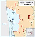
Memel Bridgehead 1-1-1945.jpg 1,015 × 1,056; 117 KB
-
Operation Undertone Map 1945.png 2,185 × 1,647; 5.15 MB
-
Parcours2eDB.jpg 1,480 × 587; 205 KB
-
Rhineland campaign 1945 map.jpg 497 × 700; 121 KB
-
Sixth AG offensive.png 1,581 × 1,777; 4.85 MB
-
Task-Force-Baum.jpg 1,000 × 659; 157 KB
-
Verdun depot installations.png 2,967 × 2,252; 85 KB
-
WWII - Germany from West, January, 1945.jpg 1,024 × 795; 335 KB
-
Берлинская Операция.jpg 1,420 × 872; 297 KB


