Category:Maps of Upper Austria
Jump to navigation
Jump to search
States of Austria:  Burgenland ·
  Carinthia ·
  Lower Austria ·
  Salzburg ·
  Styria ·
  Tyrol ·
  Upper Austria ·
  Vienna ·
  Vorarlberg
Wikimedia category | |||||
| Upload media | |||||
| Instance of | |||||
|---|---|---|---|---|---|
| Category combines topics | |||||
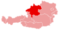
| Upper Austria | |||||
federal state in the North of Austria  .svg)   | |||||
| Pronunciation audio | |||||
| Instance of | |||||
| Location |
| ||||
| Visitor center |
| ||||
| Capital | |||||
| Legislative body | |||||
| Anthem | |||||
| Head of government |
| ||||
| Population |
| ||||
| Area |
| ||||
| Elevation above sea level |
| ||||
| official website | |||||
 | |||||
Use the appropriate category for maps showing all or a large part of Upper Austria. See subcategories for smaller areas:
| If the map shows | Category to use |
|---|---|
| Upper Austria on a recently created map | Category:Maps of Upper Austria or its subcategories |
| Upper Austria on a map created more than 70 years ago | Category:Old maps of Upper Austria or its subcategories |
| the history of Upper Austria on a recently created map | Category:Maps of the history of Upper Austria or its subcategories |
| the history of Upper Austria on a map created more than 70 years ago | Category:Old maps of the history of Upper Austria or its subcategories |
Deutsch: Karten von Oberösterreich
English: Maps of Upper Austria
Subcategories
This category has the following 12 subcategories, out of 12 total.
Media in category "Maps of Upper Austria"
The following 43 files are in this category, out of 43 total.
-
 Austria Upper Austria relief location map.png 2,513 × 2,223; 6.3 MB
-
 Upper Austria Topographic Empty.png 1,700 × 1,500; 2.2 MB
-
 Gemeinden Oberösterreich.svg 363 × 341; 193 KB
-
 Karte oesterreich oberoe.png 299 × 154; 14 KB
-
 Raumeinheiten Oberoesterreich V2.png 1,700 × 2,400; 2.59 MB
-
 20190130 St.Wolfgang 1271 (46503200425).jpg 7,952 × 5,304; 34.03 MB
-
 After Action Report - Krems - NARA - 100384933.jpg 10,800 × 7,750; 9.88 MB
-
 After Action Report - Leoben - NARA - 100384935.jpg 10,800 × 7,774; 10.77 MB
-
 After Action Report - Linz - NARA - 100384937.jpg 10,800 × 7,857; 10.64 MB
-
 Austria ooe.svg 2,000 × 1,125; 145 KB
-
 Bezirk Braunau am Inn Positionskarte.svg 744 × 815; 29 KB
-
 Bezirk Eferding Positionskarte.svg 708 × 444; 13 KB
-
 Bezirk Gmunden Positionskarte.svg 744 × 1,052; 25 KB
-
 Bezirk Vöcklabruck Positionskarte.svg 723 × 567; 35 KB
-
 Bistuemer oesterreich linz.png 299 × 154; 12 KB
-
 Burgstall Ipf-neu.jpg 1,458 × 745; 59 KB
-
 Districts of Upper Austria.png 652 × 569; 89 KB
-
 Empire d'Autriche 1914 Haute-Autriche.png 3,507 × 2,480; 3.84 MB
-
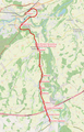
 Karte Aschacher Bahn.png 928 × 2,024; 1.7 MB
-
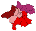
 Karte Aut Ooe Bezirke.png 300 × 265; 4 KB
-
 Karte Aut Ooe Hausruckviertel.png 300 × 265; 4 KB
-
 Karte Aut Ooe Innviertel.png 300 × 265; 4 KB
-
 Karte Aut Ooe Mühlviertel.png 300 × 265; 4 KB
-
 Karte Aut Ooe Traunviertel V2.png 300 × 265; 4 KB
-
 Karte der Eisenwurzen.svg 848 × 709; 992 KB
-
 Karte Lokalbahn Gmunden–Vorchdorf.png 2,253 × 2,178; 3.4 MB
-
 Karte Lokalbahn Lambach–Vorchdorf-Eggenberg.png 1,318 × 2,052; 1.97 MB
-
 Karte Oberoesterreich Viertel mit Legende.png 300 × 303; 7 KB
-
 Mappa geometrica der Stadt Enns 1750.jpg 766 × 800; 162 KB
-
 Meteoritenfall Mauerkirchen.jpg 394 × 396; 68 KB
-
 Oberoesterreich Donaumonarchie.png 674 × 510; 7 KB
-
 Oberösterreich.png 2,057 × 1,455; 1.07 MB
-
 Orte im Gebiet der Weyerer Boegen.png 716 × 560; 375 KB
-
 OÖLV.gif 90 × 79; 2 KB
-
 Raumeinheiten Oberösterreich.png 2,000 × 1,879; 719 KB
-
 Rodl Donau catchment.png 1,200 × 1,368; 2.99 MB
-
 RTV Sendegiebt.jpg 4,905 × 3,357; 2.15 MB
-
 Sendegebiet RTV Regionalfernsehen .jpg 2,480 × 3,508; 1.69 MB
-
 Skizze der Weyerer Boegen.png 716 × 560; 385 KB
-
 Steyr Enns catchment.png 1,683 × 2,297; 6.11 MB
-
 Tischberg-Kamenec.PNG 460 × 441; 48 KB
-
 Traun Donau catchment.png 1,200 × 1,195; 2.62 MB
-
 Viertel Oberösterreichs.png 684 × 599; 29 KB


.jpg)


