Category:Maps of Lower Austria
Jump to navigation
Jump to search
States of Austria:  Burgenland ·
  Carinthia ·
  Lower Austria ·
  Salzburg ·
  Styria ·
  Tyrol ·
  Upper Austria ·
  Vienna ·
  Vorarlberg
Wikimedia category | |||||
| Upload media | |||||
| Instance of | |||||
|---|---|---|---|---|---|
| Category combines topics | |||||
| Lower Austria | |||||
federated state of Austria      | |||||
| Instance of | |||||
| Location |
| ||||
| Capital |
| ||||
| Legislative body |
| ||||
| Anthem |
| ||||
| Head of government |
| ||||
| Population |
| ||||
| Area |
| ||||
| Elevation above sea level |
| ||||
| official website | |||||
 | |||||
Use the appropriate category for maps showing all or a large part of Lower Austria. See subcategories for smaller areas:
| If the map shows | Category to use |
|---|---|
| Lower Austria on a recently created map | Category:Maps of Lower Austria or its subcategories |
| Lower Austria on a map created more than 70 years ago | Category:Old maps of Lower Austria or its subcategories |
| the history of Lower Austria on a recently created map | Category:Maps of the history of Lower Austria or its subcategories |
| the history of Lower Austria on a map created more than 70 years ago | Category:Old maps of the history of Lower Austria or its subcategories |
Deutsch: Karten von Niederösterreich
English: Maps of Lower Austria
Subcategories
This category has the following 13 subcategories, out of 13 total.
Media in category "Maps of Lower Austria"
The following 107 files are in this category, out of 107 total.
-
 Karte oesterreich niederoe.png 299 × 154; 14 KB
-
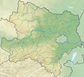 Austria Lower Austria topographic location map.png 1,772 × 1,622; 3.86 MB
-
 Bassa Austria-Posizione.png 410 × 243; 10 KB
-
 After Action Report - Wiener Neustadt - NARA - 100384943.jpg 10,800 × 7,817; 9.51 MB
-
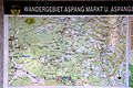 Aspang-Markt - Wanderkarte.jpg 3,000 × 2,000; 1.82 MB
-

-
 Bezirk Baden Übersicht.PNG 308 × 184; 7 KB
-
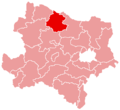
 Bezirk Gänserndorf.png 372 × 601; 19 KB
-
 Bezirk Krems-Land.png 554 × 583; 22 KB
-
 Bezirk Lilienfeld Übersicht.PNG 321 × 220; 6 KB
-
 Bezirk Mistelbach Übersicht.png 550 × 575; 24 KB
-
 Bezirk Mistelbach.png 550 × 575; 21 KB
-
 Bezirk Mödling Übersicht.PNG 174 × 120; 3 KB
-
 Bezirk Neunkirchen Übersicht.PNG 279 × 273; 10 KB
-
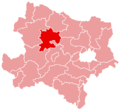
 Bezirk Sankt Pölten-Land.png 584 × 575; 20 KB
-
 Bezirk Wien Umgebung Übersicht.PNG 346 × 262; 12 KB
-
 Bezirk Wien-Umgebung.png 736 × 599; 20 KB
-
 Bezirkskarte Niederösterreich.png 666 × 599; 127 KB
-
 Bistuemer oesterreich st poelten.png 299 × 154; 12 KB
-
 Bistuemer oesterreich wien.png 299 × 154; 12 KB
-
 Brewery Schwechat - map (cropped).jpg 3,597 × 2,526; 2.81 MB
-
 Brewery Schwechat - map.jpg 4,589 × 3,000; 3.77 MB
-
 Cemetery Purkersdorf, Lower Austria, Austria-basemap.at - map.png 2,566 × 2,300; 805 KB
-
 Cemetery Vösendorf, Lower Austria, Austria-basemap.at - map.png 2,112 × 2,709; 516 KB
-
 DolniRakousko1.png 434 × 331; 39 KB
-
 Dunkelsteinerwald grafik a.png 516 × 564; 146 KB
-
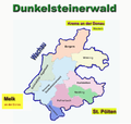 Dunkelsteinerwald grafik b.png 769 × 728; 223 KB
-
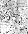
 Empire d'Autriche 1914 Basse-Autriche.png 3,507 × 2,480; 3.89 MB
-
 Erlauf Donau catchment.png 1,683 × 1,886; 5.78 MB
-
 Erlebnisweg Hausleiten Plan.jpg 1,787 × 1,221; 500 KB
-
 Fladnitztal-Radweg-Karte.jpg 2,478 × 2,108; 2.25 MB
-
 Fladnitztal-Radweg-Lage.jpg 2,265 × 2,084; 694 KB
-
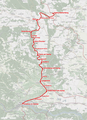
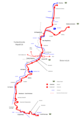
 Franz-Josefs-Bahn 2021.png 1,501 × 932; 321 KB
-
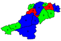
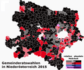 Gemeinderatswahlen in Niederösterreich 2015 - Mehrheiten in den Gemeinden.png 1,050 × 886; 581 KB
-
 Grafische Darstellung des Bezirks Scheibbs - panoramio.jpg 5,184 × 3,456; 9.76 MB
-
 GRASELKARTE001.jpg 2,316 × 2,792; 2 MB
-
 HQL Plan 3C.jpg 1,772 × 1,064; 381 KB
-
 HQL Plan 4C.svg 1,140 × 655; 289 KB
-
 Kamp krems.png 1,599 × 803; 1.92 MB
-
 Kamptalbahn-Karte.png 1,714 × 2,360; 3.14 MB
-
 Karte Aut Noe AM.png 600 × 548; 11 KB
-
 Karte Aut Noe Bezirke dunkelsteinerwald.png 300 × 274; 11 KB
-
 Karte Aut Noe Bezirke.png 434 × 331; 20 KB
-
 Karte Aut Noe BN.png 300 × 274; 5 KB
-
 Karte Aut Noe BW.png 300 × 274; 6 KB
-
 Karte Aut Noe GD.png 300 × 274; 5 KB
-
 Karte Aut Noe GF.png 300 × 274; 5 KB
-
 Karte Aut Noe HL.png 300 × 274; 5 KB
-
 Karte Aut Noe HO.png 300 × 274; 5 KB
-
 Karte Aut Noe KO.png 300 × 274; 5 KB
-
 Karte Aut Noe KR.png 300 × 274; 5 KB
-
 Karte Aut Noe LF.png 300 × 274; 5 KB
-
 Karte Aut Noe MD.png 300 × 274; 5 KB
-
 Karte Aut Noe ME.png 300 × 274; 5 KB
-
 Karte Aut Noe MI.png 300 × 274; 5 KB
-
 Karte Aut Noe NK.png 300 × 274; 5 KB
-
 Karte Aut Noe P.png 300 × 274; 5 KB
-
 Karte Aut Noe PL.png 300 × 274; 5 KB
-
 Karte Aut Noe SB.png 300 × 274; 5 KB
-
 Karte Aut Noe TU.png 300 × 274; 5 KB
-
 Karte Aut Noe WB.png 300 × 274; 5 KB
-
 Karte Aut Noe WT.png 300 × 274; 5 KB
-
 Karte Aut Noe ZT.png 300 × 274; 5 KB
-
 Karte Flughafen Wien DE.png 2,559 × 2,736; 983 KB
-
 Karte nationalpark donau auen.png 3,465 × 1,108; 741 KB
-
 Karte NOE Industrieviertel.png 300 × 275; 12 KB
-
 Karte NOE Mostviertel.png 300 × 275; 12 KB
-
 Karte NOE Waldviertel.png 300 × 275; 12 KB
-
 Karte NOE Weinviertel.png 300 × 275; 12 KB
-
 Karte von Puchberg 5.JPG 2,048 × 1,536; 1.52 MB
-
 Karte von Puchberg 6x.JPG 2,048 × 1,536; 560 KB
-
 Karte von Puchberg am Schneeberg 1.JPG 3,264 × 2,448; 3.92 MB
-
 Karte von Puchberg am Schneeberg 2.JPG 3,264 × 2,448; 3.73 MB
-
 Map ill. devin.JPG 3,840 × 2,160; 2.96 MB
-
 Moorbad Harbach - Steinspirale Meilenstein des Friedens - Standort-Karte.jpg 4,000 × 3,000; 2.99 MB
-
 Nationalpark Thayatal Karte.png 1,799 × 1,265; 166 KB
-
 Niederoesterreich Donaumonarchie.png 674 × 510; 7 KB
-
 Niederösterreich – Wahlbeteiligung bei Gemeinderatswahlen 1990–2015.png 1,400 × 870; 26 KB
-
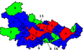
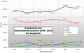 Niederösterreich – Wahlergebnisse der Gemeinderatswahlen 1990–2015.png 1,400 × 870; 62 KB
-
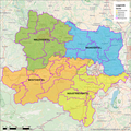
 Niederösterreich.png 2,057 × 1,455; 1.07 MB
-
 Noe Karte Leuchturm GS IST 12 2016.jpg 2,007 × 1,770; 482 KB
-
 Orientierungsplan Akademiepark Wr Neustadt DSC 7160w.jpg 5,836 × 3,955; 9.5 MB
-
 Ostrong.png 449 × 842; 782 KB
-
 Map at pernegg waldviertel.png 400 × 240; 3 KB
-
 Radkarte .jpg 2,448 × 3,264; 3.25 MB
-
 Rohrendorf bei Krems - Kellergassenplan.jpg 4,068 × 2,712; 2.99 MB
-
 Map at schönbach.png 400 × 240; 3 KB
-
 Semmering-bahn.jpg 2,180 × 864; 1.22 MB
-
 Sitzendorf Hauptplatz - Plan.jpg 4,487 × 6,000; 6.54 MB
-
 Sitzendorf HauptplatzPlan.png 3,051 × 4,080; 5.41 MB
-
 Slovaks and Moravians in Lower Austria.png 884 × 734; 1.38 MB
-
 Strassenbahn baden voeslau.jpg 262 × 816; 52 KB
-
 Teufelstein Föhrenberge.jpg 759 × 344; 175 KB
-
 Triestingtal Kartenaufzeichnung.png 477 × 509; 292 KB
-
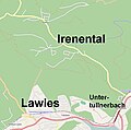 Tullnerbach Ortsteile.jpg 728 × 724; 66 KB
-
 Tullnerfelder Bahn Strecke.png 1,784 × 881; 195 KB
-
 Türnitz in LF.PNG 855 × 553; 19 KB
-
 Umgebung von Mödling und Lachsenburg im VUWW - Schweikhardt 1837 - Sektion 8.jpg 4,447 × 2,976; 10.99 MB
-
 Verkehrsspinne 2009.pdf 589 × 589; 377 KB
-
 Vierteleinteilung in Niederösterreich.png 2,362 × 2,362; 4.95 MB
-
 Waldviertelbahn strecken.png 2,000 × 3,000; 267 KB
-
 Walthers im Franziszeischen Kataster.jpg 1,648 × 2,338; 556 KB
-
 Wandergebiet Alland Karte Weissenbach.JPG 2,132 × 1,204; 466 KB
-
 Wandergebiet Alland Karte.JPG 2,132 × 1,204; 462 KB
-
 Wanderkarte Alland Altenmarkt.jpg 2,132 × 1,204; 470 KB
-
 Wildnisgebiet Duerrenstein Lassingtal.jpeg 1,156 × 763; 87 KB
-
 Ybbs Donau catchment.png 1,685 × 1,725; 5.18 MB


.jpg)


