Category:Maps of Burgenland
Jump to navigation
Jump to search
States of Austria:  Burgenland ·
  Carinthia ·
  Lower Austria ·
  Salzburg ·
  Styria ·
  Tyrol ·
  Upper Austria ·
  Vienna ·
  Vorarlberg
Wikimedia category | |||||
| Upload media | |||||
| Instance of | |||||
|---|---|---|---|---|---|
| Category combines topics | |||||
| Burgenland | |||||
state of Austria | |||||
| Instance of | |||||
| Part of | |||||
| Named after | |||||
| Location | Austria | ||||
| Visitor center | |||||
| Capital | |||||
| Legislative body | |||||
| Official language | |||||
| Anthem |
| ||||
| Head of government |
| ||||
| Inception |
| ||||
| Population |
| ||||
| Area |
| ||||
| Elevation above sea level |
| ||||
| Different from | |||||
| official website | |||||
 | |||||
Use the appropriate category for maps showing all or a large part of Burgenland. See subcategories for smaller areas:
| If the map shows | Category to use |
|---|---|
| Burgenland on a recently created map | Category:Maps of Burgenland or its subcategories |
| Burgenland on a map created more than 70 years ago | Category:Old maps of Burgenland or its subcategories |
| the history of Burgenland on a recently created map | Category:Maps of the history of Burgenland or its subcategories |
| the history of Burgenland on a map created more than 70 years ago | Category:Old maps of the history of Burgenland or its subcategories |
Deutsch: Karten von Burgenland
English: Maps of Burgenland
Subcategories
This category has the following 11 subcategories, out of 11 total.
Media in category "Maps of Burgenland"
The following 24 files are in this category, out of 24 total.
-
Austria Burgenland relief location map.jpg 975 × 1,546; 478 KB
-
Burgenland map.png 2,057 × 1,455; 856 KB
-
Burgenland.PNG 311 × 397; 9 KB
-
Deutsch Kaltenbrunn Karte.jpg 704 × 1,116; 306 KB
-
Gerichtsbezirk Eisenstadt.svg 600 × 1,050; 12 KB
-
Gerichtsbezirke im Burgenland.svg 600 × 1,050; 12 KB
-
Helenenschacht,-Brennberg,-öffentlicher-Anschlag-(150810).jpg 2,362 × 1,506; 3.88 MB
-
K.-Steinbruch Okt. 1855.JPG 2,816 × 2,112; 2.21 MB
-
Karte Aut Bgld EI.png 400 × 371; 3 KB
-
Karte Aut Bgld EU.png 400 × 371; 2 KB
-
Karte Aut Bgld GS.png 400 × 371; 2 KB
-
Karte Aut Bgld JE.png 400 × 371; 2 KB
-
Karte Aut Bgld MA.png 400 × 371; 2 KB
-
Karte Aut Bgld ND.png 400 × 371; 2 KB
-
Karte Aut Bgld OP.png 400 × 371; 2 KB
-
Karte Aut Bgld RU.png 400 × 371; 3 KB
-
Karte Aut Bgld.png 400 × 371; 2 KB
-
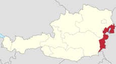
Karte oesterreich burgenland.png 299 × 154; 14 KB
-
Königshof 1855-1.JPG 2,816 × 2,112; 1.96 MB
-
Map at Neudorf.PNG 404 × 251; 7 KB
-
Map Aut Bgld OW.png 400 × 371; 4 KB
-
Mattersburg - Karte der Region Rosalia (01).jpg 3,000 × 2,000; 1.42 MB
-
Wiesen - Ortsplan (01).jpg 2,000 × 3,000; 1.35 MB
-
ZilliZillingtal - Tiefenbohrung (02).jpg 3,000 × 2,000; 1.2 MB


