Category:Rail transport maps of Tyne and Wear
Jump to navigation
Jump to search
Media in category "Rail transport maps of Tyne and Wear"
The following 8 files are in this category, out of 8 total.
-
Blaydon rlies 2016.png 1,548 × 746; 160 KB
-
Blaydon rlies.png 1,548 × 746; 60 KB
-
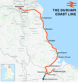
Durham Coast Line.png 1,481 × 1,550; 1.42 MB
-
Northumberland Line.png 1,992 × 2,001; 2.26 MB
-
Rail transport infrastructure map - UK - North East England.svg 756 × 869; 1.72 MB
-
TWM tunnels.png 569 × 750; 877 KB
-
Tyne Valley line.png 3,019 × 1,265; 2.48 MB
-
Tyneside Electrics diagram.png 1,552 × 754; 287 KB


