Category:Maps of Southern California
Jump to navigation
Jump to search
Wikimedia category | |||||
| Upload media | |||||
| Instance of | |||||
|---|---|---|---|---|---|
| Category combines topics | |||||
| Southern California | |||||
American geographic and cultural region | |||||
| Instance of | |||||
| Location | California, Pacific States Region | ||||
| Has part | |||||
| Significant event | |||||
| Different from | |||||
 | |||||
Subcategories
This category has the following 8 subcategories, out of 8 total.
L
O
R
S
V
Media in category "Maps of Southern California"
The following 71 files are in this category, out of 71 total.
-
USA California Southern location map.svg 685 × 387; 430 KB
-
U.S. - Los Angeles Metropolitan Area location map.svg 512 × 539; 176 KB
-
BeverlyHillsOilField.png 2,200 × 1,700; 2.13 MB
-
Bulletin (1905) (14596175327).jpg 4,146 × 2,576; 1.64 MB
-
Bulletin (1905) (14759687306).jpg 4,132 × 2,673; 1.27 MB
-
CA Senate 2008.png 308 × 333; 18 KB
-
CA ShakeOut Map.pdf 1,137 × 931; 996 KB
-
Cahuilla kumeyaay map.svg 1,389 × 1,727; 203 KB
-
California mammals (1906) (20488824156).jpg 3,216 × 1,808; 1.11 MB
-
California mineral production for 1920, with county maps (1921) (14577623679).jpg 3,232 × 2,004; 727 KB
-
California Sea Lion Distribution.png 3,300 × 2,550; 507 KB
-
California south tehachapi.. (1900) (14592989558).jpg 2,775 × 4,258; 1.46 MB
-
California Southern Railroad route map.png 648 × 760; 50 KB
-
LocMap Channel Islands National Park.png 280 × 183; 31 KB
-
Channel Islands IceAge Sealevels.png 2,462 × 845; 7.95 MB
-
Channelislandsca.jpg 800 × 552; 129 KB
-
Chaparral region of southern california map 1911.jpg 3,773 × 3,418; 1.29 MB
-
Wpdms shdrlfi020l colorado river aqueduct.jpg 300 × 267; 49 KB
-
CuyamaValley.jpg 3,300 × 2,550; 1.03 MB
-
2010 Southern California Earthquake Storm.PNG 500 × 461; 74 KB
-
Fault systems in Southern California.png 942 × 706; 954 KB
-
Southern California freeways.svg 1,152 × 640; 232 KB
-
Map of the USA highlighting the Greater Los Angeles Area.gif 4,200 × 3,105; 1.53 MB
-
GreaterLAmap.png 1,000 × 1,000; 621 KB
-
Greetings from Southern California (NBY 437614).jpg 823 × 522; 89 KB
-
Hector-Mine-earthquake-1999-Oct-16-USGS-map.jpg 461 × 548; 74 KB
-
Inland empire within southern california.png 342 × 308; 160 KB
-
Map of California hightlighting the IE Metro Area.png 203 × 230; 13 KB
-
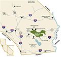
Joshua Tree National Park - area map.jpg 1,164 × 1,091; 112 KB
-
LA-IE Freeway System.jpg 1,600 × 952; 158 KB
-
LaGoletaLoc.png 3,000 × 2,250; 4.51 MB
-
Location map Santa Clarita.svg 796 × 627; 1.89 MB
-
Los Angeles Aqueduct Map.png 1,357 × 1,900; 4.62 MB
-
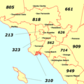
Los Angeles area codes.png 535 × 533; 45 KB
-
Map of area near Los Angeles, California - NARA - 100305836.jpg 9,200 × 6,675; 3.18 MB
-
Map of area of California - NARA - 100305838.jpg 9,216 × 6,105; 2.76 MB
-
Map of the Southern Part of California and adjoining country - NARA - 93193226.jpg 6,200 × 4,597; 1.98 MB
-
Metrolink system diagram.svg 2,020 × 1,420; 1,007 KB
-
Metrolink System Map.png 2,282 × 1,900; 815 KB
-
Metrolink.png 1,272 × 1,041; 168 KB
-
Mojave Desert map.svg 1,712 × 1,992; 342 KB
-
Wpdms shdrlfi020l owens river.jpg 300 × 300; 57 KB
-
P Schumacher Plate 9.png 1,884 × 3,002; 1.86 MB
-
March 2010 Pico Rivera earthquake intensity USGS.jpg 612 × 627; 177 KB
-
SaltLakeOilField.jpg 3,300 × 2,550; 1.02 MB
-
Santa ana winds.jpg 400 × 359; 93 KB
-
Santacatalinaisland.jpg 654 × 552; 326 KB
-
Wpdms shdrlfi020l santa susana mountains.jpg 300 × 270; 44 KB
-
SantaAnaWinds QuikSCAT 2002feb.jpg 540 × 377; 92 KB
-
SoCal Coast.jpg 720 × 1,084; 374 KB
-
SoCal megaregion.png 634 × 479; 116 KB
-
SoCal Watershed.jpg 1,070 × 798; 525 KB
-
SoCal.png 1,800 × 1,024; 335 KB
-
Southern California counties in red noshade.png 596 × 676; 15 KB
-
Southern California Precipitations.gif 960 × 745; 32 KB
-
Southern California sea floor.png 1,596 × 1,494; 1.04 MB
-
Southern California.png 725 × 417; 124 KB
-
Southern California.svg 725 × 417; 37 KB
-
Sr-sj-natmon-bluebound.jpg 741 × 897; 561 KB
-
The city and county of Los Angeles in southern California (1903) (14577022308).jpg 1,864 × 3,192; 558 KB
-
The copper resources of California (1905) (14784940445).jpg 3,434 × 1,972; 653 KB
-
US Gulf of Mexico offshore gas.jpg 1,100 × 850; 127 KB
-
USDistCourtCentDistCA.PNG 221 × 127; 3 KB
-
Wpdms shdrlfi020l coachella valley.jpg 300 × 270; 44 KB
-
Wpdms shdrlfi020l colorado desert.jpg 300 × 267; 49 KB
-
Wpdms shdrlfi020l santa monica mountains.jpg 300 × 270; 44 KB
-
Wpdms shdrlfi020l santa ynez mountains.jpg 300 × 270; 45 KB
