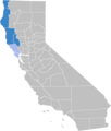
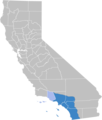
Category:Maps of Regions of California
Jump to navigation
Jump to search
| NO WIKIDATA ID FOUND! Search for Maps of Regions of California on Wikidata | |
| Upload media |
Use the appropriate category for maps showing all or a large part of Regions of California. See subcategories for smaller areas:
| If the map shows | Category to use |
|---|---|
| Regions of California on a recently created map | Category:Maps of Regions of California or its subcategories |
| Regions of California on a map created more than 70 years ago | Category:Old maps of Regions of California or its subcategories |
| the history of Regions of California on a recently created map | Category:Maps of the history of Regions of California or its subcategories |
| the history of Regions of California on a map created more than 70 years ago | Category:Old maps of the history of Regions of California or its subcategories |
Subcategories
This category has the following 9 subcategories, out of 9 total.
M
- Maps of Big Sur (19 F)
- Maps of Mojave Desert (4 F)
S
- Maps of San Diego–Tijuana (12 F)
- San Pablo Bay - maps (22 F)
Media in category "Maps of Regions of California"
The following 28 files are in this category, out of 28 total.
-
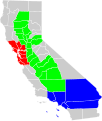
California geographical region county map.svg 621 × 733; 258 KB
-
CA floristic province.png 210 × 380; 132 KB
-
Ca-regions.png 874 × 995; 210 KB
-
Ca-regions.svg 925 × 1,053; 188 KB
-
Cal3 Map.png 511 × 857; 66 KB
-
California Central Valley county map.svg 621 × 733; 504 KB
-
California Central Valley Grasslands map.svg 1,712 × 1,992; 338 KB
-
California Central Valley.gif 400 × 608; 110 KB
-
California CentralValley county map.png 292 × 500; 55 KB
-
California economic region county map.svg 621 × 733; 280 KB
-
California economic regions map (labeled and colored).svg 621 × 733; 635 KB
-
California fish and game (19892301513).jpg 1,680 × 1,922; 256 KB
-
California Geomorphic Provinces.svg 733 × 830; 215 KB
-
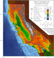
California Topography and Geomorphic.gif 1,117 × 1,200; 336 KB
-
California Topography-MEDIUM.png 1,862 × 2,000; 2.25 MB
-
Central California.png 1,872 × 3,881; 553 KB
-
Costa Central de Califòrnia.png 2,000 × 2,361; 305 KB
-
East Bay Static Map.png 2,000 × 1,724; 588 KB
-
East Bay Static Map.svg 445 × 383; 504 KB
-
Map of the USA highlighting the Greater Los Angeles Area.gif 4,200 × 3,105; 1.53 MB
-
Map of California highlighting North Coast region.svg 9,164 × 10,536; 234 KB
-
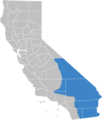
Map of the Californian Deserts region of California.png 1,124 × 1,327; 184 KB
-
Map of the Central Coast region of California.png 1,124 × 1,327; 179 KB
-
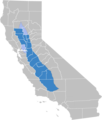
Map of the Central Valley region of California.png 1,124 × 1,327; 185 KB
-
Map of the North Coast region of California.png 1,124 × 1,327; 180 KB
-
Map of the Shasta Cascade region of California.png 1,124 × 1,327; 178 KB
-
Map of the South Coast region of California.png 1,124 × 1,327; 183 KB
-
Southern Border.png 2,000 × 2,361; 508 KB

