Category:Maps of Santa Barbara County, California
Jump to navigation
Jump to search
Wikimedia category | |||||
| Upload media | |||||
| Instance of | |||||
|---|---|---|---|---|---|
| Category combines topics | |||||
| Santa Barbara County | |||||
county in southern California, United States | |||||
| Instance of | |||||
| Named after | |||||
| Location | California, Pacific States Region | ||||
| Capital | |||||
| Inception |
| ||||
| Population |
| ||||
| Area |
| ||||
| official website | |||||
 | |||||
Subcategories
This category has the following 3 subcategories, out of 3 total.
Media in category "Maps of Santa Barbara County, California"
The following 51 files are in this category, out of 51 total.
-
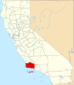
Map of California highlighting Santa Barbara County.svg 916 × 1,054; 151 KB
-
California map showing Santa Barbara County.png 200 × 231; 22 KB
-
California county map (Santa Barbara County highlighted).svg 621 × 733; 503 KB
-
2017 12 11-08.57.46.111-CST.jpg 7,200 × 5,400; 17.28 MB
-
Admiralty Chart No 778 Conception Point to Point Pinos, Published 1899, Corrections Copyright 1960.jpg 11,042 × 16,228; 45.61 MB
-
Bird's eye view of Santa Barbara, California, 1877 (NYPL Hades-118945-55096).tif 5,731 × 4,144; 67.95 MB
-
Bulletin (1905) (14782686875).jpg 3,408 × 2,668; 1.37 MB
-
CA-24th.png 659 × 399; 37 KB
-
CarpOffshore.jpg 3,300 × 2,550; 1,019 KB
-
LocMap Channel Islands National Park.png 280 × 183; 31 KB
-
Costa Central de Califòrnia.png 2,000 × 2,361; 305 KB
-
DickSmithWildernessLocMap.jpg 1,583 × 1,245; 1.56 MB
-
EllwoodOilField.jpg 2,750 × 2,125; 506 KB
-
LaBreaFire.jpeg 1,280 × 853; 250 KB
-
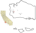
LaGoletaDetail.jpg 3,000 × 2,250; 6.42 MB
-
LaGoletaLoc.png 3,000 × 2,250; 4.51 MB
-
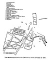
Map showing the arrangement of the Mission Santa Barbara in 1840, ca.1920 (CHS-8950).jpg 1,186 × 1,424; 486 KB
-
Mescalitan.JPG 428 × 303; 27 KB
-
Oil1969extent.jpg 3,040 × 2,288; 804 KB
-
P Schumacher 20.png 1,958 × 1,920; 2.08 MB
-
Point Conception, California, 1869 (map by C. Rockwell).jpg 591 × 384; 34 KB
-
Santa Barbara County Region Map.png 2,200 × 1,700; 881 KB
-
Santa Barbara County WV.svg 1,100 × 850; 566 KB
-
Santa Barbara, California 1896. LOC 75693113.jpg 2,728 × 1,704; 896 KB
-
Santa-Barbara-Wildfire.png 1,688 × 1,286; 1.49 MB
-
Santa-rosa-island-nps-map.PNG 450 × 277; 16 KB
-
SouthCuyamaOilField.jpg 3,300 × 2,550; 1.08 MB


