Category:Maps of Scotland in the 11th century
Jump to navigation
Jump to search
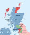
English: This category is about the subject of  Scotland 1001-1100 CE: History maps showing all or a substantial part of the territory of Scotland as it was in the 11th century.
Contemporary old maps belong into: Category:Old maps of Scotland and its subcategories.
Contemporary old maps belong into: Category:Old maps of Scotland and its subcategories.
Media in category "Maps of Scotland in the 11th century"
The following 8 files are in this category, out of 8 total.
-
Map of the Kingdom of Galloway circa 1100.png 1,363 × 845; 403 KB
-
C. 1050 Scotland.jpg 821 × 1,153; 696 KB
-
Domnall mac Murchada (map).png 574 × 1,000; 187 KB
-
Fingal mac Gofraid (map).png 1,288 × 2,245; 522 KB
-
Kingdom of Mann and the Isles-en.svg 1,297 × 1,362; 209 KB
-
Scots lang-es.svg 2,400 × 2,830; 869 KB
-
Scots lang-fr.svg 2,400 × 2,830; 864 KB
-
Strathclyde.kingdom.influence.areas.png 489 × 717; 717 KB


