Category:Maps of the history of Scotland
Jump to navigation
Jump to search
Subcategories
This category has the following 27 subcategories, out of 27 total.
B
D
P
R
T
Media in category "Maps of the history of Scotland"
The following 182 files are in this category, out of 182 total.
-
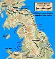
Central.Britain.c550.jpg 1,674 × 1,794; 425 KB
-
Yr.Hen.Ogledd.550.650.Koch.jpg 1,500 × 1,794; 510 KB
-
102 of 'History of the English People ... With ... maps' (11118261894).jpg 2,032 × 1,392; 489 KB
-
135 of 'History of the Great Civil War. 1642-1649. (Sixth series.)' (11183178973).jpg 1,437 × 1,913; 893 KB
-
Putz82.jpg 741 × 681; 103 KB
-
Illas Britanicas - Guèrra Civila Anglesa (1642-1651).png 801 × 956; 329 KB
-
219 of 'History of the Great Civil War. 1642-1649. (Sixth series.)' (11185041866).jpg 1,455 × 1,935; 476 KB
-
39 of 'Cusack's Reign of Queen Elizabeth for scholarship candidates' (11233625745).jpg 1,786 × 1,216; 556 KB
-
418 of 'England under Stuart Rule, etc' (11247278646).jpg 1,267 × 1,916; 646 KB
-
Ailéan mac Ruaidhrí (map2).png 1,202 × 1,491; 381 KB
-
Alasdair Óg Mac Domhnaill (map).png 1,065 × 1,104; 355 KB
-
Angles, Saxons, Jutes in Britain year 600.jpg 1,126 × 810; 301 KB
-
Anglo-Saxon England 2.svg 900 × 1,100; 574 KB
-
Aonghus mac Somhairle (map).png 842 × 984; 251 KB
-
Archdiocese of Glasgow (reign of David I).png 936 × 1,300; 180 KB
-
Archdiocese of St Andrews (reign of David I).png 936 × 1,300; 183 KB
-
Arthgal ap Dyfnwal (map).png 670 × 624; 128 KB
-
Atlas of European history (1909) (14780823151).jpg 3,056 × 2,182; 1.12 MB
-
Battle of Renfrew.png 810 × 1,127; 244 KB
-
Bishoprics.Scotland.medieval.jpg 1,395 × 2,253; 606 KB
-
Bishoprics.Scotland.reign.of.David.I.jpg 681 × 1,000; 174 KB
-
Britain.north.peoples.Ptolemy.jpg 1,899 × 2,758; 630 KB
-
British isles 802.jpg 1,076 × 1,127; 1.29 MB
-
British isles history v2.png 765 × 565; 75 KB
-
Britons in Southern Scotland (languages).png 597 × 434; 400 KB
-
Bro-Bikt - Pictland.jpg 1,777 × 1,517; 386 KB
-
BuchanLands.jpg 2,500 × 2,500; 728 KB
-
Burghs of Dabíd mac Maíl Choluim-es.svg 416 × 621; 91 KB
-
Burghs of Dabíd mac Maíl Choluim-fr.svg 416 × 621; 92 KB
-
Burghs of Dabíd mac Maíl Choluim.JPG 599 × 1,111; 97 KB
-
Burghs1153.PNG 664 × 1,146; 572 KB
-
C. 1050 Scotland.jpg 821 × 1,153; 696 KB
-
Caereni. Carte-os-rb.jpg 567 × 263; 75 KB
-
Caereni. cb.jpg 177 × 284; 11 KB
-
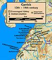
Carrick.13th.to.14th.century.jpg 2,071 × 2,392; 372 KB
-
Carrick.13th.to.14th.century.withlocator.jpg 1,376 × 1,710; 302 KB
-
Cuilén mac Illuilb (map).png 1,002 × 1,230; 307 KB
-
Dalriada he.jpg 509 × 531; 34 KB
-
Dalriada.jpg 509 × 531; 34 KB
-
Dalriada.png 794 × 1,123; 1.42 MB
-
DavidianCumbria-en.svg 539 × 465; 55 KB
-
DavidianCumbria-fr.svg 539 × 465; 57 KB
-
DavidianCumbria.JPG 469 × 623; 60 KB
-
DavidianCumbria.svg 628 × 471; 56 KB
-
Diocese of Aberdeen (reign of David I).png 936 × 1,300; 181 KB
-
Diocese of Aberdeen Parishes.png 1,833 × 1,437; 283 KB
-
Diocese of Argyll (reign of David I).png 936 × 1,300; 181 KB
-
Diocese of Brechin (reign of David I).png 936 × 1,300; 183 KB
-
Diocese of Caithness (reign of David I).png 936 × 1,300; 182 KB
-
Diocese of Dunblane (reign of David I).png 936 × 1,300; 183 KB
-
Diocese of Dunkeld (reign of David I).png 936 × 1,300; 182 KB
-
Diocese of Galloway (reign of David I).png 936 × 1,300; 182 KB
-
Diocese of Moray (reign of David I).png 936 × 1,300; 181 KB
-
Diocese of Ross (reign of David I).png 936 × 1,300; 181 KB
-
Diocese of Scotland (reign of David I).png 936 × 1,300; 201 KB
-
Diocese of the Isles, circa 1300 (map 2).png 679 × 1,001; 200 KB
-
Domnall mac Eimín (map).png 708 × 1,080; 240 KB
-
Dryburgh Abbey Churches.jpg 940 × 900; 95 KB
-
Dubgall mac Somairle (map).png 803 × 1,084; 283 KB
-
Dubhghall mac Ruaidhri (map1).png 633 × 770; 150 KB
-
Dubhghall mac Ruaidhri (map2).png 1,202 × 1,491; 358 KB
-
Dubhghall mac Suibhne (map).png 1,100 × 855; 329 KB
-
Dyfnwal ab Owain (map).png 800 × 937; 227 KB
-
Earldom of Orkney(Norweigan Puppet).jpg 821 × 882; 48 KB
-
Early Medieval Scotland areas.png 794 × 1,123; 1.51 MB
-
EarlyChristianityInScotland.PNG 765 × 1,276; 348 KB
-
Eochaid, son of Rhun (map1).png 583 × 523; 119 KB
-
Eochaid, son of Rhun (map2).png 500 × 612; 139 KB
-
Eóghan Mac Dubhghaill (map 1).png 835 × 1,087; 318 KB
-
Eóghan Mac Dubhghaill (map 2).png 800 × 306; 111 KB
-
Eóin Mac Suibhne (map).png 1,080 × 690; 185 KB
-
Falkirk1298(1).JPG 686 × 586; 216 KB
-
Falkirk1298(2).JPG 694 × 602; 180 KB
-
Gallovidian lordship map.png 1,363 × 845; 390 KB
-
Gask Ridge Limes 85 n. chr.png 1,434 × 1,066; 692 KB
-
Gask Ridge.jpg 1,220 × 780; 356 KB
-
Gofraid mac Amlaíb (d.1187) map.png 750 × 980; 189 KB
-
Gofraid mac Amlaíb (d.1187) map.svg 750 × 980; 240 KB
-
Guðrøðr Rǫgnvaldsson (map).png 908 × 1,301; 317 KB
-
Guðrøðr Óláfsson (map).png 1,129 × 1,529; 422 KB
-
Illas Britanicas - Conquista normanda d'Anglatèrra.png 801 × 956; 282 KB
-
Illas Britanicas - Conquista romana.png 801 × 956; 302 KB
-
Kermac Macmaghan (map).png 1,002 × 1,522; 323 KB
-
Kingdom of Mann and the Isles-en.svg 1,297 × 1,362; 209 KB
-
Kingdom of Scotland.PNG 1,218 × 1,245; 39 KB
-
Kingdom of the Isles, circa 1200 (ita).png 768 × 1,057; 231 KB
-
Kingdom-of-Strathclyde.jpg 1,200 × 1,316; 237 KB
-
KingdomsandMormaers.PNG 1,336 × 1,748; 2.23 MB
-
Lachlann Mac Ruaidhrí (map).png 761 × 951; 260 KB
-
Locations in north Britain in the early tenth century.png 385 × 600; 166 KB
-
Locations in north Britain in the early tenth century.svg 385 × 600; 248 KB
-
Lordship of the Isles, 1346.png 512 × 798; 177 KB
-
Ludy Brytanii ok. 600.svg 994 × 1,233; 1.47 MB
-
Mac Scelling (map).png 780 × 1,138; 262 KB
-
Map of Dryburgh Abbey Lands.jpg 721 × 762; 60 KB
-
Map of Glencairn's Rising.svg 2,088 × 2,197; 2.73 MB
-
Map of the clans of Scotland (1899, third edition).jpg 3,505 × 4,568; 5.68 MB
-
Map of the Kingdom of Galloway circa 1100.png 1,363 × 845; 403 KB
-
MappaBritanniaeFacie.jpg 2,954 × 2,557; 837 KB
-
MappaBritanniaeFacie3.png 1,100 × 936; 2.13 MB
-
MappaBritanniaeFacie4.png 1,400 × 1,690; 4.25 MB
-
Medieval Moray.jpg 583 × 870; 202 KB
-
MedievalScotland.PNG 1,272 × 1,395; 1.6 MB
-
Mormaerdoms-es.svg 744 × 1,052; 52 KB
-
Mormaerdoms.png 2,398 × 3,559; 801 KB
-
Mormaerdoms.svg 744 × 1,052; 40 KB
-
Murchadh Mac Suibhne (map).png 1,100 × 849; 275 KB
-
Máel Coluim, King of Strathclyde (map).png 633 × 785; 130 KB
-
Máel Coluim, son of the king of the Cumbrians (map1).png 724 × 670; 139 KB
-
Máel Coluim, son of the king of the Cumbrians (map2).png 724 × 670; 119 KB
-
Nations of the UK (with some flags).svg 512 × 384; 401 KB
-
Nations of the UK-id.svg 781 × 574; 633 KB
-
Nations of the UK.png 720 × 540; 108 KB
-
Nations of the UK.svg 512 × 384; 247 KB
-
North Britain 547-685.png 794 × 683; 818 KB
-
North.Britain.Roman.marching.camps.jpg 2,173 × 3,039; 908 KB
-
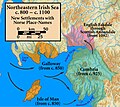
Northeast.Irish.Sea.Norse.placenames.jpg 1,005 × 897; 282 KB
-
Northern.Britain.land.cover.jpg 2,811 × 4,064; 1,007 KB
-
Northumbria 802.jpg 1,800 × 2,218; 649 KB
-
Northumbrian bishoprics and monasteries, 680s.svg 1,104 × 1,586; 664 KB
-
Old Military roads in Scotland.svg 744 × 1,052; 1.5 MB
-
Onuist map.png 385 × 600; 167 KB
-
OrkneyBrit1.GIF 493 × 606; 8 KB
-
Peuplesdecosse.png 1,102 × 2,000; 228 KB
-
Premieresvillesecossaises.png 639 × 880; 53 KB
-
Raghnall Mac Ruaidhrí (map).png 856 × 1,061; 287 KB
-
Ragnall mac Gofraid (map).png 1,002 × 1,522; 366 KB
-
Reino de Escocia.png 1,118 × 1,117; 412 KB
-
Rhun ab Arthgal (map).png 616 × 864; 174 KB
-
Rhydderch ap Dyfnwal (map).png 701 × 619; 108 KB
-
Roman.Britain.north.130.jpg 1,553 × 2,275; 587 KB
-
Roman.Britain.north.155.jpg 1,719 × 1,564; 424 KB
-
Roman.Britain.north.180.jpg 1,697 × 2,132; 599 KB
-
Roman.Britain.north.270.jpg 1,715 × 2,132; 594 KB
-
Roman.Britain.north.350.400.jpg 2,862 × 2,334; 822 KB
-
Roman.Britain.north.370.jpg 1,703 × 2,162; 565 KB
-
Roman.Britain.north.84.jpg 1,670 × 2,768; 665 KB
-
Roman.Britain.Severan.Campaigns.jpg 1,810 × 1,931; 510 KB
-
Roman.Scotland.370.jpg 2,211 × 1,877; 497 KB
-
Roman.Scotland.north.130.jpg 2,203 × 1,913; 532 KB
-
Roman.Scotland.north.155.jpg 2,223 × 1,865; 562 KB
-
Roman.Scotland.north.180.jpg 2,203 × 1,881; 535 KB
-
Roman.Scotland.north.270.jpg 2,211 × 1,861; 515 KB
-
Roman.Scotland.north.84.jpg 2,207 × 1,893; 562 KB
-
Rouantelezhioù Piktek-Pictish Kingdoms.png 355 × 599; 116 KB
-
Ruaidhrí mac Raghnaill (map).png 879 × 914; 269 KB
-
Rǫgnvaldr Guðrøðarson (map 1).png 887 × 1,149; 284 KB
-
Scotland grevskap.jpg 800 × 994; 105 KB
-
Scotland grevskap.png 843 × 1,031; 34 KB
-
Scotland.south.c1200.regions.languages.jpg 2,243 × 2,169; 541 KB
-
Scotland.south.Ptolemy.map.jpg 1,915 × 1,809; 606 KB
-
SCOTLANG1100.PNG 331 × 600; 288 KB
-
Scots lang.svg 720 × 980; 69 KB
-
Scottish-Norwegian War.jpg 596 × 417; 17 KB
-
Skottland forste byer.jpg 1,000 × 1,254; 117 KB
-
Skottland kart.jpg 997 × 630; 149 KB
-
St.Ninian.dedications.jpg 1,550 × 2,392; 693 KB
-
Strathclyde-940-AD.png 1,800 × 2,100; 558 KB
-
Strathclyde.kingdom.influence.areas.png 489 × 717; 717 KB
-
Suibne mac Cináeda (map).png 1,018 × 1,513; 364 KB
-
Suibne mac Cináeda (map2).png 1,513 × 1,018; 334 KB
-
Territòris de Cnut lo Grand.png 722 × 665; 134 KB
-
Teviotdale localisation.png 1,224 × 714; 27 KB
-
Walter fitz Alan (map1).png 1,014 × 1,468; 220 KB
-
Walter fitz Alan (map2).png 644 × 580; 108 KB
-
Walter fitz Alan (map3).png 644 × 580; 91 KB
-
Wars of Ecgfrith-pt.svg 1,104 × 1,586; 708 KB
-
Wars of Ecgfrith.svg 1,104 × 1,586; 711 KB
-
WigtownshireBrit2.GIF 608 × 604; 14 KB
-
WigtownshireBrit2.PNG 608 × 604; 20 KB
-
York Dioceses XII.png 1,088 × 1,548; 312 KB
-
Évêchés écossais règne de David Ier-es.svg 532 × 780; 582 KB
-
Évêchés écossais règne de David Ier.svg 532 × 780; 614 KB
-
Ímar mac Arailt (map).png 1,012 × 1,525; 367 KB
-
Óláfr Guðrøðarson (map 1).png 665 × 1,000; 214 KB
-
Óspakr-Hákon (map).png 590 × 901; 188 KB
