Category:Maps of the San Francisco Bay Area
Jump to navigation
Jump to search
Subcategories
This category has the following 14 subcategories, out of 14 total.
Media in category "Maps of the San Francisco Bay Area"
The following 92 files are in this category, out of 92 total.
-
Bay Area county map.png 667 × 667; 125 KB
-
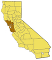
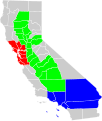
Map of California highlighting SFBayArea.PNG 200 × 231; 16 KB
-
Wpdms usgs photo point reyes large 2.jpg 300 × 280; 16 KB
-
1857 U.S.C.S. Map of San Francisco Bay - Geographicus - SanFrancisco-uscs-1857.jpg 4,000 × 4,935; 1.97 MB
-
1981 Regional Transit Connection map in 12th Street station.JPG 3,888 × 5,184; 3.1 MB
-
2018-11-16-EPA-airnow-peak aqi sanfrancisco ca.jpg 525 × 400; 50 KB
-
After earthquake and fire (1906) (14763158305).jpg 2,824 × 4,260; 1.49 MB
-
Angel Island - the Ellis Island of the west (1917) (14592847368).jpg 1,600 × 1,936; 723 KB
-
Bair Greco mosquito map.png 1,222 × 790; 1.09 MB
-
Bay Area and Santa Cruz cities and counties.svg 960 × 1,070; 433 KB
-
Bay Area freeways.svg 1,152 × 640; 281 KB
-
Bay Area Map de.png 2,480 × 2,480; 1.66 MB
-
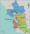
Bayarea map.png 1,539 × 1,732; 475 KB
-
Bayarea map.svg 693 × 779; 296 KB
-
Bays of San Francisco and San Pablo, 1874.jpg 1,276 × 943; 398 KB
-
San Francisco Bay bridges.svg 356 × 438; 34 KB
-
CA topo san quentin quadrangle.jpg 3,300 × 4,263; 7.11 MB
-
CA-14th.png 745 × 399; 47 KB
-
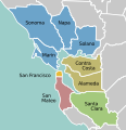
California Bay Area county map (zoom&color).svg 512 × 529; 251 KB
-
California Bay Area county map.svg 891 × 733; 295 KB
-
California extended metropolitan areas locator map (gray).png 1,708 × 2,232; 807 KB
-
California fault parameters sfbay1.png 561 × 635; 35 KB
-
California fish and game (19890409284).jpg 1,576 × 1,892; 327 KB
-
California geographical region county map.svg 621 × 733; 258 KB
-
Chart of San Francisco Bar Showing Location of the Steamer Escambia - NARA - 128215928.jpg 6,380 × 4,638; 1.33 MB
-
DasymapBG Bay Area choropleth and dasymetric maps.jpg 231 × 474; 76 KB
-
Don Edwards SF Bay National Wildlife Refuge map extracted from PDF pamphlet.png 1,503 × 995; 809 KB
-
5.6 california quake Oct 30 2007.png 612 × 684; 64 KB
-
Eq-prob.jpg 535 × 716; 150 KB
-
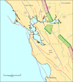
Faultlines arround San Francisco.gif 568 × 549; 51 KB
-
Greco Island and Bair Island.png 505 × 391; 257 KB
-
Lange diercke sachsen vereinigte staaten san francisco.jpg 965 × 924; 493 KB
-
Location map Greater San Francisco Bay Area.svg 894 × 1,578; 48.86 MB
-
Location map of San Francisco Bay Area.svg 744 × 1,052; 109 KB
-
Location Map San Francisco Bay Area.png 524 × 636; 272 KB
-
Location map San Francisco Bay Area.svg 1,181 × 938; 40.02 MB
-
Map of San Francisco Bay and Country Adjacent East - NARA - 100305697 (page 1).jpg 8,136 × 14,228; 9.07 MB
-
Map of San Francisco Bay and Country Adjacent East - NARA - 100305697 (page 2).jpg 8,240 × 13,484; 8.16 MB
-
Map of San Francisco Bay and Country Adjacent East - NARA - 100305697 (page 3).jpg 8,372 × 14,142; 7.64 MB
-
Map of San Francisco Bay and Country Adjacent East - NARA - 100305697 (page 4).jpg 8,228 × 14,220; 8.75 MB
-
Map of Suisun Bay- Port Chicago and Vicinity 5th Edition - NARA - 84785934.jpg 13,274 × 10,816; 10.07 MB
-
Map silicon valley cities.png 1,413 × 1,506; 240 KB
-
Muir Beach CDP, California.gif 575 × 425; 17 KB
-
Municipal blue book of San Francisco, 1915 (1915) (14595334997).jpg 1,676 × 2,492; 681 KB
-
NSRW San Francisco - harbor.jpg 610 × 708; 236 KB
-
Pacific service magazine (1918) (14760434126).jpg 2,048 × 3,202; 768 KB
-
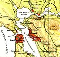
PSM V57 D080 Vicinity of the golden gate.png 1,658 × 986; 792 KB
-
RioVistaLoc.jpg 3,300 × 2,550; 1.26 MB
-
San Francisco Aerial View.jpg 3,840 × 2,160; 2.16 MB
-
San Francisco Bay Area 11-county CSA.jpg 508 × 600; 24 KB
-
San Francisco Bay Area Water Trail Vision Map.jpg 2,302 × 3,047; 426 KB
-
San Francisco Bay Trail Map.pdf 1,275 × 1,650; 7.69 MB
-
SAN FRANCISCO UND UMGEBUNG.png 2,000 × 2,961; 12.32 MB
-
San Francisco, California 1955 Yellow Book.jpg 800 × 931; 134 KB
-
San Jose-San Francisco-Oakland CSA 2010 Census.png 508 × 600; 40 KB
-
San Jose-San Francisco-Oakland CSA.png 421 × 489; 24 KB
-
San Jose-San Francisco-Oakland CSA.svg 621 × 733; 255 KB
-
San Mateo Park. LOC 75693111.jpg 2,848 × 3,480; 1.42 MB
-
San Pablo Bay and Napa Delta, USGS map CA Mare Island 298113 1916 62500.jpg 2,491 × 2,966; 1.78 MB
-
SanFransiscoBayArea.jpg 439 × 480; 95 KB
-
Santa-Clara-Silicon-Valley.svg 2,234 × 2,513; 331 KB
-
SF CSA.jpg 575 × 527; 39 KB
-
SFBALiqufactionMap.jpg 1,019 × 1,597; 884 KB
-
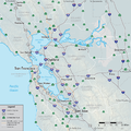
SFBay Highways-01.png 1,667 × 1,667; 890 KB
-
Shake Intensity - 2014 South Napa Earthquake.jpg 612 × 718; 114 KB
-
Silicon Valley Income Map 20160315.png 954 × 700; 442 KB
-
California SD-03 (2011).svg 1,450 × 1,680; 55 KB
-
California SD-13 (2011).svg 1,450 × 1,680; 55 KB
-
California SD-17 (2011).svg 1,450 × 1,680; 55 KB
-
Stinson Beach CDP, California.gif 575 × 425; 28 KB
-
Superfund sites at the Silicon Valley.png 1,024 × 768; 154 KB

