Category:Maps of Haverfordwest
Jump to navigation
Jump to search
Media in category "Maps of Haverfordwest"
The following 10 files are in this category, out of 10 total.
-
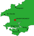
2010 Wales Pembrokeshire Community Haverfordwest map.svg 512 × 393; 1,018 KB
-
2024 Wales Pembrokeshire Community Haverfordwest map.svg 512 × 393; 1.19 MB
-
Haverfordwest pembrokeshire map.svg 452 × 466; 32 KB
-
LDRhosCymydau.png 1,174 × 866; 42 KB
-
Location map Wales Haverfordwest.png 2,446 × 1,633; 1.38 MB
-
Medieval map of Haverfordwest - geograph.org.uk - 831744.jpg 640 × 627; 80 KB
-
Ordnance Survey Drawings - Haverfordwest, Pembrokeshire (Sir Benfro) (OSD 183).jpg 4,000 × 2,404; 2.6 MB
-
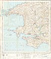
Ordnance Survey One-Inch Sheet 138 Fishguard, Published 1947.jpg 11,275 × 12,741; 13.14 MB
-
Ordnance Survey One-Inch Sheet 151 Pembroke, Published 1952.jpg 11,343 × 13,282; 13.65 MB


