Category:OpenStreetMap maps of Palestine
Jump to navigation
Jump to search
Media in category "OpenStreetMap maps of Palestine"
The following 12 files are in this category, out of 12 total.
-
Al-Haramain Mosque.jpg 1,322 × 675; 322 KB
-
Coordinates of Shireen Abu Akleh murder.png 1,387 × 775; 487 KB
-
Deir al-Balah (central) OpenStreetMap 2024-01-29.png 2,432 × 1,754; 2.29 MB
-
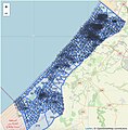
Gaza Strip numbered zones, 2023 Israel-Hamas War.jpg 669 × 680; 118 KB
-
Jenin - map of Shirin Abu Alah shooting 2.png 771 × 671; 283 KB
-
Jenin - map of Shirin Abu Alah shooting.png 1,401 × 782; 502 KB
-
Khan Younes Map.png 1,049 × 798; 558 KB
-
Location map Gaza.png 921 × 975; 589 KB
-
Map of Netzarim corridor, mostly Hebrew titles.png 800 × 566; 119 KB
-
OpenStreetMap image of Northern Gaza Evacuation Line.png 1,238 × 762; 688 KB
-
OpenStreetMap, English rendering of Gaza strip.png 2,732 × 2,884; 2.57 MB
-
Shireen Abu Akleh map 3.jpg 786 × 682; 60 KB


