Category:Maps of Oss
Jump to navigation
Jump to search
Wikimedia category | |||||
| Upload media | |||||
| Instance of | |||||
|---|---|---|---|---|---|
| Category combines topics | |||||
| Oss | |||||
municipality in the Netherlands | |||||
| Instance of |
| ||||
| Location | North Brabant, Netherlands | ||||
| Located in or next to body of water | |||||
| Capital | |||||
| Head of government | |||||
| Population |
| ||||
| Area |
| ||||
| Elevation above sea level |
| ||||
| Replaces |
| ||||
| Different from | |||||
| official website | |||||
 | |||||
Subcategories
This category has the following 6 subcategories, out of 6 total.
L
Media in category "Maps of Oss"
The following 21 files are in this category, out of 21 total.
-
1865 Dieden.png 1,544 × 1,353; 203 KB
-
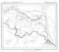
1865 Geffen.png 1,289 × 1,646; 152 KB
-
1865 Herpen.png 1,544 × 1,345; 208 KB
-
1865 Huisseling.png 1,520 × 1,346; 179 KB
-
1865 Oijen.png 1,256 × 1,614; 165 KB
-
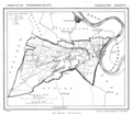
1865 Oss.png 1,557 × 1,365; 182 KB
-
1866 Lithoijen.png 1,262 × 1,589; 150 KB
-
2013-Oss.jpg 4,272 × 2,239; 5.21 MB
-
2013-Top33-gem-Oss.jpg 2,988 × 1,478; 2.79 MB
-
BAG woonplaatsen - Gemeente Oss.png 2,419 × 2,419; 1.28 MB
-
Dieden, Demen en Langel.png 1,544 × 1,353; 204 KB
-
Gem-Oss-2014Q1.jpg 8,412 × 4,251; 13.42 MB
-
Gem-Oss-OpenTopo.jpg 10,461 × 5,253; 8.73 MB
-
LocatieOss.png 280 × 130; 10 KB
-
Map - NL - Municipality code 0828 (2019).svg 300 × 160; 444 KB
-
Map - NL - Oss (2009).svg 625 × 575; 2.68 MB
-
Oijen en teeffelen.jpg 959 × 1,205; 202 KB
-
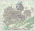
Oss-plaats-OpenTopo.jpg 2,447 × 2,207; 2.86 MB
-
Oss-stad-2014Q1.jpg 2,447 × 2,111; 2.54 MB
-
Oss-topografie.jpg 1,746 × 1,924; 2.09 MB
-
Paalgraven.png 320 × 320; 11 KB


