Category:Maps of Metro Manila
Appearance
Regions of the Philippines: Metro Manila · Cagayan Valley · Central Luzon · Calabarzon · Mimaropa · Bicol · Western Visayas · Central Visayas · Eastern Visayas · Zamboanga Peninsula · Northern Mindanao · Soccsksargen · Bangsamoro
- Provinces of the Philippines Abra · Agusan del Norte · Agusan del Sur · Aklan · Albay · Antique · Apayao · Aurora · Basilan · Bataan · Batanes · Batangas · Benguet · Biliran · Bohol · Bukidnon · Bulacan · Cagayan · Camarines Norte · Camarines Sur · Camiguin · Capiz · Catanduanes · Cavite · Cebu · Cotabato · Davao de Oro · Davao del Norte · Davao del Sur · Davao Occidental · Davao Oriental · Dinagat Islands · Eastern Samar · Guimaras · Ifugao · Ilocos Norte · Ilocos Sur · Iloilo · Isabela · Kalinga · La Union · Laguna · Lanao del Norte · Lanao del Sur · Leyte · Maguindanao del Norte · Maguindanao del Sur · Marinduque · Masbate · Misamis Occidental · Misamis Oriental · Mountain Province · Negros Occidental · Negros Oriental · Northern Samar · Nueva Ecija · Nueva Vizcaya · Occidental Mindoro · Oriental Mindoro · Palawan · Pampanga · Pangasinan · Quezon · Quirino · Rizal · Romblon · Samar · Sarangani · Siquijor · Sorsogon · South Cotabato · Southern Leyte · Sultan Kudarat · Sulu · Surigao del Norte · Surigao del Sur · Tarlac · Tawi-Tawi · Zambales · Zamboanga del Norte · Zamboanga del Sur · Zamboanga Sibugay ·
- Province-level divisions (independent cities, Metro Manila) Davao City · Metro Manila · Puerto Princesa · Zamboanga City ·
Subcategories
This category has the following 16 subcategories, out of 16 total.
E
L
M
- Maps of Makati (50 F)
- Maps of Mandaluyong (9 F)
- Maps of Muntinlupa (2 F)
P
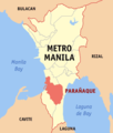
- Maps of Parañaque (2 F)
- Maps of Pasay (2 F)
Q
T
V
Pages in category "Maps of Metro Manila"
This category contains only the following page.
Media in category "Maps of Metro Manila"
The following 72 files are in this category, out of 72 total.
-
Metro manila map.png 258 × 465; 18 KB
-
Balangkas Map.png 785 × 736; 197 KB
-
BFP NCR Fire District Map.png 700 × 1,260; 46 KB
-
Commonwealth Avenue route map.svg 638 × 1,246; 142 KB
-
COVID-19 Outbreak Cases in Metro Manila.svg 638 × 1,147; 251 KB
-
Districts of Metro Manila.svg 512 × 922; 423 KB
-
DPWH Map of Radial and Circumferential Roads.png 2,326 × 3,300; 6.65 MB
-
EDSA route.PNG 700 × 1,260; 42 KB
-
Hacienda de Mandaluyong Map.jpg 3,000 × 4,000; 10.2 MB
-
Iss047e099713 lrg Manila.jpg 4,928 × 3,280; 5.17 MB
-
Magsaysay Boulevard route map.svg 449 × 844; 127 KB
-
Manila Philippines street map.svg 2,006 × 2,173; 10.24 MB
-
Manila-transportation-map.jpg 2,550 × 2,671; 2.61 MB
-
Manila-transportation-map.pdf 1,275 × 1,335, 2 pages; 65.16 MB
-
Manila-transportation-map.png 2,121 × 2,329; 3.83 MB
-
Manila.Mayors.Party.png 700 × 1,260; 43 KB
-
Manila.png 1,016 × 1,860; 312 KB
-
Map of districts of the National Capital Region Police Office.svg 512 × 922; 423 KB
-
Map of major roads around Metro Manila.svg 638 × 1,246; 153 KB
-
Map of Manila 1570.png 2,734 × 2,984; 208 KB
-
Map of Metro Manila (blank).svg 638 × 1,246; 70 KB
-
Map of Rizal (1938).svg 512 × 551; 231 KB
-
Map of the Kingdom of Namayan.jpg 333 × 599; 43 KB
-
Mapa de las Ciudades de Gran Manila.jpg 948 × 1,612; 75 KB
-
Marikina Second District.png 2,400 × 2,400; 264 KB
-
Mega Manila.png 4,544 × 4,272; 1.39 MB
-
Metro Manila by cityhood.PNG 700 × 1,260; 48 KB
-
Metro Manila Elevation Map.png 1,000 × 1,584; 2.22 MB
-
Metro Manila in Philippines.svg 1,869 × 2,465; 924 KB
-
Metro Manila in the Philippines.png 2,762 × 5,362; 345 KB
-
Metro Manila location map.svg 512 × 922; 224 KB
-
Metro Manila Logo Map.jpg 289 × 526; 39 KB
-
Metro manila map (1).png 500 × 900; 38 KB
-
METRO MANILA MAP.png 332 × 600; 17 KB
-
Metro manila map.rus.png 258 × 465; 41 KB
-
Metro Manila PH A(H1N1).png 700 × 1,260; 38 KB
-
Metro Manila police districts.png 700 × 1,260; 44 KB
-
Metro Manila water zones.PNG 700 × 1,260; 46 KB
-
Metro Manila Water Zones.svg 512 × 922; 551 KB
-
Metro Manila WV region map.png 438 × 824; 199 KB
-
Metromaniladistricts.PNG 700 × 1,260; 41 KB
-
NCRPO map.png 698 × 1,260; 41 KB
-
Number coding scheme.png 700 × 1,260; 41 KB
-
Old Metro Manila location map.svg 512 × 922; 244 KB
-
Ortigasmap sm.jpg 844 × 356; 73 KB
-
Ph fil las piñas.png 2,376 × 3,672; 418 KB
-
Ph fil marikina.png 1,962 × 1,863; 478 KB
-
Ph fil pasig barangays.png 1,763 × 2,542; 309 KB
-
Ph locator ncr laspinas.png 300 × 352; 10 KB
-
Ph locator ncr makati.png 300 × 352; 10 KB
-
Ph locator ncr malabon.png 300 × 352; 8 KB
-
Ph locator ncr mandaluyong.png 300 × 352; 10 KB
-
Ph locator ncr manila-sr.png 300 × 352; 22 KB
-
Ph locator ncr manila.png 300 × 352; 10 KB
-
Ph locator ncr marikina.png 300 × 352; 10 KB
-
Ph locator ncr muntinlupa.png 300 × 352; 10 KB
-
Ph locator ncr navotas.png 300 × 352; 8 KB
-
Ph locator ncr paranaque.png 300 × 352; 10 KB
-
Ph locator ncr pasay.png 300 × 352; 10 KB
-
Ph locator ncr pasig.png 300 × 352; 10 KB
-
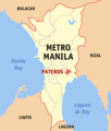
Ph locator ncr pateros.png 300 × 352; 10 KB
-
Ph locator ncr san juan.png 300 × 352; 10 KB
-
Ph locator ncr sanjuan.png 300 × 352; 8 KB
-
Ph locator ncr taguig.png 300 × 352; 10 KB
-
Ph map laspinas.png 600 × 787; 59 KB
-
Political map of Metro Manila.svg 512 × 922; 577 KB
-
Quezon Avenue route map.svg 638 × 1,246; 142 KB
-
Quezon City Elevation Map.png 2,000 × 2,032; 4.49 MB
-
Roxas Boulevard route map.svg 638 × 1,246; 142 KB
-
Spanish province of Manila map.png 700 × 1,260; 64 KB
-
UAAP schools in Metro Manila.png 400 × 720; 76 KB
-
Zip Codes in Metro Manila.png 700 × 1,260; 44 KB


