Category:Maps of Luzon
Jump to navigation
Jump to search
Subcategories
This category has the following 11 subcategories, out of 11 total.
Media in category "Maps of Luzon"
The following 53 files are in this category, out of 53 total.
-
2010 Ilocos earthquake ShakeMap USGS.jpg 612 × 722; 82 KB
-
A. A. F. special aeronautical approach chart. 1 - 250.000. Northern Luzon - btv1b53189607g.jpg 12,128 × 12,724; 24.46 MB
-
AAF Cloth Chart - Philippine Series, No. C-40, Luzon Island.jpg 1,889 × 2,568; 1.48 MB
-
Admiralty Chart No 3370 San Bernardino Strait, Published 1924.jpg 16,400 × 11,275; 50.86 MB
-
Admiralty Chart No 3804 Luzon Strait, Published 1925.jpg 11,282 × 16,439; 36.18 MB
-
Admiralty Chart No 3805 Luzon Island N, Published 1963.jpg 16,265 × 11,066; 56.65 MB
-
Atlas of the Philippine Islands (1900) (14585822387).jpg 5,952 × 5,046; 7.63 MB
-
Atlas of the Philippine Islands (1900) (14771960542).jpg 6,000 × 5,116; 8.19 MB
-
Atlas of the Philippine Islands (1900) map 07.jpg 5,040 × 6,020; 6.45 MB
-
Atlas of the Philippine Islands (1900) map 09.jpg 5,000 × 6,000; 5.69 MB
-
Bataan-Karte.jpg 432 × 254; 21 KB
-
Bicol river watershed.png 1,651 × 1,230; 195 KB
-
Central luzon blank.png 1,321 × 1,210; 224 KB
-
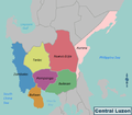
Central Luzon Map.png 536 × 467; 25 KB
-
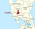
Clark Freeport and Special Economic Zone map.svg 207 × 173; 159 KB
-
COVID-19 community quarantine in Luzon.svg 13,290 × 5,089; 5.56 MB
-
FelipeAira.png 447 × 841; 24 KB
-
Gaddang Homeland 2.jpg 334 × 505; 88 KB
-
Guerilla Situation Southeast Luzon - NARA - 100385233.jpg 5,992 × 6,598; 2 MB
-
Hydrological Boundary of Laguna Lake Development Authority.png 545 × 700; 457 KB
-
Japanese Operations on Luzon Dec 1941.jpg 1,364 × 1,992; 408 KB
-
Laguna Lake Development Authority's Administrative Jurisdiction.png 545 × 700; 462 KB
-
Luzon in Philippines.svg 1,871 × 2,468; 1.38 MB
-
Luzon Island Red.png 2,000 × 3,120; 216 KB
-
Luzon regions.PNG 889 × 1,758; 64 KB
-
Map of El Príncipe (2) from "Under the red and gold".jpg 2,744 × 2,568; 1.47 MB
-
Map of El Príncipe from "Under the red and gold".jpg 4,192 × 3,190; 1.55 MB
-
Map of Luzon Island.svg 1,481 × 2,031; 521 KB
-
Map of Luzon.png 1,380 × 2,450; 112 KB
-
Mega Manila.png 4,544 × 4,272; 1.39 MB
-
Mount Pinatubo Relief Map, SRTM-1.jpg 1,200 × 900; 1.03 MB
-
NIE 1905 Luzon.jpg 1,740 × 2,221; 1.37 MB
-
Northern luzon en.png 2,068 × 3,309; 6.68 MB
-
Northern Philippines (Luzon).jpg 2,000 × 2,600; 738 KB
-
Northern philippines map.JPG 329 × 581; 55 KB
-
Pasig River basin map.png 1,168 × 992; 1.37 MB
-
Ph fil southern tagalog.png 2,000 × 3,120; 139 KB
-
Reisen in den Philippinen - Friedrich Jagor.jpg 6,518 × 4,958; 6.43 MB
-
Villa verde trail Philippines.jpg 1,800 × 1,300; 378 KB


