Category:Maps of Benguet
Jump to navigation
Jump to search
- Provinces of the Philippines Abra · Agusan del Norte · Agusan del Sur · Aklan · Albay · Antique · Apayao · Aurora · Basilan · Bataan · Batanes · Batangas · Benguet · Biliran · Bohol · Bukidnon · Bulacan · Cagayan · Camarines Norte · Camarines Sur · Camiguin · Capiz · Catanduanes · Cavite · Cebu · Cotabato · Davao de Oro · Davao del Norte · Davao del Sur · Davao Occidental · Davao Oriental · Dinagat Islands · Eastern Samar · Guimaras · Ifugao · Ilocos Norte · Ilocos Sur · Iloilo · Isabela · Kalinga · La Union · Laguna · Lanao del Norte · Lanao del Sur · Leyte · Maguindanao del Norte · Maguindanao del Sur · Marinduque · Masbate · Misamis Occidental · Misamis Oriental · Mountain Province · Negros Occidental · Negros Oriental · Northern Samar · Nueva Ecija · Nueva Vizcaya · Occidental Mindoro · Oriental Mindoro · Palawan · Pampanga · Pangasinan · Quezon · Quirino · Rizal · Romblon · Samar · Sarangani · Siquijor · Sorsogon · South Cotabato · Southern Leyte · Sultan Kudarat · Sulu · Surigao del Norte · Surigao del Sur · Tarlac · Tawi-Tawi · Zambales · Zamboanga del Norte · Zamboanga del Sur · Zamboanga Sibugay ·
- Province-level divisions (independent cities, Metro Manila) Davao City · Metro Manila · Puerto Princesa · Zamboanga City ·
Wikimedia category | |||||
| Upload media | |||||
| Instance of | |||||
|---|---|---|---|---|---|
| Category combines topics | |||||
| Benguet | |||||
province of the Philippines | |||||
| Instance of | |||||
| Location |
| ||||
| Capital | |||||
| Head of government |
| ||||
| Inception |
| ||||
| Population |
| ||||
| Area |
| ||||
| Replaces |
| ||||
| Electorate |
| ||||
| official website | |||||
 | |||||
Media in category "Maps of Benguet"
The following 44 files are in this category, out of 44 total.
-
Benguet Atok-location.png 331 × 556; 44 KB
-
Benguet Baguio-location.png 331 × 556; 43 KB
-
Benguet Bakun-location.png 331 × 556; 44 KB
-
Benguet Barangay Map.png 532 × 818; 138 KB
-
Benguet Bokod-location.png 331 × 556; 44 KB
-
Benguet Buguias-location.png 331 × 556; 44 KB
-
Benguet electric utilities.svg 615 × 275; 49 KB
-
Benguet in Philippines.svg 1,869 × 2,465; 924 KB
-
Benguet Itogon-location.png 331 × 556; 44 KB
-
Benguet Kabayan-location.png 331 × 556; 44 KB
-
Benguet Kapangan-location.png 331 × 556; 44 KB
-
Benguet Kibungan-location.png 331 × 556; 44 KB
-
Benguet La Trinidad-location.png 331 × 556; 44 KB
-
Benguet Labelled Map.png 331 × 556; 74 KB
-
Benguet Mankayan-location.png 331 × 556; 44 KB
-
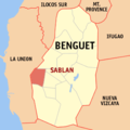
Benguet Sablan-location.png 331 × 556; 44 KB
-
Benguet Subprovince 1918 map.JPG 616 × 1,024; 221 KB
-
Benguet Tuba-location.png 331 × 556; 44 KB
-
Benguet Tublay-location15.png 331 × 556; 44 KB
-
Benguet-AdministrativeDivisionBorders.png 331 × 556; 41 KB
-
BENGUETMap-white3-Sharpened.png 331 × 556; 43 KB
-
BLIST Map.png 331 × 556; 45 KB
-
BLISTT Map.png 331 × 556; 45 KB
-
CAR Map - Benguet location.png 500 × 935; 53 KB
-
Metro baguio with rest of benguet.svg 308 × 294; 27 KB
-
Metro baguio without tublay.svg 145 × 150; 27 KB
-
Metro baguio.svg 145 × 150; 28 KB
-
Mountain province 1918 map.jpg 615 × 1,022; 244 KB
-
Ph fil benguet.png 1,824 × 2,736; 511 KB
-
Ph locator benguet atok.png 299 × 299; 11 KB
-
Ph locator benguet baguio.png 299 × 299; 11 KB
-
Ph locator benguet bakun.png 299 × 299; 11 KB
-
Ph locator benguet bokod.png 299 × 299; 11 KB
-
Ph locator benguet buguias.png 299 × 299; 11 KB
-
Ph locator benguet itogon.png 299 × 299; 11 KB
-
Ph locator benguet kabayan.png 299 × 299; 11 KB
-
Ph locator benguet kapangan.png 299 × 299; 11 KB
-
Ph locator benguet kibungan.png 299 × 299; 11 KB
-
Ph locator benguet la trinidad.png 299 × 299; 10 KB
-
Ph locator benguet mankayan.png 299 × 299; 11 KB
-
Ph locator benguet sablan.png 299 × 299; 10 KB
-
Ph locator benguet tuba.png 299 × 299; 11 KB
-
Ph locator benguet tublay.png 299 × 299; 10 KB
-
Ph locator map benguet.png 300 × 440; 19 KB


