Category:Maps of Lapland, Finland
Jump to navigation
Jump to search
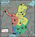
English: Maps of Lapland region, Finland
Suomi: Lapin maakunnan karttoja
Regions of Finland: Central Finland · Central Ostrobothnia · Finland Proper · Kainuu · Kymenlaakso · Lapland · North Karelia · Northern Ostrobothnia · Northern Savonia · Ostrobothnia · Pirkanmaa · Päijänne Tavastia · Satakunta · South Karelia · South Ostrobothnia · Southern Savonia · Tavastia Proper · Uusimaa · Åland
Wikimedia category | |||||
| Upload media | |||||
| Instance of | |||||
|---|---|---|---|---|---|
| Category combines topics | |||||
| Lapland | |||||
region of Finland | |||||
| Instance of | |||||
| Part of |
| ||||
| Location | Regional State Administrative Agency for Lapland, Finland | ||||
| Capital | |||||
| Anthem |
| ||||
| Inception |
| ||||
| Population |
| ||||
| Area |
| ||||
| Different from | |||||
| official website | |||||
 | |||||
Subcategories
This category has the following 12 subcategories, out of 12 total.
E
- Maps of Enontekiö (70 F)
I
- Maps of Inari (11 F)
K
- Maps of Kemijärvi (27 F)
- Maps of Kittilä (7 F)
M
R
- Maps of Rovaniemi (18 F)
S
- Maps of Salla (6 F)
- Maps of Sodankylä (6 F)
U
- Maps of Utsjoki (10 F)
Y
- Maps of Ylitornio (8 F)
Media in category "Maps of Lapland, Finland"
The following 40 files are in this category, out of 40 total.
-
Acta Soc. pro Fauna et Flora Fennica (1912-1913) (16584439488).jpg 3,414 × 1,346; 1.07 MB
-
Acta Soc. pro Fauna et Flora Fennica (1913-1914) (16772006575).jpg 1,670 × 2,328; 845 KB
-
Alpine permafrost in Scandinavia 15.jpg 1,278 × 692; 291 KB
-
EkialdekoLappikoudalerrienmapazenbakigabe.png 496 × 826; 10 KB
-
FI-LL.svg 1,835 × 3,209; 41 KB
-
Finland Lapland adm location map.svg 1,049 × 1,344; 415 KB
-
Finnish Lapland regions map.png 4,392 × 4,593; 2.46 MB
-
Finnish Lapland regions map.svg 750 × 625; 2.69 MB
-
Finnish Lapland Wikivoyage subregion division.svg 744 × 1,052; 26 KB
-
Finska Lappland Lappi.png 1,168 × 826; 1.92 MB
-
IparLappi-OSM.png 405 × 769; 105 KB
-
IparLappikoudalerrienmapazenbakigabe.png 588 × 1,063; 14 KB
-
Kataja-en.svg 1,209 × 1,301; 33 KB
-
Kemi-Tornio Ardatza.png 349 × 290; 5 KB
-
Lapin lääni.sijainti.suomi.2009.svg 1,850 × 3,220; 57 KB
-
Lapin.maakunta.suomi.2008.svg 1,850 × 3,220; 269 KB
-
Lapland Region.png 230 × 400; 8 KB
-
Lappi in Finland.svg 1,020 × 1,643; 899 KB
-
Lappi maakunta.png 2,000 × 3,500; 380 KB
-
Lappi.maakunta.kunnat.svg 744 × 1,052; 25 KB
-
Lappi.sijainti.suomi.2010.svg 1,850 × 3,220; 64 KB
-
Lappietaostrobotniaprobintziak.png 1,171 × 1,481; 87 KB
-
Lappikoantzinakoprobintziak.png 1,367 × 1,481; 160 KB
-
Lappikoudalerrienmapa.png 1,171 × 1,481; 76 KB
-
Lappikoudalerrienmapazenbakigabe.png 1,171 × 1,481; 53 KB
-
Lapponia finlandese.png 446 × 568; 403 KB
-
Laptopo blank.jpg 1,186 × 1,689; 824 KB
-
Laurila–Kelloselkä-Kantalahti railway.jpg 657 × 411; 66 KB
-
Location of Lappi in Finland.png 230 × 400; 3 KB
-
Map of Lapland, Finland-smn.svg 776 × 897; 159 KB
-
Map Province of Lapland.png 150 × 261; 18 KB
-
Peräpohjola sub-dialects map.PNG 1,171 × 1,481; 55 KB
-
Ranua.map.svg 517 × 421; 57 KB
-
Rovaniemi in Lappi (Lapland) map.svg 430 × 547; 18 KB
-
Sami languages in Lappi.PNG 1,053 × 702; 26 KB
-
Savukoskikomapa.png 1,370 × 1,375; 431 KB
-
Simo-OSM.png 423 × 302; 20 KB
-
Svpmap lappland-es.png 272 × 397; 37 KB
-
Svpmap lappland.png 275 × 400; 17 KB
-
Västerbottens län och svenska lappmarken 1796.svg 2,683 × 2,489; 578 KB


