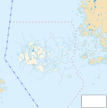
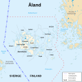
Category:Maps of Åland
Jump to navigation
Jump to search
Suomi: Ahvenanmaan maakunnan karttoja.
Regions of Finland: Central Finland · Central Ostrobothnia · Finland Proper · Kainuu · Kymenlaakso · Lapland · North Karelia · Northern Ostrobothnia · Northern Savonia · Ostrobothnia · Pirkanmaa · Päijänne Tavastia · Satakunta · South Karelia · South Ostrobothnia · Southern Savonia · Tavastia Proper · Uusimaa · Åland
Wikimedia category | |||||
| Upload media | |||||
| Instance of | |||||
|---|---|---|---|---|---|
| Category combines topics | |||||
| Åland | |||||
autonomous region of Finland | |||||
| Pronunciation audio | |||||
| Instance of |
| ||||
| Part of | |||||
| Location |
| ||||
| Located in or next to body of water | |||||
| Capital | |||||
| Legislative body | |||||
| Executive body |
| ||||
| Official language | |||||
| Anthem |
| ||||
| Currency |
| ||||
| Head of government | |||||
| Has part(s) |
| ||||
| Significant event |
| ||||
| Highest point | |||||
| Population |
| ||||
| Area |
| ||||
| Elevation above sea level |
| ||||
| Top-level Internet domain |
| ||||
| Different from | |||||
| official website | |||||
 | |||||
Subcategories
This category has the following 9 subcategories, out of 9 total.
C
E
- Election maps of Åland (1 F)
F
- Flag maps of Åland (3 F)
M
- Maps of Mariehamn (4 F)
- Maps of Märket (29 F)
O
R
- Road maps of Åland (3 F)
S
- Maps of Åland on stamps (3 F)
Media in category "Maps of Åland"
The following 64 files are in this category, out of 64 total.
-
Ahvenanmaa.sijainti.suomi.2010.svg 1,850 × 3,220; 65 KB
-
Aland.png 595 × 600; 118 KB
-
Alandmunicipalities.png 595 × 600; 111 KB
-
Ahvenanmaa kunnat 2.png 354 × 443; 17 KB
-
Ahvenanmaa kunnat.png 354 × 443; 17 KB
-
Ahvenanmaa.png 2,000 × 3,500; 369 KB
-
Ahvenanmaan lääni.sijainti.suomi.2009.svg 1,850 × 3,220; 57 KB
-
Ahvenanmaan maakuntavaalit 2015.png 995 × 973; 108 KB
-
Ahvenanmaan.maakunta.suomi.2008.svg 1,850 × 3,220; 269 KB
-
Aland map 01.png 533 × 347; 11 KB
-
Aland Map 1.jpg 377 × 269; 24 KB
-
Aland w1 locator.svg 1,000 × 1,000; 136 KB
-
Aland w2 locator.svg 1,000 × 1,000; 240 KB
-
Aland26571.png 514 × 505; 8 KB
-
Apotekarens farled.png 959 × 689; 411 KB
-
Archipelago Sea and Aland.svg 1,215 × 752; 14.56 MB
-
COVID-19 Outbreak Cases in Åland by municipalities.svg 996 × 1,004; 234 KB
-
Europe map aaland.png 1,231 × 929; 41 KB
-
Europe-Åland.svg 2,045 × 1,720; 2.22 MB
-
Fasta Åland.jpg 3,366 × 2,575; 1.37 MB
-
FI-AL.svg 1,877 × 3,233; 44 KB
-
Finland Provinces Åland.png 1,424 × 2,528; 857 KB
-
Historical province of Åland, Finland.svg 1,675 × 2,901; 449 KB
-
Lagskar locator.png 684 × 480; 362 KB
-
Location map Aland.png 924 × 978; 234 KB
-
Location of Åland in Finland.png 230 × 400; 3 KB
-
LocationAland.png 250 × 115; 14 KB
-
LocationAland2.png 250 × 115; 10 KB
-
LocationÅland.svg 1,000 × 500; 2.76 MB
-
Lumparn.png 453 × 339; 107 KB
-
Map Province of Åland.png 150 × 261; 16 KB
-
Map Sea of Åland.png 1,216 × 595; 815 KB
-
Mariehamn Airport open street map.png 805 × 665; 204 KB
-
Riksdagsval 1916.jpg 1,024 × 768; 328 KB
-
Riksdagsval 1922.jpg 1,024 × 768; 332 KB
-
Rosland1500.png 1,500 × 600; 211 KB
-
TM of Åland be.svg 681 × 516; 172 KB
-
Topographic location map of Åland.svg 676 × 516; 126 KB
-
Topographic map of Åland.svg 681 × 516; 174 KB
-
Åland Ahvenanmaa.png 1,168 × 826; 1.89 MB
-
Åland blindkarta version1.jpg 3,366 × 2,575; 1.4 MB
-
Åland blindkarta version2.jpg 3,366 × 2,575; 1.45 MB
-
Åland blindkarta version3.jpg 3,363 × 2,388; 1.29 MB
-
Åland location map 2.svg 677 × 517; 83 KB
-
Åland location map 3.svg 512 × 391; 37 KB
-
Åland location map.svg 996 × 1,004; 185 KB
-
Åland map 2.png 827 × 591; 158 KB
-
Åland map svg.svg 397 × 283; 231 KB
-
Åland map with borders.svg 996 × 1,100; 67 KB
-
Åland Map.JPG 313 × 269; 14 KB
-
Åland map.png 996 × 1,004; 52 KB
-
Åland Political Map-blank.svg 996 × 1,004; 196 KB
-
Åland Political Map-en.svg 996 × 1,004; 219 KB
-
Åland Political Map-eo.svg 996 × 1,004; 207 KB
-
Åland Political Map-fi.svg 996 × 1,004; 217 KB
-
Åland Political Map-fr.svg 996 × 1,004; 219 KB
-
Åland Political Map-sv.svg 996 × 1,004; 220 KB
-
Åland Wikivoyage map.png 1,045 × 814; 411 KB
-
Åland Wikivoyage map.svg 996 × 1,004; 249 KB
-
Åland2.png 861 × 494; 144 KB
-
Åland2topo.png 861 × 494; 148 KB
-
Ålands södra skärgårdsförsamling karta.png 1,153 × 844; 152 KB
-
Ålandstrafken's map.png 908 × 762; 391 KB
-
Åva ring.jpg 424 × 554; 67 KB


