Category:Maps of Kainuu
Jump to navigation
Jump to search
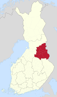
English: Maps of Kainuu region, Finland.
Suomi: Kainuun maakunnan karttoja.
Regions of Finland: Central Finland · Central Ostrobothnia · Finland Proper · Kainuu · Kymenlaakso · Lapland · North Karelia · Northern Ostrobothnia · Northern Savonia · Ostrobothnia · Pirkanmaa · Päijänne Tavastia · Satakunta · South Karelia · South Ostrobothnia · Southern Savonia · Tavastia Proper · Uusimaa · Åland
Wikimedia category | |||||
| Upload media | |||||
| Instance of | |||||
|---|---|---|---|---|---|
| Category combines topics | |||||
| Kainuu | |||||
region of Finland | |||||
| Instance of | |||||
| Location |
| ||||
| Capital | |||||
| Anthem |
| ||||
| Inception |
| ||||
| Population |
| ||||
| Area |
| ||||
| official website | |||||
 | |||||
Subcategories
This category has the following 5 subcategories, out of 5 total.
K
S
Media in category "Maps of Kainuu"
The following 17 files are in this category, out of 17 total.
-
Finland regions Kainuu.png 1,424 × 2,528; 802 KB
-
Kainuu 1947.svg 1,098 × 1,070; 199 KB
-
Kainuu Region.png 230 × 400; 8 KB
-
Kainuu.png 2,000 × 3,500; 371 KB
-
Kainuu.sijainti.suomi.2010.svg 1,850 × 3,220; 64 KB
-
Kainuukuntamap.png 569 × 490; 179 KB
-
Kainuukuntamapwithnumbers.png 569 × 490; 180 KB
-
Kainuumap.png 569 × 491; 171 KB
-
Kainuun kuntarajat ja nimet.png 640 × 640; 29 KB
-
Kainuun.maakunta.suomi.2008.svg 1,850 × 3,220; 269 KB
-
Kajaanin.seutukunta.sijainti.2008.svg 1,850 × 3,220; 169 KB
-
Location of Kainuu in Finland.png 230 × 400; 4 KB
-
Map of Kainuu-fi.svg 1,098 × 1,070; 217 KB
-
Map of Kainuu-numbers.svg 1,098 × 1,070; 195 KB
-
MapOfKainuu2016.svg 595 × 842; 7 KB
-
MapofKainuu2016v2.svg 540 × 580; 7 KB
-
Provincia di Oulu.png 753 × 476; 583 KB


