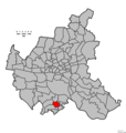
Category:Maps of Harburg
Jump to navigation
Jump to search
Subcategories
This category has the following 17 subcategories, out of 17 total.
A
- Maps of Hamburg-Altenwerder (17 F)
C
- Maps of Hamburg-Cranz (13 F)
E
F
- Maps of Hamburg-Francop (9 F)
G
- Maps of Hamburg-Gut Moor (8 F)
H
- Maps of Hamburg-Heimfeld (9 F)
L
M
- Maps of Hamburg-Moorburg (13 F)
N
- Maps of Hamburg-Neuenfelde (15 F)
- Maps of Hamburg-Neuland (9 F)
R
S
- Maps of Hamburg-Sinstorf (4 F)
W
- Maps of Hamburg-Wilstorf (6 F)
Media in category "Maps of Harburg"
The following 12 files are in this category, out of 12 total.
-
Hamburg Bezirk Harburg.svg 1,713 × 1,689; 780 KB
-
Pincerno - Hamburger Bezirke 2008 - Harburg.gif 1,267 × 1,333; 22 KB
-
Hamburg-Stadtteilkarte-Harburg.jpg 600 × 569; 140 KB
-
Bezirkskarte Hamburg-Harburg.png 2,605 × 2,550; 1 MB
-
Pincerno - Bezirk Harburg 11-2008.png 1,267 × 1,333; 48 KB
-
Hamburg Harburg Subdivisions.svg 258 × 193; 1.25 MB
-
Hamburg location map simplified districts-Harburg.svg 558 × 548; 111 KB
-
Pincerno - Langenbek 11-2008.PNG 1,267 × 1,333; 48 KB
-
Pincerno - Marmstorf 11-2008.PNG 1,267 × 1,333; 48 KB
-
Mellinger20.jpg 1,661 × 2,106; 3.55 MB
-
Pincerno - Stadtteile Bezirk Harburg 11-2008.png 1,267 × 1,333; 28 KB
-
Pincerno - Wilstorf 11-2008.PNG 1,267 × 1,333; 48 KB


