Category:Maps of Hamburg-Mitte
Jump to navigation
Jump to search
Subcategories
This category has the following 19 subcategories, out of 19 total.
B
- Maps of Hamburg-Billstedt (13 F)
- Maps of Hamburg-Borgfelde (20 F)
F
- Maps of Hamburg-Finkenwerder (15 F)
H
- Maps of Hamburg-HafenCity (43 F)
- Maps of Hamburg-Hamm (45 F)
- Maps of Hamburg-Hammerbrook (34 F)
- Maps of Hamburg-Horn (23 F)
M
N
R
S
- Maps of Hamburg-St. Pauli (52 F)
- Maps of Hamburg-St. Georg (44 F)
- Maps of Hamburg-Steinwerder (26 F)
V
- Maps of Hamburg-Veddel (24 F)
W
- Maps of Hamburg-Wilhelmsburg (29 F)
Media in category "Maps of Hamburg-Mitte"
The following 17 files are in this category, out of 17 total.
-
Bezirkskarte Hamburg-Mitte.png 2,605 × 2,550; 1.02 MB
-
Hamburg Bezirk Hamburg-Mitte.svg 1,713 × 1,689; 780 KB
-
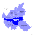
Pincerno - Bezirk Hamburg-Mitte - 11-2008.png 1,267 × 1,333; 49 KB
-
Pincerno - Bezirk Hamburg-Mitte 2008.gif 1,267 × 1,333; 32 KB
-
Pincerno - Hamburger Bezirke 2008 - Hamburg-Mitte.gif 1,267 × 1,333; 21 KB
-
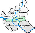
Hamburg-Stadtteilkarte-Mitte.jpg 600 × 569; 137 KB
-
Hamburger Hafen 1910.jpg 1,672 × 1,146; 2.28 MB
-
Pincerno - Bezirk Hamburg-Mitte 8-2007.PNG 1,267 × 1,333; 49 KB
-
Pincerno - Billbrook - 11-2008.PNG 1,267 × 1,333; 48 KB
-
Hamburg Hafenbecken 1952.png 4,275 × 2,648; 1.03 MB
-
Hamburg location map simplified districts-Mitte.svg 558 × 548; 124 KB
-
Hamburg Mitte Subdivisions.svg 963 × 549; 1.49 MB
-
HH-Kleiner-Grasbrook-quarter.png 843 × 746; 189 KB
-
Pincerno - Klostertor 8-2007.PNG 1,267 × 1,333; 48 KB
-
Karte Schibli-Tunnel.svg 1,026 × 858; 446 KB
-
Pincerno - Stadtteile Bezirk Hamburg-Mitte 11-2008.png 1,267 × 1,333; 23 KB
-
Pincerno - Stadtteile im Bezirk Hamburg-Mitte 2008 III.gif 1,267 × 1,333; 15 KB


